[{"name":"Everest Base Camp Helicopter Tour","duration":"1","image_url":"https:\/\/www.havenholidaysnepal.com\/storage\/trip-galleries\/1\/thumb_6cd53005d75a86e373d31419d1b14d78.webp","offer_price":1195,"url":"https:\/\/www.havenholidaysnepal.com\/trips\/everest-base-camp-helicopter-tour"},{"name":"Everest Mountain Flight","duration":"1","image_url":"https:\/\/www.havenholidaysnepal.com\/storage\/trip-galleries\/4\/thumb_3b0b4f1d6f72b0ad224daf4752f2c6e0.jpg","offer_price":285,"url":"https:\/\/www.havenholidaysnepal.com\/trips\/everest-mountain-flight"},{"name":"Everest Short Trek","duration":"9","image_url":"https:\/\/www.havenholidaysnepal.com\/storage\/trip-galleries\/5\/thumb_BXPP3621.JPEG0.02033800 1727957098.webp","offer_price":895,"url":"https:\/\/www.havenholidaysnepal.com\/trips\/everest-short-trek"},{"name":"Gokyo Valley Trek","duration":"12","image_url":"https:\/\/www.havenholidaysnepal.com\/storage\/trip-galleries\/6\/thumb_10bc469b14731f23d3ce84a7092ad53f.jpg","offer_price":1195,"url":"https:\/\/www.havenholidaysnepal.com\/trips\/gokyo-valley-trek"},{"name":"15 days Annapurna Base Camp Trek","duration":"15","image_url":"https:\/\/www.havenholidaysnepal.com\/storage\/trip-galleries\/7\/thumb_87d1533bc45faf070990aef0579e4be4.jpg0.81855100 1728285496.webp","offer_price":785,"url":"https:\/\/www.havenholidaysnepal.com\/trips\/15-days-annapurna-base-camp-trek"},{"name":"Nepal Pilgrimage Tour","duration":"14","image_url":"https:\/\/www.havenholidaysnepal.com\/storage\/trip-galleries\/8\/thumb_02c3bcf2ad2e8a4c1703e90ae747b5f1.jpg","offer_price":1475,"url":"https:\/\/www.havenholidaysnepal.com\/trips\/nepal-pilgrimage-tour"},{"name":"UNESCO World Heritage Site Tour","duration":"10","image_url":"https:\/\/www.havenholidaysnepal.com\/storage\/trip-galleries\/9\/thumb_unesco-world-heritage-site-Lumbani-temple-buddhists-hindus-kathmandu-nepal0.36988600 17347617740.93089500 1737469667.webp","offer_price":715,"url":"https:\/\/www.havenholidaysnepal.com\/trips\/unesco-world-heritage-site-tour"},{"name":"Island Peak Climbing","duration":"16","image_url":"https:\/\/www.havenholidaysnepal.com\/storage\/trip-galleries\/11\/thumb_Island peak0.53947000 1734692503.webp","offer_price":2495,"url":"https:\/\/www.havenholidaysnepal.com\/trips\/island-peak-climbing"},{"name":"Upper Mustang Trek","duration":"18","image_url":"https:\/\/www.havenholidaysnepal.com\/storage\/trip-galleries\/12\/thumb_upper mustang 7 Oct-2024.jpg0.95398900 1728286166.webp","offer_price":2995,"url":"https:\/\/www.havenholidaysnepal.com\/trips\/upper-mustang-trek"},{"name":"Annapurna Circuit Trek","duration":"16","image_url":"https:\/\/www.havenholidaysnepal.com\/storage\/trip-galleries\/15\/thumb_tibetan-flags.jpg0.04843900 1728289138.webp","offer_price":985,"url":"https:\/\/www.havenholidaysnepal.com\/trips\/annapurna-circuit-trek"},{"name":"Gosainkunda Lake Trek","duration":"10","image_url":"https:\/\/www.havenholidaysnepal.com\/storage\/trip-galleries\/16\/thumb_5A8083B3-C007-41A8-853F-D0C37C97D235_1_105_c.jpeg0.52581200 1731845258.webp","offer_price":595,"url":"https:\/\/www.havenholidaysnepal.com\/trips\/gosainkunda-lake-trek"},{"name":"Zip-lining in Pokhara and Dhulikhel","duration":"1","image_url":"https:\/\/www.havenholidaysnepal.com\/storage\/trip-galleries\/18\/thumb_215f765e2ebc995dd5c800b4bfdbacc3.jpg","offer_price":82,"url":"https:\/\/www.havenholidaysnepal.com\/trips\/zip-lining-in-pokhara-and-dhulikhel"},{"name":"Annapurna Heli Tour","duration":"1","image_url":"https:\/\/www.havenholidaysnepal.com\/storage\/trip-galleries\/19\/thumb_d71a6bbb9fd4da8d1b567a5cdbdec85d.jpg","offer_price":555,"url":"https:\/\/www.havenholidaysnepal.com\/trips\/annapurna-heli-tour"},{"name":"Paragliding in Pokhara","duration":"1","image_url":"https:\/\/www.havenholidaysnepal.com\/storage\/trip-galleries\/20\/thumb_de788d2dd9726783431f882c007efae1.jpg","offer_price":65,"url":"https:\/\/www.havenholidaysnepal.com\/trips\/paragliding-in-pokhara"},{"name":"Ultra-Flight in Pokhara","duration":"1","image_url":"https:\/\/www.havenholidaysnepal.com\/storage\/trip-galleries\/21\/thumb_e27a9fb572a5c21611bb2a3c18e4b8f0.jpeg","offer_price":175,"url":"https:\/\/www.havenholidaysnepal.com\/trips\/ultra-flight-in-pokhara"},{"name":"Sarangkot Hiking","duration":"1","image_url":"https:\/\/www.havenholidaysnepal.com\/storage\/trip-galleries\/22\/thumb_100ef822fea19987166c6c1366215f15.jpg","offer_price":55,"url":"https:\/\/www.havenholidaysnepal.com\/trips\/sarangkot-hiking"},{"name":"Mera Peak Climbing","duration":"18","image_url":"https:\/\/www.havenholidaysnepal.com\/storage\/trip-galleries\/24\/thumb_d16ae3895f678cf26ffbf2455f541fb5.jpg0.31883400 1732617790.webp","offer_price":2475,"url":"https:\/\/www.havenholidaysnepal.com\/trips\/mera-peak-climbing"},{"name":"Lower Dolpo Trek","duration":"18","image_url":"https:\/\/www.havenholidaysnepal.com\/storage\/trip-galleries\/26\/thumb_Dolpo Galary - 1.JPG0.37725200 1727939952.webp","offer_price":2995,"url":"https:\/\/www.havenholidaysnepal.com\/trips\/lower-dolpo-trek"},{"name":"Nagarkot Sunrise\/Sunset Tour","duration":"1","image_url":"https:\/\/www.havenholidaysnepal.com\/storage\/trip-galleries\/27\/thumb_5147a5532644283a380f2e86f3857c13.jpg0.17748000 1728488108.webp","offer_price":30,"url":"https:\/\/www.havenholidaysnepal.com\/trips\/nagarkot-sunrise-sunset-tour"},{"name":"16 day Everest Base Camp Trek","duration":"16","image_url":"https:\/\/www.havenholidaysnepal.com\/storage\/trip-galleries\/28\/thumb_IMG_4311.JPG0.64984800 1727942213.webp","offer_price":1475,"url":"https:\/\/www.havenholidaysnepal.com\/trips\/16-day-everest-base-camp-trek"},{"name":"Ghorepani Poon Hill trek with Jungle Safari and Trishuli River Rafting -13 days","duration":"13","image_url":"https:\/\/www.havenholidaysnepal.com\/storage\/trip-galleries\/29\/thumb_Ghorepani Poon hill.jpg0.48460800 1728281439.webp","offer_price":795,"url":"https:\/\/www.havenholidaysnepal.com\/trips\/ghorepani-poon-hill-trek-with-jungle-safari-and-trishuli-river-rafting--13-days"},{"name":"Mardi Himal Trek","duration":"12","image_url":"https:\/\/www.havenholidaysnepal.com\/storage\/trip-galleries\/30\/thumb_s1.jpg0.62112600 1728200721.webp","offer_price":795,"url":"https:\/\/www.havenholidaysnepal.com\/trips\/mardi-himal-trek"},{"name":"Langtang Valley Trekking","duration":"10","image_url":"https:\/\/www.havenholidaysnepal.com\/storage\/trip-galleries\/31\/thumb_IMG_4702.JPG0.84916500 1727958504.webp","offer_price":685,"url":"https:\/\/www.havenholidaysnepal.com\/trips\/langtang-valley-trekking"},{"name":"Real Adventure Tour in Nepal","duration":"9","image_url":"https:\/\/www.havenholidaysnepal.com\/storage\/trip-galleries\/32\/thumb_ebd1b8cc78d90abe8b9003dd9a2f25bf.jpg0.82151300 1728213516.webp","offer_price":695,"url":"https:\/\/www.havenholidaysnepal.com\/trips\/real-adventure-tour-in-nepal"},{"name":"Luxury Tour in Nepal","duration":"10","image_url":"https:\/\/www.havenholidaysnepal.com\/storage\/trip-galleries\/33\/thumb_8574e61b252b18676b042caf30d830df.jpg","offer_price":1675,"url":"https:\/\/www.havenholidaysnepal.com\/trips\/luxury-tour-in-nepal"},{"name":"Luxury Everest Panorama Trek With EBC Heli Sightseeing","duration":"8","image_url":"https:\/\/www.havenholidaysnepal.com\/storage\/trip-galleries\/34\/thumb_URZL2397.JPEG0.01209600 1728027820.webp","offer_price":2395,"url":"https:\/\/www.havenholidaysnepal.com\/trips\/luxury-everest-panorama-trek-with-ebc-heli-sightseeing"},{"name":"13 day Everest Base Camp Trek with Helicopter","duration":"13","image_url":"https:\/\/www.havenholidaysnepal.com\/storage\/trip-galleries\/35\/thumb_IMG_4292.JPG0.70131500 1728029276.webp","offer_price":2095,"url":"https:\/\/www.havenholidaysnepal.com\/trips\/13-day-everest-base-camp-trek-with-helicopter"},{"name":"Manaslu Circuit Trek","duration":"16","image_url":"https:\/\/www.havenholidaysnepal.com\/storage\/trip-galleries\/36\/thumb_Mt Manaslu 03-Oct-2024.jpg0.65804900 1727938470.webp","offer_price":955,"url":"https:\/\/www.havenholidaysnepal.com\/trips\/manaslu-circuit-trek"},{"name":"Kanchenjunga Base Camp Trek","duration":"21","image_url":"https:\/\/www.havenholidaysnepal.com\/storage\/trip-galleries\/37\/thumb_Kanchanjunga Trek -!.jpg0.54744400 1727938497.webp","offer_price":2275,"url":"https:\/\/www.havenholidaysnepal.com\/trips\/kanchenjunga-base-camp-trek"},{"name":"Ganesh Himal and Sing-La Trek","duration":"18","image_url":"https:\/\/www.havenholidaysnepal.com\/storage\/trip-galleries\/38\/thumb_Ganesh Himal slider-1.jpg0.43764500 1727937722.webp","offer_price":2975,"url":"https:\/\/www.havenholidaysnepal.com\/trips\/ganesh-himal-and-sing-la-trek"},{"name":"Island Peak Climb with Everest Base Camp Trek","duration":"21","image_url":"https:\/\/www.havenholidaysnepal.com\/storage\/trip-galleries\/39\/thumb_2be428730fe83525bc85a010564f99de.jpg","offer_price":2750,"url":"https:\/\/www.havenholidaysnepal.com\/trips\/island-peak-climb-with-everest-base-camp-trek"},{"name":"Students' Adventure Tour in Nepal","duration":"12","image_url":"https:\/\/www.havenholidaysnepal.com\/storage\/trip-galleries\/41\/thumb_a926d22fbfe08cba271c41ac289b3fd2.jpg","offer_price":995,"url":"https:\/\/www.havenholidaysnepal.com\/trips\/students-adventure-tour-in-nepal"},{"name":"7 Day Poonhill Trek","duration":"7","image_url":"https:\/\/www.havenholidaysnepal.com\/storage\/trip-galleries\/42\/thumb_6196bd69036473293a2c24cc21ed57d7.jpg0.10880600 1728205378.webp","offer_price":555,"url":"https:\/\/www.havenholidaysnepal.com\/trips\/7-day-poonhill-trek"},{"name":"7 Days Annapurna Base Camp Trek","duration":"7","image_url":"https:\/\/www.havenholidaysnepal.com\/storage\/trip-galleries\/43\/thumb_IMG_2214.JPG0.08204900 1728202033.webp","offer_price":355,"url":"https:\/\/www.havenholidaysnepal.com\/trips\/7-days-annapurna-base-camp-trek"},{"name":"3 days Poonhill Trek","duration":"3","image_url":"https:\/\/www.havenholidaysnepal.com\/storage\/trip-galleries\/44\/thumb_Poon hill.jpg0.60816600 1731412954.webp","offer_price":165,"url":"https:\/\/www.havenholidaysnepal.com\/trips\/3-days-poonhill-trek"},{"name":"Poon Hill Luxury Trek with Chitwan-12 days","duration":"12","image_url":"https:\/\/www.havenholidaysnepal.com\/storage\/trip-galleries\/45\/thumb_Poom hill.jpg0.52074500 1730180532.webp","offer_price":1175,"url":"https:\/\/www.havenholidaysnepal.com\/trips\/poon-hill-luxury-trek-with-chitwan-12-days"},{"name":"Everest Luxury Trek-7 days","duration":"7","image_url":"https:\/\/www.havenholidaysnepal.com\/storage\/trip-galleries\/46\/thumb_ACRX9330.JPEG0.93236200 1728031275.webp","offer_price":2395,"url":"https:\/\/www.havenholidaysnepal.com\/trips\/everest-luxury-trek-7-days"},{"name":"Hindu Pilgrimage Tour in Nepal-10 days","duration":"10","image_url":"https:\/\/www.havenholidaysnepal.com\/storage\/trip-galleries\/47\/thumb_a94bf96a4d31decb419f6f828a3280d2.jpg","offer_price":995,"url":"https:\/\/www.havenholidaysnepal.com\/trips\/hindu-pilgrimage-tour-in-nepal-10-days"},{"name":"Everest Base Camp Short Trek-12 days","duration":"12","image_url":"https:\/\/www.havenholidaysnepal.com\/storage\/trip-galleries\/48\/thumb_IMG_4311.JPG0.52680100 1727945154.webp","offer_price":995,"url":"https:\/\/www.havenholidaysnepal.com\/trips\/everest-base-camp-short-trek-12-days"},{"name":"Everest Base Camp Hike 12 Days","duration":"12","image_url":"https:\/\/www.havenholidaysnepal.com\/storage\/trip-galleries\/49\/thumb_IMG_4260.JPG0.51729100 1728061234.webp","offer_price":1295,"url":"https:\/\/www.havenholidaysnepal.com\/trips\/everest-base-camp-hike-12-days"},{"name":"11 Days Everest Base Camp Trek","duration":"11","image_url":"https:\/\/www.havenholidaysnepal.com\/storage\/trip-galleries\/50\/thumb_IMG_4249.JPG0.21392500 1727946959.webp","offer_price":985,"url":"https:\/\/www.havenholidaysnepal.com\/trips\/11-days-everest-base-camp-trek"},{"name":"6 Days Annapurna Base Camp Trek","duration":"6","image_url":"https:\/\/www.havenholidaysnepal.com\/storage\/trip-galleries\/51\/thumb_6 days Abc.jpg0.58185400 1728200798.webp","offer_price":285,"url":"https:\/\/www.havenholidaysnepal.com\/trips\/6-days-annapurna-base-camp-trek"},{"name":"Annapurna Base Camp Trek","duration":"8","image_url":"https:\/\/www.havenholidaysnepal.com\/storage\/trip-galleries\/52\/thumb_IMG_2214.JPG0.29415700 1729487656.webp","offer_price":585,"url":"https:\/\/www.havenholidaysnepal.com\/trips\/annapurna-base-camp-trek"},{"name":"Everest Base Camp Trek with Helicopter Fly Out 10 Days","duration":"10","image_url":"https:\/\/www.havenholidaysnepal.com\/storage\/trip-galleries\/53\/thumb_IMG_4328.JPG0.52056600 1728058444.webp","offer_price":1875,"url":"https:\/\/www.havenholidaysnepal.com\/trips\/everest-base-camp-trek-with-helicopter-fly-out-10-days"},{"name":"Everest Base Camp Trek 14 Days","duration":"14","image_url":"https:\/\/www.havenholidaysnepal.com\/storage\/trip-galleries\/54\/thumb_Everest Base Camp Trek 14 days Oct 3 2024.JPG0.43202700 1727939745.webp","offer_price":1235,"url":"https:\/\/www.havenholidaysnepal.com\/trips\/everest-base-camp-trek-14-days"},{"name":"ABC Trek with Poonhill 11 Days","duration":"11","image_url":"https:\/\/www.havenholidaysnepal.com\/storage\/trip-galleries\/55\/thumb_ABC with fishtail.JPG0.21441100 1728277965.webp","offer_price":555,"url":"https:\/\/www.havenholidaysnepal.com\/trips\/abc-trek-with-poonhill-11-days"},{"name":"Muldai Hill Trek 9 Days","duration":"9","image_url":"https:\/\/www.havenholidaysnepal.com\/storage\/trip-galleries\/56\/thumb_7efee59f0a8c6817c8255bd2b9f3539d.jpeg0.19479300 1728213091.webp","offer_price":675,"url":"https:\/\/www.havenholidaysnepal.com\/trips\/muldai-hill-trek-9-days"},{"name":"Mardi Himal Trek 6 days","duration":"6","image_url":"https:\/\/www.havenholidaysnepal.com\/storage\/trip-galleries\/57\/thumb_slider 1.jpeg0.36909700 1728184981.webp","offer_price":590,"url":"https:\/\/www.havenholidaysnepal.com\/trips\/mardi-himal-trek-6-days"},{"name":"Mardi Himal Trek 7 days","duration":"7","image_url":"https:\/\/www.havenholidaysnepal.com\/storage\/trip-galleries\/58\/thumb_slider1.jpg0.61666600 1728206414.webp","offer_price":620,"url":"https:\/\/www.havenholidaysnepal.com\/trips\/mardi-himal-trek-7-days"},{"name":"Mardi Himal Trek 8 Days","duration":"8","image_url":"https:\/\/www.havenholidaysnepal.com\/storage\/trip-galleries\/59\/thumb_sli1.jpg0.38569100 1728206631.webp","offer_price":695,"url":"https:\/\/www.havenholidaysnepal.com\/trips\/mardi-himal-trek-8-days"},{"name":"14 Days Manaslu Trek","duration":"14","image_url":"https:\/\/www.havenholidaysnepal.com\/storage\/trip-galleries\/60\/thumb_sunrise-mt-manaslu-during-manaslu-circuit-larke-pass-trekking-himalaya-nepal (1)0.81855800 1738673284.webp","offer_price":885,"url":"https:\/\/www.havenholidaysnepal.com\/trips\/14-days-manaslu-trek"},{"name":"Dhampus-Sarangkot Trek with Chitwan 8 days","duration":"8","image_url":"https:\/\/www.havenholidaysnepal.com\/storage\/trip-galleries\/61\/thumb_Sarangkot Bhangyang.jpg0.75461400 1728210333.webp","offer_price":790,"url":"https:\/\/www.havenholidaysnepal.com\/trips\/dhampus-sarangkot-trek-with-chitwan-8-days"},{"name":"7 Days Golden Triangle Tour","duration":"7","image_url":"https:\/\/www.havenholidaysnepal.com\/storage\/trip-galleries\/62\/thumb_311ce1d117ee0ba75402a7c301bcdf830.73532400 1739179809.webp","offer_price":845,"url":"https:\/\/www.havenholidaysnepal.com\/trips\/7-days-golden-triangle-tour"},{"name":"Annapurna Circuit Trek 12 days","duration":"12","image_url":"https:\/\/www.havenholidaysnepal.com\/storage\/trip-galleries\/63\/thumb_IMG_20161024_092237.jpg0.57796600 1728289938.webp","offer_price":695,"url":"https:\/\/www.havenholidaysnepal.com\/trips\/annapurna-circuit-trek-12-days"},{"name":"Everest Base Camp Budget Trek 16 Days","duration":"16","image_url":"https:\/\/www.havenholidaysnepal.com\/storage\/trip-galleries\/64\/thumb_IMG_4423.JPG0.92579200 1728144669.webp","offer_price":958,"url":"https:\/\/www.havenholidaysnepal.com\/trips\/everest-base-camp-budget-trek-16-days"},{"name":"Poonhill Budget Trek 7 Days","duration":"7","image_url":"https:\/\/www.havenholidaysnepal.com\/storage\/trip-galleries\/65\/thumb_5be067852d0c5228d6f3155bc425c6b5.jpg","offer_price":395,"url":"https:\/\/www.havenholidaysnepal.com\/trips\/poonhill-budget-trek-7-days"},{"name":"Annapurna Base Camp Budget Trek 8 Days","duration":"8","image_url":"https:\/\/www.havenholidaysnepal.com\/storage\/trip-galleries\/66\/thumb_Pokhara.jpg0.16188000 1728212001.webp","offer_price":375,"url":"https:\/\/www.havenholidaysnepal.com\/trips\/annapurna-base-camp-budget-trek-8-days"},{"name":"The Real UNESCO Seven World Heritage Tour in Kathmandu 4 days","duration":"4","image_url":"https:\/\/www.havenholidaysnepal.com\/storage\/trip-galleries\/67\/thumb_Baudha Stupa.JPG0.63906900 1728201021.webp","offer_price":380,"url":"https:\/\/www.havenholidaysnepal.com\/trips\/the-real-unesco-seven-world-heritage-tour-in-kathmandu-4-days"},{"name":"Everest Base Camp Jeep Ride with Helicopter Return","duration":"14","image_url":"https:\/\/www.havenholidaysnepal.com\/storage\/trip-galleries\/68\/thumb_788ee5b63a6efb6f3c3d048b4270daca.JPG","offer_price":1895,"url":"https:\/\/www.havenholidaysnepal.com\/trips\/everest-base-camp-jeep-ride-with-helicopter-return"},{"name":"Annapurna Base Camp Jeep Ride with Helicopter Return 7 days","duration":"7","image_url":"https:\/\/www.havenholidaysnepal.com\/storage\/trip-galleries\/69\/thumb_abc jeep.jpg0.10280600 1728204064.webp","offer_price":1455,"url":"https:\/\/www.havenholidaysnepal.com\/trips\/annapurna-base-camp-jeep-ride-with-helicopter-return-7-days"},{"name":"Everest Base Camp Trek","duration":"15","image_url":"https:\/\/www.havenholidaysnepal.com\/storage\/trip-galleries\/70\/thumb_Everest Base Camp Trek 3 oct- 2024.JPG0.58445300 1727941472.webp","offer_price":1355,"url":"https:\/\/www.havenholidaysnepal.com\/trips\/everest-base-camp-trek"},{"name":"7 UNESCO World Heritage Tour Kathmandu 2 days","duration":"2","image_url":"https:\/\/www.havenholidaysnepal.com\/storage\/trip-galleries\/72\/thumb_Bhaktipur 3.jpg0.05559600 1728201496.webp","offer_price":150,"url":"https:\/\/www.havenholidaysnepal.com\/trips\/7-unesco-world-heritage-tour-kathmandu-2-days"},{"name":"Day Tour to UNESCO Heritage Sites","duration":"1","image_url":"https:\/\/www.havenholidaysnepal.com\/storage\/trip-galleries\/73\/thumb_228A1018.jpg0.79892500 1728199793.webp","offer_price":55,"url":"https:\/\/www.havenholidaysnepal.com\/trips\/day-tour-to-unesco-heritage-sites"},{"name":"Golden Triangle Tour in Nepal","duration":"8","image_url":"https:\/\/www.havenholidaysnepal.com\/storage\/trip-galleries\/74\/thumb_f54139cf9100f00015ffe0400687e946.webp","offer_price":588,"url":"https:\/\/www.havenholidaysnepal.com\/trips\/golden-triangle-tour-in-nepal"},{"name":"Everest Base Camp Honeymoon Tour by Helicopter with Pokhara","duration":"7 days","image_url":"https:\/\/www.havenholidaysnepal.com\/storage\/trip-galleries\/76\/thumb_RJTL7517.JPEG0.40261600 1731499989.webp","offer_price":9999,"url":"https:\/\/www.havenholidaysnepal.com\/trips\/everest-base-camp-honeymoon-tour-by-helicopter-with-pokhara"},{"name":"Yoga and Meditation Retreat Tour in Nepal","duration":"10 days","image_url":"https:\/\/www.havenholidaysnepal.com\/storage\/trip-galleries\/77\/thumb_decf8e33-6617-4400-9df0-63bf75509adf.JPG0.51948300 1731574810.webp","offer_price":2575,"url":"https:\/\/www.havenholidaysnepal.com\/trips\/yoga-and-meditation-retreat-tour-in-nepal"},{"name":"Chisapani-Nagarkot Trek","duration":"3","image_url":"https:\/\/www.havenholidaysnepal.com\/storage\/trip-galleries\/78\/thumb_0b64dfceaeab48ac36d685476bdebafb.webp","offer_price":165,"url":"https:\/\/www.havenholidaysnepal.com\/trips\/chisapani-nagarkot-trek"},{"name":"Chitwan Jungle Safari Tour","duration":"2","image_url":"https:\/\/www.havenholidaysnepal.com\/storage\/trip-galleries\/79\/thumb_IMG_1696.JPG0.28467800 1733054554.webp","offer_price":175,"url":"https:\/\/www.havenholidaysnepal.com\/trips\/chitwan-jungle-safari-tour"},{"name":"Kailash Overland Tour","duration":"16","image_url":"https:\/\/www.havenholidaysnepal.com\/storage\/trip-galleries\/80\/thumb_PA2605230.68496700 1735818657.webp","offer_price":2495,"url":"https:\/\/www.havenholidaysnepal.com\/trips\/kailash-overland-tour"},{"name":"4 nights 5 days Bhutan Tour","duration":"5","image_url":"https:\/\/www.havenholidaysnepal.com\/storage\/trip-galleries\/81\/thumb_PB0508470.23069500 1735828937.webp","offer_price":1265,"url":"https:\/\/www.havenholidaysnepal.com\/trips\/4-nights-5-days-bhutan-tour"},{"name":"Everest Base Camp Trek Without Flying","duration":"16","image_url":"https:\/\/www.havenholidaysnepal.com\/storage\/trip-galleries\/82\/thumb_308b054484eddc042e092e1ae2ae5586.webp","offer_price":685,"url":"https:\/\/www.havenholidaysnepal.com\/trips\/everest-base-camp-trek-without-flying"},{"name":"Everest Base Camp Trek by Land","duration":"16","image_url":"https:\/\/www.havenholidaysnepal.com\/storage\/trip-galleries\/83\/thumb_8f0f2784a3ae7343d193b64fe8d47c96.webp","offer_price":675,"url":"https:\/\/www.havenholidaysnepal.com\/trips\/everest-base-camp-trek-by-land"},{"name":"Everest Base Camp Trek by Jeep","duration":"16","image_url":"https:\/\/www.havenholidaysnepal.com\/storage\/trip-galleries\/84\/thumb_f82b3acdfc933bc3e0197624c001b0a6.webp","offer_price":675,"url":"https:\/\/www.havenholidaysnepal.com\/trips\/everest-base-camp-trek-by-jeep"},{"name":"Everest Base Camp Trek without Lukla Flight","duration":"16","image_url":"https:\/\/www.havenholidaysnepal.com\/storage\/trip-galleries\/85\/thumb_2d0acc76dc958e3122a3745074989914.webp","offer_price":675,"url":"https:\/\/www.havenholidaysnepal.com\/trips\/everest-base-camp-trek-without-lukla-flight"},{"name":"Langtang Valley Trek","duration":"7","image_url":"https:\/\/www.havenholidaysnepal.com\/storage\/trip-galleries\/86\/thumb_a845db06c5feada1478e8aed659fce97.webp","offer_price":199,"url":"https:\/\/www.havenholidaysnepal.com\/trips\/langtang-valley-trek"},{"name":"Everest Base Camp Trek with Gokyo Lake","duration":"17","image_url":"https:\/\/www.havenholidaysnepal.com\/storage\/trip-galleries\/87\/thumb_c6aa32f7654f2eda78134bc84ac70b79.webp","offer_price":1885,"url":"https:\/\/www.havenholidaysnepal.com\/trips\/everest-base-camp-trek-with-gokyo-lake"},{"name":"Everest Three Passes Trek","duration":"19","image_url":"https:\/\/www.havenholidaysnepal.com\/storage\/trip-galleries\/88\/thumb_db5364eaab56f5755da55868f8ca4258.webp","offer_price":1735,"url":"https:\/\/www.havenholidaysnepal.com\/trips\/everest-three-passes-trek"},{"name":"Annapurna Base Camp Trek From Pokhara","duration":"5","image_url":"https:\/\/www.havenholidaysnepal.com\/storage\/trip-galleries\/89\/thumb_49c813cf1054ff06108963924a78ee88.webp","offer_price":255,"url":"https:\/\/www.havenholidaysnepal.com\/trips\/annapurna-base-camp-trek-from-pokhara"},{"name":"Sarangkot Sunrise Tour from Pokhara","duration":"1","image_url":"https:\/\/www.havenholidaysnepal.com\/storage\/trip-galleries\/90\/thumb_932d995b8fb702634a23e8f9a0432c6e.webp","offer_price":35,"url":"https:\/\/www.havenholidaysnepal.com\/trips\/sarangkot-sunrise-tour-from-pokhara"},{"name":"Langtang Valley Trek-8 days","duration":"8","image_url":"https:\/\/www.havenholidaysnepal.com\/storage\/trip-galleries\/91\/thumb_81d3d0a6979c9ed01f65d5ade53820b2.webp","offer_price":250,"url":"https:\/\/www.havenholidaysnepal.com\/trips\/langtang-valley-trek-8-days"},{"name":"Manaslu Circuit Trek 12 days","duration":"12","image_url":"https:\/\/www.havenholidaysnepal.com\/storage\/trip-galleries\/92\/thumb_d8251bbef0c8a246a02bda5c150a27c2.webp","offer_price":675,"url":"https:\/\/www.havenholidaysnepal.com\/trips\/manaslu-circuit-trek-12-days"},{"name":"2 Days Poon Hill Trek","duration":"2","image_url":"https:\/\/www.havenholidaysnepal.com\/storage\/trip-galleries\/93\/thumb_9d8fa8f60767538857d6c7cb3a7fee8b.webp","offer_price":135,"url":"https:\/\/www.havenholidaysnepal.com\/trips\/2-days-poon-hill-trek"},{"name":"Upper Mustang Jeep Tour","duration":"6","image_url":"https:\/\/www.havenholidaysnepal.com\/storage\/trip-galleries\/94\/thumb_9a3098a6c860b87ad3339773ef5435b9.webp","offer_price":1095,"url":"https:\/\/www.havenholidaysnepal.com\/trips\/upper-mustang-jeep-tour"},{"name":"Tsum Valley Trek","duration":"11","image_url":"https:\/\/www.havenholidaysnepal.com\/storage\/trip-galleries\/95\/thumb_704a6a1eb293553827633dbd8ad7d22c.webp","offer_price":775,"url":"https:\/\/www.havenholidaysnepal.com\/trips\/tsum-valley-trek"},{"name":"Mardi Himal Trek from Pokhara","duration":"4","image_url":"https:\/\/www.havenholidaysnepal.com\/storage\/trip-galleries\/96\/thumb_c92e9ee49c2564a11c7a9ba593439efc.webp","offer_price":295,"url":"https:\/\/www.havenholidaysnepal.com\/trips\/mardi-himal-trek-from-pokhara"},{"name":"4 Days Poon Hill Trek","duration":"4","image_url":"https:\/\/www.havenholidaysnepal.com\/storage\/trip-galleries\/97\/thumb_c349e182edd0858f3e3409d945f0d2ec.webp","offer_price":215,"url":"https:\/\/www.havenholidaysnepal.com\/trips\/4-days-poon-hill-trek"},{"name":"Poon Hill Sunrise Jeep Tour from Pokhara","duration":"2","image_url":"https:\/\/www.havenholidaysnepal.com\/storage\/trip-galleries\/98\/thumb_509875052b16f6f9156db386e3592eb8.webp","offer_price":260,"url":"https:\/\/www.havenholidaysnepal.com\/trips\/poon-hill-sunrise-jeep-tour-from-pokhara"},{"name":"Muktinath Jeep Tour from Pokhara","duration":"3","image_url":"https:\/\/www.havenholidaysnepal.com\/storage\/trip-galleries\/99\/thumb_1651790cb7422703fe86d472a35d4f90.webp","offer_price":255,"url":"https:\/\/www.havenholidaysnepal.com\/trips\/muktinath-jeep-tour-from-pokhara"},{"name":"Ghorepani Poon Hill Trek from Pokhara","duration":"5","image_url":"https:\/\/www.havenholidaysnepal.com\/storage\/trip-galleries\/100\/thumb_27fa62452af4ea8e08544aaa035cc446.webp","offer_price":295,"url":"https:\/\/www.havenholidaysnepal.com\/trips\/ghorepani-poon-hill-trek-from-pokhara"},{"name":"Ghandruk, Poon Hill, Muktinath and Upper Mustang Tour","duration":"7 days","image_url":"https:\/\/www.havenholidaysnepal.com\/storage\/trip-galleries\/101\/thumb_a7dd15032cd9693005233b1df7dc63d3.webp","offer_price":685,"url":"https:\/\/www.havenholidaysnepal.com\/trips\/ghandruk-poon-hill-muktinath-and-upper-mustang-tour"},{"name":"Nar Phu Valley Trek with Annapurna Circuit","duration":"16 days","image_url":"https:\/\/www.havenholidaysnepal.com\/storage\/trip-galleries\/102\/thumb_21f5af1d6f698a6898b64413bcc19c69.webp","offer_price":1395,"url":"https:\/\/www.havenholidaysnepal.com\/trips\/nar-phu-valley-trek-with-annapurna-circuit"},{"name":"Poon Hill-Jhino Danda Hot Spring Trek","duration":"4","image_url":"https:\/\/www.havenholidaysnepal.com\/storage\/trip-galleries\/103\/thumb_b1a8563edaf102468aab613332282c6c.webp","offer_price":215,"url":"https:\/\/www.havenholidaysnepal.com\/trips\/poon-hill-jhino-danda-hot-spring-trek"},{"name":"Annapurna Base Camp Trek with Helicopter Return","duration":"4","image_url":"https:\/\/www.havenholidaysnepal.com\/storage\/trip-galleries\/104\/thumb_928d650987e2db5f449127b41966da53.webp","offer_price":895,"url":"https:\/\/www.havenholidaysnepal.com\/trips\/annapurna-base-camp-trek-with-helicopter-return"},{"name":"Annapurna Circuit with Tilicho Lake Trek","duration":"10","image_url":"https:\/\/www.havenholidaysnepal.com\/storage\/trip-galleries\/105\/thumb_a8c9d8bf4041c0fa676d6c239abfd24c.webp","offer_price":615,"url":"https:\/\/www.havenholidaysnepal.com\/trips\/annapurna-circuit-with-tilicho-lake-trek"}]
Discover the Langtang Valley Trek difficulty level, altitude issues, types of landscapes, and fitness required within this in-depth introduction.
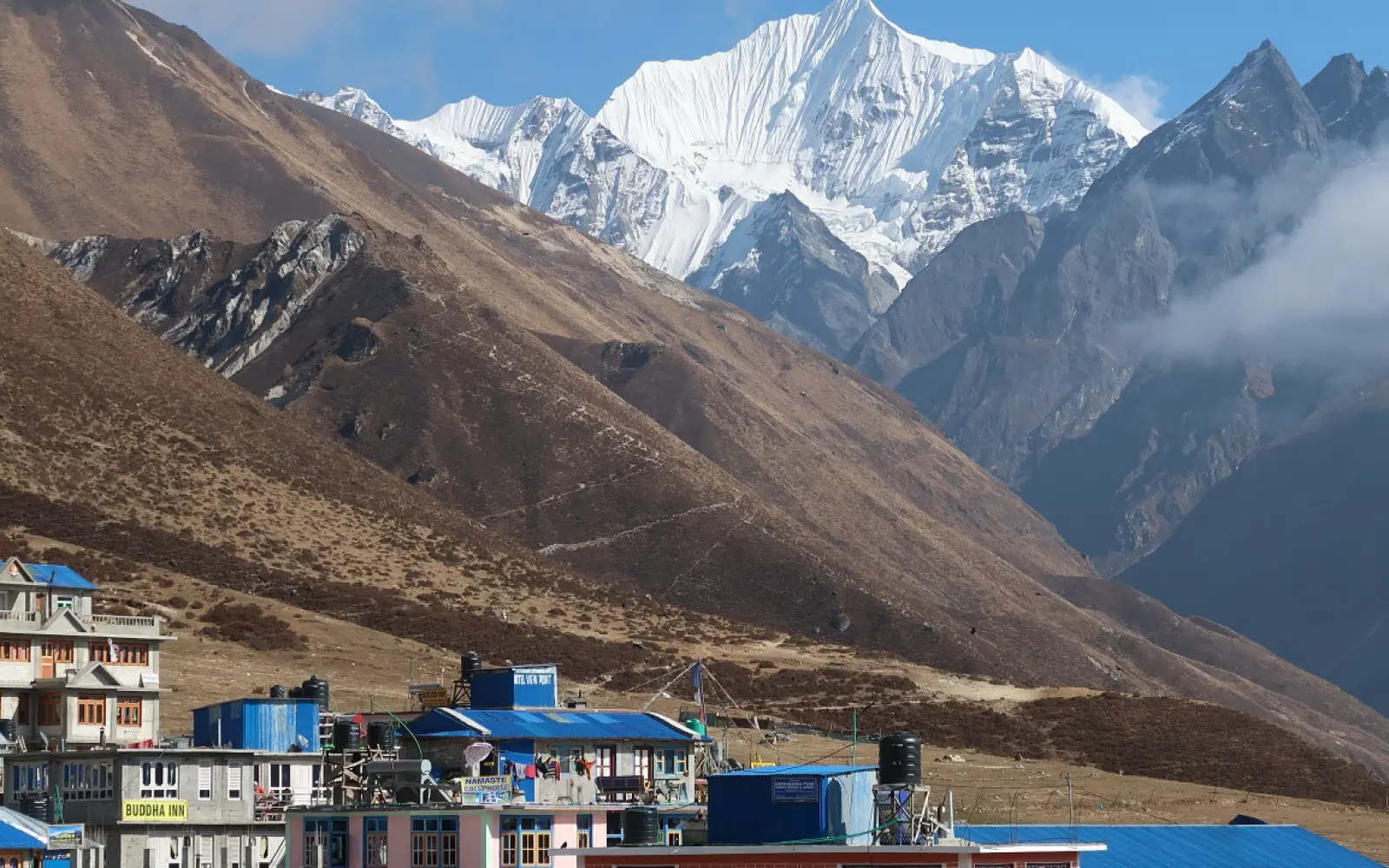
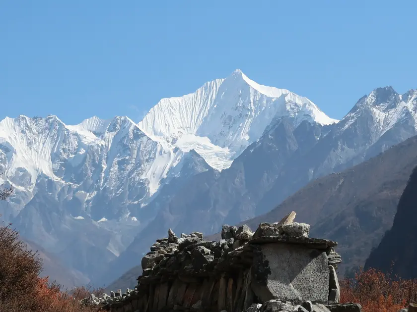
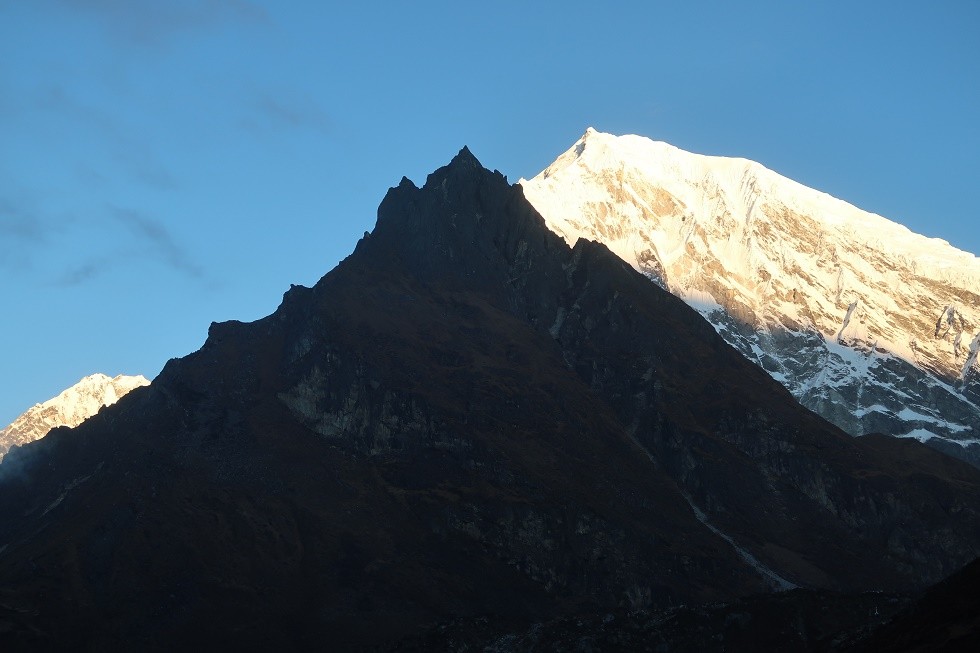
To begin with, trekkers also must understand Langtang Valley Trek difficulty before it can be planned. The trek ascends towards magnificent Himalayan peaks such as Langtang Lirung (7,200 m), Yala Peak (5,500 m), and Ganesh Himal (7,422 m). Altitude is thus a major determinant of what one experiences. To that, trail conditions vary from riverbeds and dusty paths to snow, ice, and rocky moraines near glacier areas.
Besides, the Langtang trek begins from Syabrubensi (1,550 m) after 6-7 hours drive from Kathmandu, goes uphill via villages of forest like Lama Hotel (2,430 m), Ghoda Tabela (3,030 m), and eventually ends at Kyanjin Gompa (3,870 m). Thus, the trekker witnesses consistent uphill gradient, sudden ascents, and even steep declines. Apart from that, beyond the tree line, physical endurance is challenged by cold, wind, and low air.
In addition, physical fitness is highly essential. Trekkers should possess good cardiovascular health, legs with strength, and hiking experience. Besides this, advanced planning weeks or months before is helpful, especially in stamina exercises, breathing exercises, and acclimatization hikes. Additionally, load-relieving equipment to be carried below 12-15 kg saves load keeping in view repeated gain and loss in altitude.
But weather also impacts significantly in terms of difficulty. Snow, rain, fog, or heavy winds occasionally shut down trails or make them slippery. Monsoon months lead to heavy rain; winter months provide snow-lined passes and colder conditions. Therefore, months like October-November or April offer fair weather stability and clearer trails.
Moreover, altitude sickness can turn into a serious threat. Starting from Syabrubensi (1,550 m), going up to Kyanjin Gompa (3,870 m), and even possibly further if going towards Tserko Ri (5,033 m), thin air may cause symptoms. Therefore, trekkers have to acclimatize adequately, climb slowly, consume lots of fluids, and monitor for signs like headache, nausea, or dizziness.
With regards to logistics, it gets harder once outside inhabited areas. Accommodation, food, and communication amenities thin out beyond Langtang Village (3,440 m). Trekkers should expect basic teahouse facilities, simple food, and dormitory sleeping in shared rooms. Carrying extra supplies or money comes in handy in case of emergencies as well.
In short, Langtang Valley Trek difficulty arises from extended elevation gain, diverse terrain, unpredictable weather, and altitude. Nevertheless, with adequate preparation, fitness, acclimatization, gear, and seasonal timing, many treks easily. Overall, trekkers must respect the mountain, plan reasonably, and be conservative to enjoy the experience safely.
How Difficult is the Langtang Valley Trek?
Evaluate how relevant the Langtang Valley Trek is in terms of terrain difficulty, altitude effect, physical requirements, and danger factors.
But trekkers ask how difficult the Langtang Valley Trek really is. The trek has steeply inclined ascents of 1,000-1,500 m in a day between some points. For example, ascending from Ghoda Tabela (3,030 m) to Kyanjin Gompa (3,870 m) entails about 840 m vertical climb in a day. Conversely, there is elevation loss in a day also, which puts pressure on knees and leg muscles.
What's more, the terrain is uneven and variable. Trekkers walk on forest trails, muddy slopes, suspension bridges, rocky moraine along glaciers, and sometimes patches of snow or ice. So, if you have weak ankles, poor balance, or no experience of mountain walking, you may not survive. Moreover, sudden variations of weather such as surprise snowstorms make higher altitude parts more hazardous.
Furthermore, altitude challenge remains relevant. At around 3,500 m thinner air is most commonly encountered by most people. Approaching Kyanjin Ri (4,773 m) or Tserko Ri (5,033 m), oxygen further reduces. Danger of altitude sickness thereby increases. Trekkers must factor in one or several acclimatization days. Moreover, rest and hydration are of utmost significance.
Although physical endurance demands are more than mountain climbing. Trekkers walk four to seven hours per day, typically six consecutive days or longer. They carry packs, fight fatigue, endure early starts, and tolerate rudimentary accommodations. And thus mental toughness becomes just as critical: toughing out pain, cold nights, and fatigue does.".
Moreover, logistics add to misery. Weather closure, landslide, flooding, or trail blockage can result in altering direction or postponement. Prices of food increase with elevation. For instance, eating at Kyanjin Gompa (3,870 m) is costlier than in lower villages. Other materials such as fuel, accommodation, phone recharging become scarce and costlier.
Despite those difficulties, experienced guides and well-planned trekking packages help. Guides suggest pacing, acclimatization, and route adjustment. Packages normally include accommodation, meals, permits, porters, and emergency evacuation plans. With it, therefore, trekkers have help, which minimizes much difficulty.
Finally, the trek is moderately difficult but not technical. Rock climbing equipment and ropes are not required except when diverting from the standard trail or in the winter. Most trails remain accessible so long as the fitness rate remains good to moderate. Overall, Langtang Valley Trek challenges new trekkers but repays them richly with Himalayan scenery, cultural richness, and inner strength.
Find the Langtang Valley Trek distances from major points and average day walking times to plan your itinerary and pace.
Here, preparation for the Langtang Valley Trek involves knowledge of walking miles and hours per day. The whole trek from Syabrubensi (1,550 m) to Kyanjin Gompa (3,870 m) and back covers a total distance of an about 60-70 km round trip. With side trips to places like Tserko Ri (5,033 m) or Yala Peak (5,500 m), total distance is about 80-90 km depending upon the path. Therefore, time for trekking normally takes 7-12 days.
Moreover, trekkers usually do 4 to 7 hours of walking every day. Let’s see the chart.
Segment
Approximate Distance | Walking Time
Syabrubensi → Lama Hotel (2,430 m)
14 km | 5-6 hours
Lama Hotel → Ghoda Tabela (3,030 m)
12-14 km | 5-6 hours
Ghoda Tabela → Langtang Village (3,440 m)
10-12 km | 4-5 hours
Langtang Village → Kyanjin Gompa (3,870 m)
8-10 km | 4-5 hours
In addition, if you reach Tserko Ri (5,033 m) or have a Yala Peak (5,500 m) side trip, you would trek 7-10 hours in one day. These trips involve steeper slopes and greater vertical relief. You naturally move at a slower pace while bearing higher altitude impacts.
Also, rest and acclimatization days must be factored in. Most itineraries add one extra day at Langtang Village (3,440 m) or Kyanjin Gompa (3,870 m) as an acclimatization day. Trekkers do shorter loops, visit local culture, or go to picturesque viewpoints like Kyanjin Ri (4,773 m) on those days. Therefore, those days have less than 2-3 hours of walking.
Apart from this, weather and trail conditions also affect hours and distance. For instance, snow or heavy rain would cause detours that extend walks. Wet and icy trail surface reduces speed. Visibility issues also result in stops and slower travel. For this reason, trekkers must provide extra time for unexpected delays.
Further, hours and daily distance also differ with age, physical fitness, load weight, and group size. An athletic person carrying a light pack can walk at 4-5 km/h on easy ground. Group with heavy packs or novices, however, could only achieve 2-3 km/h. Trekker must adjust itinerary to avoid fatigue.
In summary, Langtang Valley Trek is approximately 60-70 km subject to the route and normally about 4-7 walking hours a day. Keeping in mind acclimatization as well as side excursions, total itinerary can run up to 10-12 days. With this, realistic planning, even pacing, and flexibility with time yield best results for pleasure and safety.
Discover altitude gain on the Langtang Valley Trek, how your body must acclimatize safely, what heights you'll reach, and how to keep altitude sickness at bay.
Here, the Langtang Valley Trek involves steady altitude gain over a few days. The trek starts from Syabrubensi (1,550 m) and ascends via Lama Hotel (2,480 m), Langtang Village (3,440 m), Kyanjin Gompa (3,870 m). Beyond Kyanjin, optional day-trips go to Kyanjin Ri (4,773 m) or Tserko Ri (5,033 m). Thus, your body should be adapted to increasing elevation gradually in order to reduce risk.
Also, altitude sickness becomes more probable above 2,500-3,000 m, especially after the tree line. Trekkers typically complain of headache, nausea, dizziness, or shortness of breath if they ascend too fast. Therefore, the provision of rest days at midpoint elevations is imperative. Most itineraries provide acclimatization days at Langtang Village (3,440 m) or Kyanjin Gompa (3,870 m). Guides recommend "climb high, sleep low" wherever feasible.
Furthermore, acclimatization needs more than gradual ascent. You need to hydrate adequately, consume sufficient calories, refrain from alcohol, and let your body rest. Most sources recommend trekkers to climb no higher than 300-500 m altitude in a day after 3,000 m. Some package treks restrict altitude gain between successive nights to reasonable levels. When the signs of altitude sickness set in, immediate descent or resting until recovery becomes essential.
Moreover, optional climbs like to Kyanjin Ri (4,773 m) or Tserko Ri (≈ 5,033 m) require even more planning discretion. Trekkers who attempt those peaks typically start early dawn, utilize extra acclimatization, and pace themselves conservatively. Trails leading to these high points gain vertical elevation rapidly, expose you to harsher weather, decrease air pressure, and increase UV radiation intensity. Guides would generally counsel against rushing these sections.
Nevertheless, acclimatization adds time and cost to your trek. You’ll need extra nights, extra meals, possibly paying for higher‐altitude teahouses with more limited facilities. Many package tours include those rest days; independent trekkers must budget for them. Still, cost remains far lower than risk. In many cases, the cost of an extra day’s lodging and food is modest compared to medical evacuation or severe illness.
Finally, in conclusion, altitude gain during the Langtang Valley Trek walks you through low hills (1,550 m) to alpine peaks over 5,000 m. The higher the altitude, the more acclimatization requirements. Trekkers must climb gradually, incorporate rest days, monitor symptoms, hydrate well, consume wholesome food, and descend if necessary. With proper altitude management, the majority of people successfully carry out the trek and marvel at its breathtaking scenery without serious medical issues.
Learn about weather and seasonal challenges on the Langtang Valley Trek: monsoon rainfall, winter snow, best seasons, temperature variations and trail implications.
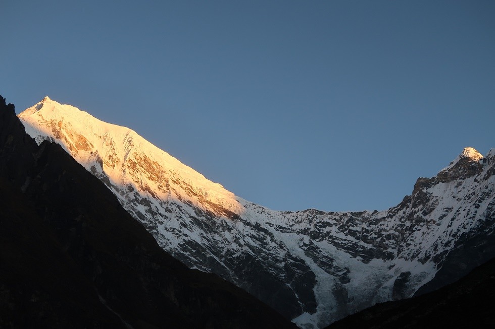
Meanwhile, the weather on the Langtang Valley Trek differs drastically with seasons and elevations. Spring (March-May) and autumn (September-November) offer the most stable weather, with clear skies, comfortable daytime temperatures ( 10-25 °C in lower to mid elevations), and chilly nights especially above 3,000 m. Summer (monsoon, June-August) is a period of intense rain, high humidity, muddy paths, landslides, and leeches. Winter (December-February) offers snow, icy paths, bitterly cold nights (below freezing), and sometimes limited lodge facilities.
Further, altitude modifies weather intensity. At lower elevations such as Syabrubensi (1,550 m) and Lama Hotel (2,480 m), monsoon rains and humidity are more intense, and temperatures rarely drop below freezing. At mid-elevations such as Langtang Village (3,440 m) and Kyanjin Gompa (3,870 m), snow can linger into spring, overnight temperatures dive well below 0 °C in winter, wind chill becomes a consideration, and storms can suddenly materialize. Higher peaks like Kyanjin Ri (4,773 m) or Tserko Ri (5,033 m) have bitter cold, wind-driven snow, and very poor visibility when clouds move in.
In addition, seasonal conditions affect more than temperature. Under monsoon, trails are slippery, rivers are swollen, bridges may be ruined or impassable, road access to Syabrubensi may be blocked. Rain adds the risk of hypothermia, leaks in accommodations, and heavy pack misery. Winter snow can shut down parts of trail, require special gear (crampons, warm clothing), reduce available teahouse amenities, and limit daylight hours. Spring and autumn offer the best compromise of long daylight, less rainfall, stable trails, and visibility and are the peak trekking seasons.
Moreover, mornings and evenings may be radically different. You may experience sun, heat during midday, and freezing cold or bitter evenings. Wind may further intensify exposure at open slopes, ridges. Afternoon cloud development during spring and monsoon season often brings thunderstorms or snow in the upper areas. Always carry layers, water-repellent outer clothing, insulation, and sun protection. Guides emphasize preparation for sudden weather changes.
Finally, by way of summary, weather and seasonal considerations are vital aspects of preparation for the Langtang Valley Trek. Spring or fall offers the most predictable conditions. Monsoon and winter offer risks in trails, visibility, lodging, and physical exertion. Trekkers must monitor forecast, carry the right gear, create flexibility in itinerary, and expect weather to vary by elevation. With preparation, you can reduce discomfort and maximize safety while enjoying stunning scenery.
Trail Terrain and Steep Sections Explained
Learn about the trail terrain and steep sections of the Langtang Valley Trek: forest trails, rocky moraines, snow patches, steep climbs, technical difficulties.
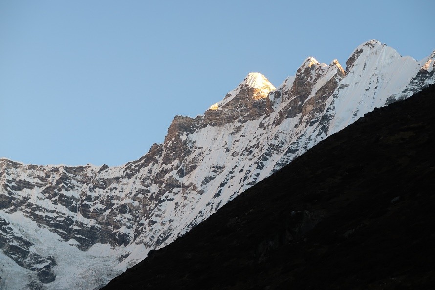
Meanwhile, the trail terrain of the Langtang Valley Trek varies greatly from lush forested trails at lower altitudes to rocky hillside and glacier moraines at higher altitudes. Between Syabrubensi (1,550 m) and Lama Hotel (2,480 m), you walk in mixed broadleaf forest, rhododendron trees, mud, and river crossings. Progressing to higher country above Langtang Village (3,440 m), trail surfaces change to loose rocks, boulders, scree, and patches of snow or ice. Terrain difficulty thus rises with elevation.
Moreover, steep terrain is also experienced on many days. As an example, the day from Lama Hotel (2,480 m) to Langtang Village (3,440 m) involves steep climbs over ridgelines and uphill switchbacks, particularly above tree line. The hike to Kyanjin Ri (4,773 m) or Tserko Ri (5,033 m) involves steep gradient increases, loose rock or snow if hiking in late autumn or spring, and exposed ridgelines. Similarly, some descent paths are steep and uneven, putting a strain on knees and muscles. Trekkers must utilize poles and good footwear.
Besides, trail width, footing, and obstacles also frequently alter. At stream crossings hikers will traverse wooden or suspension bridges; after rain, trails will erode or become muddy; snow bridges over streams will form in winter. Moraine sections near glaciers become uneven, unstable, and sometimes slippery. When heading further up above glaciers or on ridges, wind will loosen gravel or blow snow. All of these require careful footsteps, balance, and sometimes hands/feet scrambling.
Besides steepness of terrain, the duration of steep sections matters. On some days you have long uphill slogs for a few hours; fatigue accumulates. While descending on steep rocky paths after Kyanjin Gompa, knees undergo strain. Trekking poles, proper boots, slow pace reduce the risk of injury.
Finally, in conclusion, trail terrain on Langtang Trek varies from smooth woodland paths to rugged rock and snow high altitude paths. Steep ascents and descents, especially above Langtang Village and side summits, pose serious challenges. Trekkers should be prepared with decent boots, trekking poles, and experience on rough terrain. With care and slow acclimatization, you can safely navigate these steep and technical sections while enjoying regal mountain landscapes.
Fitness Level and Training Tips for Trekkers
Discover what level of fitness is suitable for the Langtang Valley Trek and get expert tested training tips to build strength, endurance, and resilience before embarking on your Himalayan trekking adventure.
While meanwhile, a good physical condition is the base for a nice and safe Langtang Valley Trek. The trek goes up from Syabrubensi (1,550 m) to Kyanjin Gompa (3,870 m) with side summit possibilities like Kyanjin Ri (4,773 m) or Tserko Ri (5,033 m). So your body must get used to ascending and descending hiking, often 5-7 hours per day, with load of equipment. Without acclimatization, fatigue, muscle sore or injury will slow you down or decrease enjoyment.
Also, pre-training, some weeks or months before, increases concentration and physical endurance as well as acclimatization to altitude. Begin with cardiovascular conditioning—running, cycling, swimming, or brisk walking at least three times a week. Also, include strength conditioning with leg focus (squatting, lunging, calf raises) and core stability (planks, back work), because your knees, ankles, and back support ongoing stresses on uneven terrain. On top of this, acclimatize with the weight of a backpack 5-10 kg for simulation of trek loads. Wear boots to break-in and avoid blisters which are to be used on the trek.
And flexibility and balance are important particularly while walking over rocky, slippery, or steep terrain. Add yoga, stretching, ankle strengthening, and balance exercises. Mental fitness too is important. Walking at high altitude, with uncertain weather, extended walking hours, and at times isolation requires resilience. Developing mental endurance by performing longer local hikes, sleeping in basic accommodation, or practicing multi-day walks prepares you.
Also, incorporate rest and recovery into your training regime. Overtraining leads to injury; undertraining leads to burnout on the trail. A minimum of one weekly rest day, good sleep, hydration, nutrition. Gentle training can be commenced 12 weeks before the trek if you are capable; less active people might take 3-6 months to gradually increase up to it safely.
But acclimatize your body ahead of time with conditioning hikes on trek days: hike 4-5 hours with hill climbs, early starts, loaded packs, rugged terrain. This will reveal weaknesses (e.g. shin splints, weak ankles, back pain) to correct before going high. Also check cardiovascular fitness through doctor if you have pre-existing medical conditions.
Finally, trekkers need fair to moderate fitness, not mountaineering fitness, to do the Langtang Valley Trek in safety. You will need to be able to walk uphill and downhill for 5-7 hours, with 10-15 kg, and handle rough ground and cold. Through cardio, strength, flexibility, mental preparation and recovery in your training, you will reduce the risk of injury, altitude issues, and exhaustion. Thus, at the time of the trek, you can enjoy Himalayan landscape and culture without cramping, breathlessness, or regret.
Important packing andgear checklist for Langtang Valley Trek: layers, boots, water purification, permits, and safety equipment to be secure and comfortable.
Meanwhile, proper packing keeps you warm, safe, and efficient on the Langtang Valley Trek. Temperatures fluctuate significantly: lower altitudes like Syabrubensi (1,550 m) can be warm in the day, but night temperatures at Kyanjin Gompa (3,870 m) or higher can be freezing. In such cases, layer clothing (moisture-wicking base layer, insulating mid-layer, waterproof/windproof outer layer) is required. You must also wear waterproof ankle-supporting trekking boots, several good socks, gloves, a warm headgear and sun protection.
Besides, bring gear that allows for safety and direction. Appropriate backpack (50-65 L) for your duffel gear and minor daypack (20-30 L) for everyday items. Use trekking poles to reduce strain on knees, especially on descending steep parts. Bring headlamp/torch and spare batteries for early dark mornings or poor lodge lighting.
And also, water, purification, and hygiene equipment fend off sickness. Bring refillable water bottles (at least 2 L total) and purification tablets or filters. Boiled water from tea houses is cheaper but higher elevation price and availability diminish. Bring simple personal first-aid kit: blister gear, painkillers, altitude sickness medication (Diamox if prescribed), sunblock, high SPF lip balm.
Also, outer layer clothing for protection against weather, temperature, and logistical reasons. Waterproof rain jacket & trousers, snow/mud gaiters, insulated jacket for evenings, thermal base layers for cold weather. Permits, ID, travel insurance, lodge cash, low-temperature rated sleeping bag (if trekking in cold)-10 to -20 °C. Dry bags or stuff sacks to store or dry gear. Electronics: power bank, solar panel charger, spare batteries, UV sunglasses, hat, gloves.
Further, do not over-pack. Keep your pack weight minimal. Porters or duffels assist you in carrying bulk that you do not need on a daily basis. Bulky packs hinder your pace, add fatigue and susceptibility to injury. Try packing with the full pack weight beforehand.
Short and sweet, a great Langtang Valley Trek gear and packing list includes layered clothing, good boots, safety and orientation gear, cold-weather gear, hydration and filtration, first aid, and careful weight management. With these items intact, trekkers reduce exposure to cold, weather, injury, waterborne illness, and altitude. Proper gear allows focus on scenery, culture, and the joy of walking rather than misery.
Food, Water, and Energy Requirements during the Trek
Learn what food and beverage options are during Langtang Valley Trek, how much calories you need, hydration rules, and daily trekking energy budgeting.
Meanwhile, food, water, and energy give your body the energy it needs while undertaking the Langtang Valley Trek. Appetite diminishes with increased elevation while calorie need is higher. Most trekkers expend 2,500-3,500 kcal or more per day based on load carried, terrain, walking time, altitude, and climatic conditions. Most of the energy is derived from carbohydrates (rice, noodles, bread), proteins (dal, meat, eggs), fats (oils, nuts), and snacks. Take three meals with snacks. Make breakfast revive you, lunches filling, dinners comforting and refilling. Add hot beverages to recover.
In addition, food prices and availability change with altitude. In lower areas like Syabrubesi (1,550 m), plain meal prices of Dal-bhat, noodle or soup are affordable (US$2-3). As you go higher above Ghoda Tabela (3,030 m), Langtang Village (~3,440 m), or Kyanjin Gompa (3,870 m), the price of meals rises: US$5-10 or more per plate. Full-day food budget for a day costs around US$20-25 in most teahouse treks.
Also, hydration and water become critical with activity and altitude. Drink at least 2-4 liters of water per day; more on high-altitude or hot days. Unfiltered stream water can be dangerous; use water purification tablets, filter, or boil water from tea houses. Bottled water is pricier at higher altitudes. Boiled water at tea houses is less money than buying bottled, but even boiled costs rise the higher you go.
Also, structure your power supply through snacks. Pack energy bars, nuts, dried fruit, chocolate, or trail mix that have quick calories. Snack before hunger so you won't feel "empty". Electrolyte beverages replace lost salts through sweating. Sweet foods sometimes boost morale too.
A quick cost & water comparison chart of food and energy needs:
Item | Approx. Cost -low elevation/High Elevation
Approx. Cost (high elevation) | Caloric / Other Notes
Basic meal (Dal-bhat, soup) | US$2-3 | US$5-10
High in carbs & protein; satisfying
Snacks (chocolate, bars, nuts) | US$1-4 | US$2-5
In-between meal energy suitable for
Bottled water (1 L) | US$2-3 | US$4-5
More expensive higher up; purification is less expensive
Boiled / Filtered water | US$1-3 | US$1-3
Less safe and costly than bottled at altitude
Moreover, calories needed also differ with hours of walking, temperature, altitude, and pack load. During day walks of 5-7 hours you might need ~2,500-3,000 kcal. For cold nights or extended climb days, extra fuel (e.g. >3,500 kcal) is helpful. Eat enough despite not being hungry. Drink before sleep, avoid too much caffeine and alcohol, get proper sleep.
Lastly, Langtang Valley Trek food, water, and energy requirements require planning. Budgeting money for where altitude increases, carrying snacks and purification gear, drinking loads of water, and choosing high-calorie foods prevent exhaustion or altitude sickness. Adequate fueling and hydrating you keep you in flow, healthy, and enjoying yourselves while trekking under incredible Himalayan scenery.
Accommodation Quality and Availability in Langtang Region
Know accommodation quality and availability on the Langtang Valley Trek, teahouses, guesthouses, price by elevation, facilities and tips on booking at high altitude.
Simultaneously, trekkers will have lodges on the Langtang Valley route that vary extensively with altitude, seasonality, and village size. On lower slopes like Syabrubesi (1,550 m) and Lama Hotel (2,470 m), teahouses and guesthouses offer twin or dormitory accommodations with basic furniture, hot blankets, shared bathrooms, and sometimes attached bathrooms at extra cost. In mid-elevation stopping places such as Ghoda Tabela (3,030 m) and Langtang Village (3,430 m), the accommodation is simple; mattresses are thin, bathrooms are shared, and facilities such as hot water, Wi-Fi, and charging are accessible, but are pricey and less dependable. At high altitude, i.e., Kyanjin Gompa (3,870 m), accommodation becomes more primitive: rooms are basic with blankets or shared quilts; often no heating; individual bathrooms are still the exception; hot water may be solar or gas and may incur extra charge or be available on tap at certain times.
Besides, availability is seasonal. During high trekking seasons (spring: March-May, autumn: September-November) teahouses are in demand. Teahouses are fully booked; travelers can have to arrive at noon to find a room. During off-season (monsoon: June-August, winter: December-February), most lodges are shut, particularly in higher altitude areas. Therefore availability is patchy; quality of the service decreases.
Plus, accommodation costs more with altitude and peak season. At lower-altitude rest stops like Syabrubesi and Lama Hotel, you pay between NPR 500-1,000 per night for a basic twin bed room. In mid-altitude towns like Langtang Village, prices up to NPR 1,000-1,500/night. At Kyanjin Gompa, you pay NPR 1,000-2,000/night, depending on quality of room, view, or private bathroom facility. During peak season, prices are higher; off-season, there are discounts or low rates.
Also, the number of amenities impacts comfort. Hot showers exist in lower and mid-altitude lodges (Syabrubesi, Lama Hotel, maybe Ghoda Tabela) often at extra charge (NPR 200-500). At the higher altitudes (Langtang Village, Kyanjin Gompa) they are less available; solar heating or gas heating may not function on cloudy or cold days. Room cleanliness is satisfactory but the blankets may be too light for cold at high altitudes; some trekkers take their own sleeping bag with a rating of at least -10 °C, especially for overnight stays in Kyanjin Gompa or side trips above 5,000 m.
Below are highlight points on what to expect:
Rooms: dorm or twin, shared bathroom standard; private bathrooms not common and additional expense.
Bedding: provided blanket; warm enough only at low/mid altitudes; take a sleeping bag especially above 3,500 m.
Showers: warm showers in lower places; high altitude areas: short time / sometimes cold.
Utilities: charging kit, Wi-Fi sometimes available in village lodges; higher up additional cost or hit-and-miss.
Peak season: pre-booking helps get desired lodges; off-season: fewer options, some shut.
In short, accommodation in the Langtang region proves useful but rudimentary, and quality decreases at higher elevations. Availability, though, is good if one books early, goes during peak season with reservations, and brings essential gear (sleeping bag, warm clothes). So expect modest comfort, rising price with altitude, and occasional sacrifices of luxury for safety, cleanliness, and warmth.
Learn about risks of altitude illness on Langtang Trek—AMS, HAPE, HACE—plus proven prevention methods, symptoms, altitude heights, medication, and response.
Here, altitude sickness ranks among the most risky health dangers of the Langtang Valley Trek, especially as the trekkers ascend higher than ~ 2,500-3,000 m. Acute Mountain Sickness (AMS) appears in headache, nausea, dizziness, fatigue, or insomnia. If the trekkers do not pay any heed to them, the disease could advance to High-Altitude Pulmonary Edema (HAPE) or High-Altitude Cerebral Edema (HACE), both of which are potentially fatal.
Further, the climb rises steeply: from Syabrubesi (1,550 m) to Lama Hotel (2,480 m), and Langtang Village (3,430 m), Kyanjin Gompa (3,870 m), with detours to Kyanjin Ri (4,773-5,000 m) or Tserko Ri (5,033 m). Any climb over 3,000 m hence demands proper acclimatization. Trekkers need to limit daily gain of altitude to about 300-500 m beyond 3,000 m, take rest days, particularly at Langtang Village or Kyanjin Gompa.
Moreover, lifestyle habits, nutrition, and hydration determine risk greatly. Trekkers need to drink plenty of water—typically 3-4 liters per day, more if heavily exerting, to decrease dehydration risk. They need to consume energy-providing meals, focusing on carbohydrates. Trekkers need to abstain from alcohol, smoking, and heavy foods, which are greasy or hard to digest and stress the body. Sleep matters: rest well, sleep lower if possible, and avoid sleeping too quickly after heavy exertion.
Also, medication enables prevention if taken with medical advice. Acetazolamide (Diamox) is a typical medication to prevent AMS: the majority of guides recommend starting it 24-48 hours before ascending 3,000 m, taking established doses while going up. Trekkers, however, must consult a doctor first since it has possible side-effects.
Additionally, recognition and action on early symptoms are important. Stop ascending if headache, nausea, weakness, or shortness of breath becomes increasing. Rest for one or more days; if symptoms persist or worsen (e.g. water in the lungs, confusion, loss of coordination), descend immediately. Use oxygen or portable treatment if possible. Trekkers should travel with first aid-qualified guides; many use pulse oximeters and basic medical kits.
In summary, Langtang Valley Trek renders trekkers extremely susceptible to altitude sickness at heights over 3,000 m. Nevertheless, trekkers can avoid serious illness in the most part by ascending gradually, being well-hydrated, consuming a balanced diet, resting, taking prophylactic medication, and detecting symptoms early. By keeping the proper type of awareness and caution, you can trek safely and enjoy its stunning high-altitude landscapes.
Safety Tips for Narrow Trails and Landslide Zones
Get trekking tips on narrow trails and landslide trails on the Langtang Valley Trek—route information, seasonal hazards, gear, use of guides, emergency.
Meanwhile, steep trails in the Langtang region are especially dangerous, especially after or during heavy rain, snowmelt, or earthquake. Trails follow steep ridges, riverbanks, and cliffs. On most sections between Bamboo and Lama Hotel, trails cross loose terrain or tread exposed drop-offs. Similarly, terrain above 4,000 m on steep moraines or ridge crests can break away or have loose boulders. They require careful foot placement, good balance, and alertness.
Further, landslide-prone terrain becomes dangerous especially during monsoon (June-August) or after spring snowmelt or an earthquake. Heavy rains start soil saturation that results in landslides closing trails, eroding paths, and destabilizing slope material. Avalanches happen on steep slopes above 4,000 m in winter or spring as well. Trekkers then must avoid trekking in bad weather, consult trail reports from the locals, and follow guide advice.
Also, choosing good gear and boots minimizes risks on bad ground that is unstable and narrow. Trekking poles help with balance; good boots with good grip reduce slipping. Gloves help when scrambling. A headlamp helps for early starts or when trails get dark in cloudy weather. Carry loads lightly in order to keep your center of gravity steady. Also, do not tread near trail edges when donkeys or porters are coming towards you; leave room.
In addition, when approaching landslide debris or washouts, inspect trail over prior to crossing. At times there are temporary bridges or crossings; at times you will need to detour or wait out clearing. Educate yourself: local guides usually understand which areas are temporarily unstable or closed. Avoid hiking during or shortly following heavy rain, particularly in landslide-prone areas (e.g. Bamboo and Pahire zones, slope above streams). Carry emergency contact info; know where nearest shelters are.
Following are safety habits in major points:
Always hike with a guide familiar with the trail; they identify unstable slopes earlier.
Check weather forecasts beforehand; don't climb narrow ridges during storms or heavy rain.
Use trekking poles; keep pack weight low; use ankle-supporting boots and heavy tread.
Back away from edges when donkeys or pack animals are coming near; provide space.
Watch for signs of danger: rolling ground, cracking sound, falling rock. Withdraw if necessary.
Learn descent options: lower-altitude safe refuges or villages; map routes of withdrawal.
In short, steep trail and landslide country on the Langtang Trek constitute real risk but are manageable with prudence. You must use appropriate gear, have experienced guides with you, monitor weather, maintain moderate load, avoid risky periods (monsoon, after heavy snowfall, or earthquake activity). With prudence and vigilance, you can successfully traverse the broken terrain, enjoy scenery, and reach destinations without meeting disaster.
Langtang Valley Trek Difficulty vs Annapurna and Everest Treks
Compare Langtang Valley Trek difficulty vs Annapurna and Everest treks: altitude, terrain, duration, fitness and risk differences for better choice.
Mainly, few compare how Langtang Valley Trek is to Annapurna Treks (ABC, Circuit) and Everest Base Camp in terms of difficulty. Langtang peaks like Kyanjin Ri (4,773 m) or other Tserko Ri (5,000 m) are not similar to Annapurna Base Camp (4,130 m) or Annapurna Circuit's Thorong La Pass (5,416 m). Everest Base Camp is 5,364 m. Thus, Everest and Annapurna Circuit pose altitude more challengingly than Langtang. Annapurna Base Camp possesses moderate altitude as equal as Langtang but its terrain and crowds vary.
Besides, terrain and trail conditions differ immensely. Langtang trails are less developed, less maintained, with rocky moraines, muddy paths, and fewer stone staircases, especially above Langtang Village (3,440 m). Annapurna Base Camp (ABC) contains many stone staircases (e.g. Ulleri), better developed support infrastructure, and better quality marked trails. Everest Base Camp contains glacier moraines, snow, icy ridges, long exposed sections. So Everest trekkers find it most demanding in trail exposure and technicality.
Also, the time and day effort differ. Langtang usually takes 7-10 days with acclimatization, trekking 4-7 hours a day. Annapurna Base Camp is 7-12 days depending on rest days; Annapurna Circuit is longer (14-20+ days). Everest Base Camp usually involves longer approach (flight and many daily hikes), more high-altitude days. Thus time spent at altitude and total fatigue compound difficulty in Everest and Annapurna Circuit.
Additionally, risk for altitude sickness also increases with maximum elevation. As Langtang's summit options are about 5,000 m, it has moderate risk when done at rapid pace. Annapurna Circuit goes over Thorong La (5,416 m), which is of greater risk. Everest Base Camp region has prolonged exposure to high altitudes and often in poorer conditions, increasing risk further. Trekkers need more acclimatization, slower pace, and proper preparation in Annapurna and Everest than in Langtang.
Likewise, crowd sizes, infrastructure, and logistics influence perceived difficulty. Annapurna and Everest routes receive dozens more climbers; lodges, food, and stores upgrade continually; trails can become crowded on peak sections. Langtang is less crowded, offers greater isolation, but lodges may be less luxurious and services fewer. Sometimes that simplicity magnifies the challenge as increased altitude, cold nights, or weather change.
Finally, to wrap it up, Langtang is situated between simpler treks and the most difficult Himalayan treks. It is more difficult than Annapurna Base Camp in some roughness and terrain but less severe than Annapurna Circuit or Everest Base Camp in danger, exposure, length, and altitude. Therefore, if you have moderate fitness and short time, Langtang is a good middle ground. If you have more time, experience, and inclination to work at altitude and exposure, Annapurna Circuit or Everest provide greater challenge.
Advice for First-Time High Altitude Trekkers
Essential tips for first-time high altitude trekkers: fitness, pacing, gear, prevention of altitude sickness, mental toughness, preparation for Langtang or similar treks.
Meanwhile, new high altitude trekkers must prepare physically and mentally. They should start training months before with cardio, strength, and endurance exercises. They should include hikes that simulate altitude if possible. They should also test gear, sleep bundled up, and practice light packing. They must break boots in and ensure equipment works well in cold and wet conditions.
Additionally, upward and downward pacing does count. Starters don't need to strain: maintain elevation gain at 300-500 m per day above 3,000 m. Rest days or acclimatization days at half-heights such as Langtang Village (3,440 m) or Kyanjin Gompa (3,870 m) provide time for the body to adjust. Pay attention to their body: they must observe and take notice of any symptoms (headache, nausea, exhaustion) that call for rest or descent.
Also, nutrition and hydration support performance. Trekkers need frequent meals packed with carbohydrates, adequate proteins, and fat. They need to snack often—nuts, bars, dried fruits. They should have a minimum of 2-4 liters of water a day; more when exerting, sweating, or at high altitude. They need to avoid alcohol or high caffeine that dehydrate.
Furthermore, the gear selection precludes most discomforts and risks. Use layered clothing: moisture-wicking, insulating mid-layer, water-repellent outer. Use good waterproof boots with ankle support. Trekking poles reduce knee stress on ascents and descents. Pack sun protection: sunscreen, glasses. Pack suitable sleeping bag, rain cover, first aid, altitude medicine (if allowed), emergency comms device.
In addition, psychological resilience is just as crucial as physical. First-time trekkers will have fatigue, freezing nights, mercurial weather, tardiness and inconvenience. They have to prepare by taking shorter hikes, camping overnight in tough conditions, acclimatizing themselves to tolerating inconvenience. They have to have realistic expectations, accept slow pace, find enjoyment in small victories.
While so, prevention of altitude sickness and acclimatization are non-negotiable. They should go up slowly, take rest days, drink plenty, not work excessively especially in the early days of trekking, and take prophylactic medication like Diamox after consulting the doctor. They should be knowledgeable about signs, carry descending plan always, and never underestimate symptoms.
Below is a must checklist for beginner high altitude trekkers:
Get prepared at least 8-12 weeks prior: cardio + leg strength + endurance.
Organize acclimatization days at altitudes 3,000-4,000 m.
Keep water intake high; don't become dehydrated.
Refuel properly: carbs, proteins; eat often.
Pack essential gear (boots, layers, sun protection, poles).
Listen to body; descend if altitude sickness occurs.
Leave pride at home; never go too hard or miss rest.
In short, first-time high altitude hikers have much to gain from prep: physical fitness, smart pacing, good gear, hydration, food, and mental resilience. With all those ingredients, hiking Langtang or similar Himalaya trails is safer, more enjoyable, and less intimidating. Planning ahead makes brutal beautiful.
Hiring a Guide or Porter: Advantages and Disadvantages
Learn the pros and cons of hiring a guide or porter for Langtang or other Himalayan treks: cost, help, safety, ethical issues, comfort, considerations in making a decision.
Mainly, hiring a porter or guide on Himalayan treks like Langtang, Annapurna or Everest offers many benefits. A guide provides route commentary, cultural interpretation, safety monitoring, emergency management, and access to permits. A porter takes care of heavy loads so that you carry less, reducing exhaustion and blisters or injury risk. Moreover, they both allow for greater appreciation of views and mental bandwidth because you focus on walking and being rather than logistics or burden.
Besides, porter and guide services are not gratis and require budgeting. A local porter may cost USD 18-25/day; guides are more expensive (USD 25-40/day), depending on agency, region, season, and service. Agencies usually add accommodation, food, insurance to these charges. Such an outlay adds up over several days. Besides, you must provide proper gear and give them decent load and rest. Additional tipping is customary (10-15%).
In addition, loss of independence and flexibility. When you engage a guide, you generally acquire a set schedule, group pace, and perhaps limited freedom to adjust itinerary on the spur of the moment. Having your own pack allows flexibility of rest, pace, and arrival times; utilization of porter necessitates coordination. Guides often have agendas to squeeze in schedules to fit lodge availability or lodging quality in some off-the-beaten-path or less commercial areas.
Apart from that, there are issues of quality and ethics. There are porters or guides who lack proper equipment, training, insurance, or contracts. There are some who are underpaid, overloaded, or subjected to inhuman conditions. Trekking agencies are very diverse: ethical ones ensure fair pay, max load (typically ≤ 25-30 kg), reasonable sleeping conditions, medical insurance, reasonable clothes/shoes. You should see these before you employ.
Below is a list of guide/porter hiring pros-vs-cons:
Role
Pros | Cons
Guide
Route safety; cultural insight; emergencies handled; permits sorted | Higher cost; less solo pace; reliance on others
Porter
Less exhausted; enjoy view more | Extra cost; sometimes limited language support; must plan pick up/drop times
Guide + Porter
Balanced support; most comfort; safety + light load | Highest daily expense; group dependency; less spontaneous change
In addition, decision is made on trekking type, personal fitness, experience, and budget. If you are inexperienced at altitude, trekking Langtang with a guide gives better safety. If you travel light, experienced, and do not mind being independent, you can hire only a porter or even trek alone where it is allowed. Always check legal requirements: some treks now insist on guides or authorized staff in certain conservation areas.
Finally, on a concluding note, hiring the service of a porter or guide gives safety, support, comfort, and relieves load, especially in Langtang region or similar demanding Himalayan trails. It is also more expensive, reduces independence, and raises ethical/responsibility issues. So think through your fitness, experience, budget, and priorities first before deciding. Goodly selected guide/porter contribute to trekking experience; bad selection may rob.
Planning Extra Days of Weather Delay or Health Problem
Plan extra days of weather delay or illness into Langtang Valley Trek, recognize rough additional costs, accommodations, meals, permits, evacuation preparedness.
Meanwhile, trekkers need to leave buffer days in their itinerary for Langtang Valley Trek as weather or health conditions frequently necessitate postponements. Monsoon rains (June-August) or early/late snow during winter (December-February) can close trails or trigger landslides. In a similar way, altitude sickness or fatigue might necessitate rest days at mid-altitudes such as Langtang Village (3,440 m) or Kyanjin Gompa (3,870 m). Hence, incorporating 1-3 additional days into your schedule averts rushed accommodation or precipitous descents.
In addition, each day costs money in lodging, meals, and, in some cases, porter/guide fees. Basic tea-house rooms in lower-mid villages are about US$3-5 per night; nicer villages like Kyanjin Gompa charge US$6-10 for view or better rooms. Each day's meal comes to about US$15-25 in higher altitude towns when breakfast, lunch, dinner, and the occasional hot drink/snack are factored in. Porter and guide fees also continue; if you hire them, compensate their daily fees even on rest days.
Also, extra permit or TIMS card fees do not usually increase by days, but any National Park or conservation region fees that are required remain the same irrespective of your duration. But emergency fees or evacuation (if required) can be through the roof. Helicopter evacuation in Nepal is a few thousand USD. Travel insurance that reimburses evacuation may pay part but typically with out-of-pocket or deductible. Trekkers should ensure their insurance includes high-altitude evacuation and have cash or credit for emergency purposes.
Besides, accidental stay for health (altitude sickness, injury) might necessitate overnight stays in lodges where electricity, heating, or medical equipment is acceptable, and it will be more expensive. Sometimes shortage gaps in winter or off-season force trekkers to spend the night in more expensive accommodations or even to go back to lower villages. Since lodging quality declines with elevation, the cost of comfort or security when falling ill or being held up has the tendency to increase.
The following is a highlighting chart of "Extra Day Cost" estimates in different elevation zones:
Elevation Zone | Approx. Room Cost per Night
Food & Drink Cost per Day | Guide/Porter Daily Fee
Low-Mid Elevation (Syabrubensi → Lama Hotel, ~1,500-2,500 m) | US$3-5
US$12-18 | US$20-30 (if employed)
Mid Elevation (Langtang Village, 3,440 m) | US$5-8
US$15-25 | Same rate or slightly higher because of logistics
High Altitude (Kyanjin Gompa, ~3,870 m & side-trips) | US$6-10+
US$18-30+ | Possibly extra for porter guide transport
In addition, trekkers should plan a little more for supplies (e.g. medicines, warm clothing) in the event of sickness. A first aid purchase in advance in upland villages will be more costly due to transport. Similarly, weather hold-ups may force later meals or accommodation which all add up in cost.
Finally, to summarize, budgeting extra days on the Langtang Valley Trek becomes a requirement. Weather, acclimatization problems, or trail blockages frequently force unplanned rest or slower progress. Trekkers need to estimate extra 1-3 days beyond planned duration, proportion lodging, food, guide/porter fees accordingly, and always keep cushion money or insurance handy. With that safety net, you remain economically worry-free and make safer, more flexible decisions on the trail.
Emergency Evacuation and Insurance Advice
Details on emergency evacuation procedures on Langtang Valley Trek, insurance types, what to inspect when policy, helicopter rescue cost, and measures of safety.
By comparison, emergency evacuation and insurance are vital safety measures for Langtang Valley Trek, especially above 3,000 m and near rough terrain or high passes. Trekkers are susceptible to altitude sickness, illness, injury, or trail obstruction. Evacuation can be walking down, ground transportation, or in serious situations, helicopter rescue. Helicopter evacuation in Nepal costs tens of thousands USD. Insurance with emergency evacuation high-altitude saves lives and dollars.
Also, policies vary considerably. Trekkers must have policies that specifically cover high-altitude trekking (at least up to 5,500 m if side-trips to Tserko Ri (5,033 m) are contemplated). They should have medical evacuation, hospitalization, possibly repatriation. Ensure that rescue fees are covered under insurance, including helicopter, ground ambulance, and logistic delay. Also ensure policy covers Nepal and within Langtang National Park.
Next, rescue logistics and response time matter. Weather at Langtang decides whether helicopter can operate. During monsoon or winter heavy snow, evacuation would be delayed. Descent or ground rescue may take hours or days. Guides and trekkers must know nearest medical centers (e.g. at Syabrubensi or Kathmandu), and carry communication equipment (satellite phone, local SIM, emergency signal) to call for help.
Further, insurance price is different according to duration, height attained, age and medical history. Certain companies offer insurance for complete 2‐week treks in Langtang for approximately US$50-100 in case of evacuation and height protection. Low plans or travel insurance excluding evacuation are cheaper but risky.
Below are essential checklist points for choosing insurance & evacuation readiness preparation:
Make sure policy covers trekking to your peak (e.g. 5,000-5,500 m if trekking to Tserko Ri).
Make sure medical evacuation & rescue (helicopter & ground) are covered.
Check remote area coverage (e.g. Langtang); consider communication costs.
Carry copy of policy, emergency contact information, insurance company phone number.
Carry minimal first aid kit, know how to identify altitude sickness, descent plan in hand.
Bring spare funds to pay evacuation supplier in advance if needed; insurance can cover later.
Consequently, trekkers also need to plan physically: do not over-exert at altitude, acclimatize, monitor for symptoms. Guides will carry equipment and have communications with rescue teams, which speeds up response. Trekkers traveling alone may not have that behind them, so insurance is even more critical.
In short, emergency evacuation and insurance are non-negotiable aspects of safety for Langtang Valley Trek. They protect you in the worst possible situations—injury, altitude illness, extreme weather shutdowns. In case of right policy, rescue plan, and situational awareness, you can trek with ensured support. Always review policy details well ahead of time, carry documents, understand logistics, and include insurance as part of trip expense.
Best Seasons to Avoid Trekking Difficulty
Discover the best seasons for Langtang Valley Trek to reduce hardship—why spring and autumn offer ideal weather, trail conditions, and clarity; avoid monsoon & deep winter.
Although selecting the right season significantly impacts how difficult the Langtang Valley Trek is. Spring (March-May) and autumn (September-November) are the best seasons. These seasons have predominantly clear skies; evening cold begins to set in, but trail surfaces are relatively dry. Daytime temperatures are about 10-25 °C at lower to middle elevations. Evenings are colder above 3,000 m but mild relative to monsoon or winter extremes.
Besides, spring trails are supplemented with blooming rhododendrons and reduced snow after winter, with views being stunning and scenery inspiring. Trails in autumn follow on the tail of monsoon, which washes away the dust and cleans the air. Mountain views (Langtang Lirung, Ganesh Himal, Dorje Lakpa) thus become dramatic and sharp. Land gets dry, trails become hard, reducing slips and mud.
Further, walker traffic and services are uniform during those months. Tea-houses function widely; travel to the beginning point (Syabrubensi) is less affected by landslides or blocked roads. Guides, porters, and resupply lines function more efficiently. Weather forecasting tends to materialize, allowing trekkers to set daily walking times more accurately.
Nonetheless, monsoon (June-August) and winter (December-February) significantly add challenge. Under monsoon, slippery trails due to heavy rain, swollen rivers, landslides, and leeches. Visibility is reduced; cloud cover reduces visibility; humidity and wet gear sap energy. Winter adds cold nights below freezing at altitudes above 3,500-4,000 m, snow cover, icy trails, and limited lodge amenities to challenge. Wind chill, brief daylight hours, and risk of avalanches or snow-bound passes increase difficulty of trekking.
Here is a quick seasonal comparison to avoid difficulty:
Temperate daytime temperatures; flowering forests; services well available; less snows on paths | Intermittent rain; snow falls at the start of the season; strong sunshine; crowds increase
Autumn (Sep-Nov)
Settled weather; dry/firmer trails; excellent visibility; most facilities open | Busy at peak times; cold nights; risk of early snow late Nov
Monsoon (Jun-Aug)
Green landscape; lowered accommodation price; lower number of tourists | Torrential rains; leeches; landslides; slippery, muddy trails
Winter (Dec-Feb)
Quiet trails; snow scenery; less crowding | Extreme cold; snow/ice; a few lodges closed; minimal daylight
Finally, in short, for minimizing trekking hardship, spring and autumn are still the most suitable seasons to trek the Langtang Valley. They provide decent weather, reliable lodges, tolerable temperature, and improved views. Avoid monsoon due to its trail hazards, and avoid harsh winter if you are not adequately experienced, well equipped, and accommodative to cold. Choosing the right time turns a hard trek into a reasonable, enjoyable experience.
Connectivity and Communication Challenges in Remote Regions
Find out connectivity challenges on the Langtang Valley Trek—phone signal, Wi-Fi, SIM cards, power, remaining connected in remote terrain.
In addition, trekkers have discovered communication to be inconstant while traversing isolated areas of the Langtang Valley (from Syabrubesi 1,550 m to Kyanjin Gompa 3,870 m). Nepal Telecom (NTC) and Ncell provide signal in lower villages like Syabrubesi and a few places like Lama Hotel (2,480 m), but coverage disintegrates at forest, tiny valleys, and higher elevation above Langtang Village (3,440 m). So, calls, mobile internet, and messages often fail or go out altogether.
Furthermore, Wi-Fi in several teahouses in tourist spots such as Langtang Village (3,440 m) and Kyanjin Gompa (3,870 m), occasionally in Lama Hotel (2,480 m), exists. However, the Wi-Fi in teahouses is slow, maybe unpredictable in poor weather, and usually NPR 300-500 per device. Customers may face lag, bandwidth restrictions, or system crash.
Moreover, electricity and power supply add another layer of issues. The lower altitudes have access to better and improved grid-connection; the higher altitudes employ solar or backup power. On rainy or cloudy days, solar and backup systems may collapse, resulting in power losses or low voltage. Electronics (camera, mobiles, power banks) need protection against cold, good insulation, and backup batteries.
In addition, weather and terrain affect connectivity directly. Forest cover, valleys, ridges, or dense cloud cover interferes with signals. Rain, snow, or storm-clouds also degrade the signal or render solar charging systems useless. Trekkers may be left with no functional mobile or internet connectivity for hours or even a full day.
Below are some advice on dealing with these issues:
Carry and turn on a local SIM card (ideally NTC) before starting; carry both NTC and Ncell for backup.
Download maps offline, guidebooks, important documents, weather apps.
Carry a good quality power bank (high capacity), solar charger if possible, and keep the gadgets warm (inner pockets, insulated during nighttime).
Use Wi-Fi in villages only for essential communication; don't depend on it for high uploads or heavy video.
Sitcom device or emergency beacon for remote areas can be an option.
Finally, in brief, connectivity and communication while on Langtang Valley Trek are challenged by the following: patchy mobile network, slow or pricey Wi-Fi, limited power in the outback. But with planning—local SIMs, offline tools, power backup, expectation management—you can be fairly connected and safe. Plan for periods of disconnection, and apply physical maps, guide support, and emergency protocols as fallbacks.
Final Preparation Checklist for a Smooth Langtang Valley Trek
Make good use of this final checklist to plan well for the Langtang Valley Trek—health, fitness, equipment, permits, packing, communication, insurance and more.
In addition, end preparation is what breaks or makes your Langtang Valley Trek holiday. You must get fitness, equipment, logistics, and security into shape before you leave. Therefore, make use of the checklist below to cross off fundamentals and reduce surprises.
Final Trekking Preparation Checklist:
Category | Key Items
Actions | Purpose
Permits & Documents | Passport, visa, trekking permits, TIMS card, National Park entry
Legal travel; avoid delays or fines
Insurance & Health
Travel insurance at high altitude; first-aid kit; medications for prevention of altitude sickness; insect repellants; up-to-date vaccines | Safety; reduce risk of disease or emergency
Fitness & Acclimatization
Leg strengthening and cardio training; loaded-pack hikes; rest day acclimatization schedule (Langtang Village ~ 3,440 m, Kyanjin Gompa ~ 3,870 m) | Build endurance; reduce risk of altitude sickness
Clothing & Gear
Layered clothing; rain-proof jacket; down jacket for insulation; trecking boots (broke-in); warm socks; cold-weather sleeping bag; hat & gloves; gaiters | Warmth; cold, rain, snow protection
Electronics & Communication
Local SIM(s) (NTC/Ncell); power bank; spare batteries; sun charger; download maps offline; emergency communication device | Stay connected; navigation; safety
Food & Hydration
Energy snacks; water purification or tablets; plan food budget; bring snacks for long/hard days Maintain energy; prevent dehydration/illness
Packing Strategy
Pack only the essentials; control carry weight; hire porter services if possible; organize dry bags Minimize fatigue; protect equipment
Weather & Seasonal Equipment
Rain equipment; sun protection; insulating layers; refer latest weather report; plan schedule around season | Acclimatize to the weather; stay away from exposure
Insurance & Evacuation Plan
Familiarize with local clinics/hospitals; emergency route; contact numbers; confirm insurance covers evacuation | Prepare in case illness/injury happens
Budgeting Buffer
Unforeseen days, equipment breakdown, medical needs; cash for remote villages; guides/porter gratuity | Adaptability; not being stranded
Further, verify logistics before leaving Kathmandu or home. Arrange transport to Syabrubesi. Reserve flights, accommodations, guide/porter through a reliable agency. Leave one person in the know. Bring spare passport photos. Exchange or retain adequate local currency; cards may not be accepted in rural villages.
Also, before trekking, test all your gear: boots (trek long distances), backpack, rain clothing. Test sleeping bag in cold environment. Test carrying your entire pack to find out comfort. Finally, rest well in last few days before leaving; drink fluids; don't overdo the last 24–48 hours.
In short, a mundane Langtang Valley Trek depends on massive last-minute preparation: forms, fitness, gear, cash, phone, and attitude. Use the list, make room for flexibility, plan for flexibility. Having prepared your work, you step onto the trail in good shape, prepared to enjoy view, society, and push to the limit.
Why Choose Haven Holidays Pvt. Ltd. for Langtang Valley Trek?
Understand how Haven Holidays Pvt. Ltd. excels in providing Langtang Valley Trek—expert staff, safety, integrity, ecotourism, authentic experience.
Meanwhile, there are many trekking operators in Nepal, but Haven Holidays Pvt. Ltd. stands out on several grounds. It has full legal approval from Nepal Tourism Board and membership of Trekking Agencies Association of Nepal (TAAN), which ensures authenticity and regulation compliance. It focuses on safety and comfort, with experienced professionals and veteran local guides who know routes, hazards at high altitude, and local culture.
Besides, Haven Holidays indulges in sustainable and responsible tourism. It pledges itself to preserving culture, not harming the environment, and supporting the local communities. It maintains environmentally friendly operations, buys locally, maintains villages, and either offsets or minimizes damage. Trekkers contribute positively towards rural development.
Apart from this, the company offers transparency and client-friendly policies. It claims "no hidden costs," clear pricing in its Langtang packages, and regular updates and authentic information conveyed via its website and social media. It customizes itineraries to client budget, fitness, interest, and ensures corresponding with suitable guide/porter ratio.
Moreover, communication and support during the trek remain strong. For example, in their Langtang Valley Trek FAQs, Haven Holidays discusses Wi-Fi access, availability of mobile data, and advises clients on how best to stay connected (local SIM, maps offline, backup) in remote situations. They also give guidance on clothing, gear, and safety procedures that must be followed. Such pre-trek advice prevents surprises.
Also, their experience of operating multiple trekking/adventure tours across Nepal, with competitive rates and partnerships with international companies, makes clients feel secure. Their social welfare (contributions to rural schools etc.) demonstrates that they invest in communities, not just profits.
Finally, in summary, you would choose Haven Holidays Pvt. Ltd. for a Langtang Valley Trek if you seek legal, safe, well-organized service; transparent costs; experienced guides; support in remote-area affairs (communications, altitude, logistics); and ethical tourism. That combination ensures your experience is exciting, authentic, comfortable, and memorable.
FAQS:Langtang Valley Trek Difficulty Guide
1. How difficult is the Langtang Valley Trek? The Langtang Valley Trek is a trek, which is perfect for people who are fit and just starting out. You will be walking for 5 to 7 hours every day. You will also be going up in altitude slowly. There will be some steep parts but you do not need to know how to climb. If you get ready and take your time to get used to the altitude you can do it. 2. What is the daily walking distance and hours on Langtang Valley Trek? On the Langtang Valley Trek you will be walking for 5 to 7 hours every day. The whole trek is 70 to 80 kilometers. You will be walking on paths that go up slowly through forests and valleys and there will be some parts. You can find information about how far you will be walking each day in our Langtang Valley Trek Difficulty Guide. 3. How much altitude gain happens on Langtang Valley Trek? The Langtang Valley Trek goes up to 4,773 meters at a place called Kyanjin Ri. You will be going up in altitude slowly. It is very important to take rest days so you do not get sick from the altitude. Our Langtang Valley Trek Difficulty Guide has information about how much altitude you will be gaining and how to get used to it. 4. What is the best season for Langtang Valley Trek to avoid difficulty? The best times to go on the Langtang Valley Trek are in the spring from March to May and in the autumn from September to November. During these times the weather is nice. You can see clearly. In the summer there is a lot of rain and landslides and in the winter, there is snow. You can find information about the best times to go on the trek in our guide. 5. Is previous trekking experience required for Langtang Valley Trek? You do not need to have gone on a trek to go on the Langtang Valley Trek. It is a good idea to be in good shape. The trek is moderate which means it is perfect for people who are just starting out and have prepared well. Our guide has a section called Advice for First-Time High-Altitude Trekkers that can help you get ready. 6. What fitness level is needed for Langtang Valley Trek? You should have a level of cardiovascular fitness to go on the Langtang Valley Trek. This means you should be able to walk for a time and be able to do cardio exercises. You should also walk in hills. Do strength training to get ready for the steep parts and long days. You can find information about how to get in shape for the trek in our guide. 7. How to prevent altitude sickness on Langtang Valley Trek? To stay safe from altitude sickness on the Langtang Valley Trek you should get used to the altitude slowly go up slowly drink a lot of water and eat well. You can also take a medicine called Diamox. You should talk to a doctor first. Our guide has a lot of information about how to stay safe from altitude sickness. 8. What should I pack for Langtang Valley Trek? You should pack clothes that you can wear in layers trekking boots, a sleeping bag, a rain jacket and a first-aid kit. Our guide has a checklist of everything you need to pack so you can stay safe on the trek. 9. Is hiring a guide or porter necessary for Langtang Valley Trek? It is an idea to hire a guide or porter for the Langtang Valley Trek especially if you have never gone on a trek before. They can help you stay safe and teach you about the culture. You can find information about hiring a guide or porter in our guide. 10. How does Langtang Valley Trek difficulty compare to Everest or Annapurna? The Langtang Valley Trek is not as hard as the Everest Base Camp or Annapurna Circuit treks. It is lower in altitude and shorter. It is still a beautiful trek with some challenges. You can find information about how the Langtang Valley Trek compares to other treks in our guide. 11. What are the trail terrain and steep sections like? The trails on the Langtang Valley Trek have paths through forests parts that go up and narrow parts. There can also be landslides. Our guide has information about what the trails are like. 12. What food and water requirements exist during the trek? On the Langtang Valley Trek you can expect to eat dal bhat, noodles and snacks. You should drink 3 to 4 liters of water every day. Our guide has information about what you should eat and drink on the trek. 13. What accommodation is available in Langtang region? On the Langtang Valley Trek you can stay in teahouses that have rooms with shared facilities. The rooms are nicer in the villages. Our guide has information about where you can stay on the trek. 14. What safety tips apply for narrow trails and landslides? When you are on the trails and landslides on the Langtang Valley Trek you should be careful and follow the guides instructions. You should also check the weather. Avoid areas that are dangerous during heavy rain. Our guide has safety tips. 15. Should I plan extra days for weather or health issues? Yes, it is an idea to plan extra days in case you get delayed by bad weather get tired or need to get used to the altitude. Our guide has information about why you should plan extra days. 16. What emergency evacuation and insurance advice is there? You should get travel insurance that includes helicopter evacuation. This is because the areas on the Langtang Valley Trek are remote and do not have facilities. Our guide has information about insurance and emergency evacuation. 17. What connectivity and communication challenges exist in Langtang? On the Langtang Valley Trek you may not have cell phone signal in some areas. You should tell someone about your plans and where you will be. Our guide has information about communication challenges on the trek. 18. Why choose Haven Holidays for Langtang Valley Trek? Haven Holidays provides guides who're experts, logistics that you can count on a focus on safety and personalized service. This will make your trek memorable. Our guide has information about why you should choose Haven Holidays. 19. Is Langtang Valley Trek suitable for beginners? Yes, the Langtang Valley Trek is perfect for beginners. It is a trek and if you prepare well, you can do it. Our guide has a lot of information to help you have an enjoyable first trek in the Himalayas. 20. What is the final preparation checklist for Langtang Valley Trek? Before you go on the Langtang Valley Trek you should check your fitness level get any permits pack the right gear get insurance and plan your itinerary. Our guide has a checklist to make sure you are ready, for the trek.