Actually, high above Nepal, the Annapurna Circuit pulls trekkers into wild mountain terrain. Around the towering massif - peaking at 8,091 meters - the path loops through changing worlds. From green river valleys feet touch stony trails that rise toward sky-scraping passes. Depending on pace, walkers cover between 160 and 230 kilometers. Most finish in anywhere from ten to twenty full days. From thick green woods to dry highlands, the land shifts shape. Through small settlements, Gurung traditions stand alongside Tibetan ways. Alongside these trails, the Marsyangdi River flows close at first.
Higher up, breathing gets harder but slowly, giving time to adjust. Towering white mountains fill the horizon, always watching from afar. Out here, animals show up in faraway spots. Rest comes at small mountain huts where food is cooked by locals. Tough going pushes limits though big views wait beyond each climb. Nature walks alongside tradition while moments spark wildness. So it earns its place among high mountain journeys.
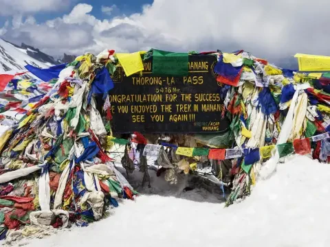
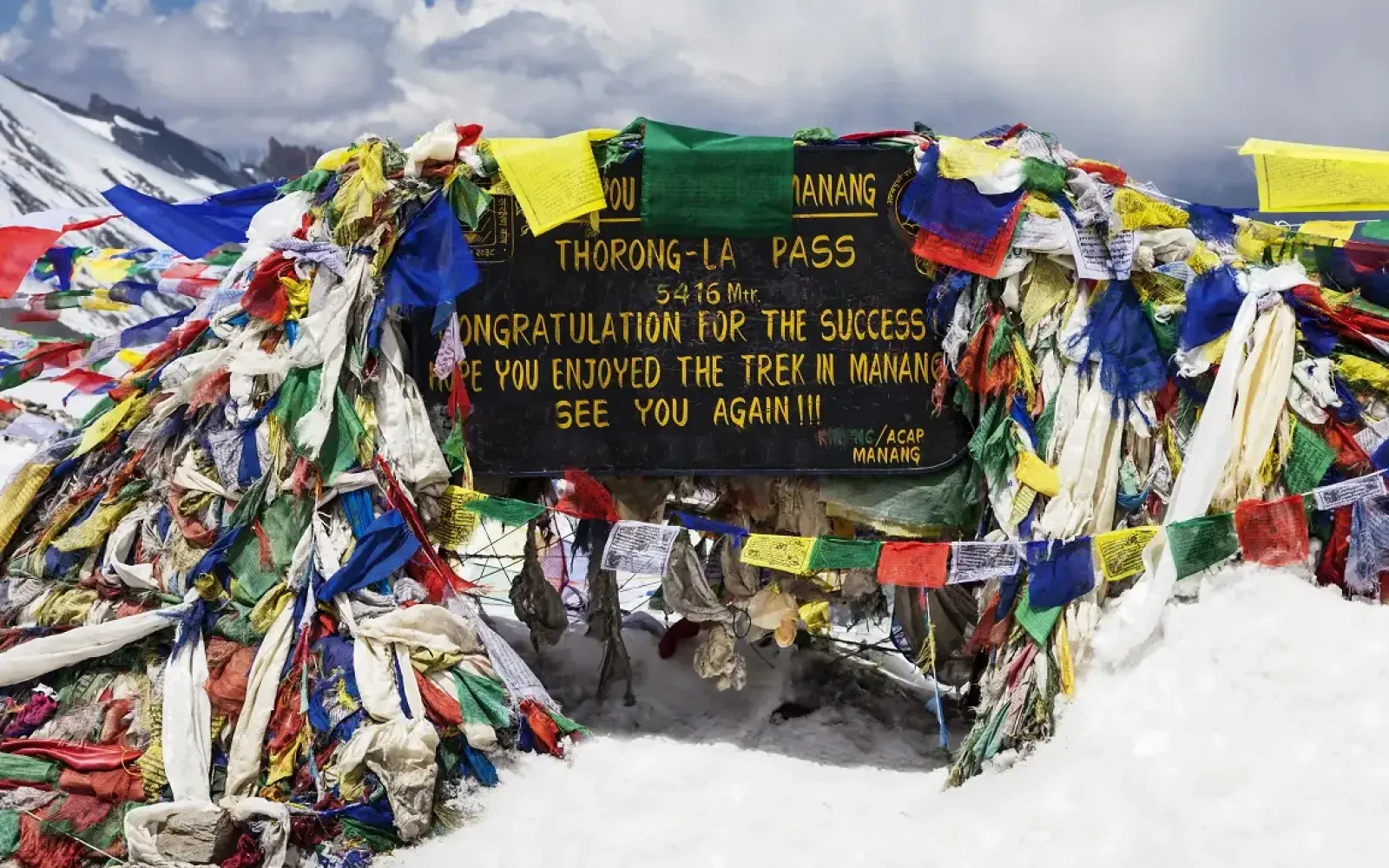
At 5,416 meters, Thorong La Pass stands as the peak of the trail. Over the ridge, views unfold without warning. Dropping down, the land turns dry, open, wild - Mustang stretches ahead. Not far off, Annapurna I climbs to 8,091 meters. Dhaulagiri follows close behind, reaching 8,167 meters into the sky. Down the valley, the path starts in Besisahar - elevation 820 meters. Most journeys finish later in Pokhara, just a bit higher at 827. Exploring further? High-altitude detours open up, such as Tilicho Lake near 5,000. Conditions shift fast here; readiness makes a difference. Paperwork isn’t paperwork alone - it supports care for the land.
Likewise, local experts on hand improve both security and understanding. A path takes shape where wheels once couldn’t roll, yet the heart of the place stays untouched. Visitors find themselves drawn back, not by novelty, but quiet familiarity. Step by step, through mist and stone, it becomes clear - this journey captures what mountain wandering truly means
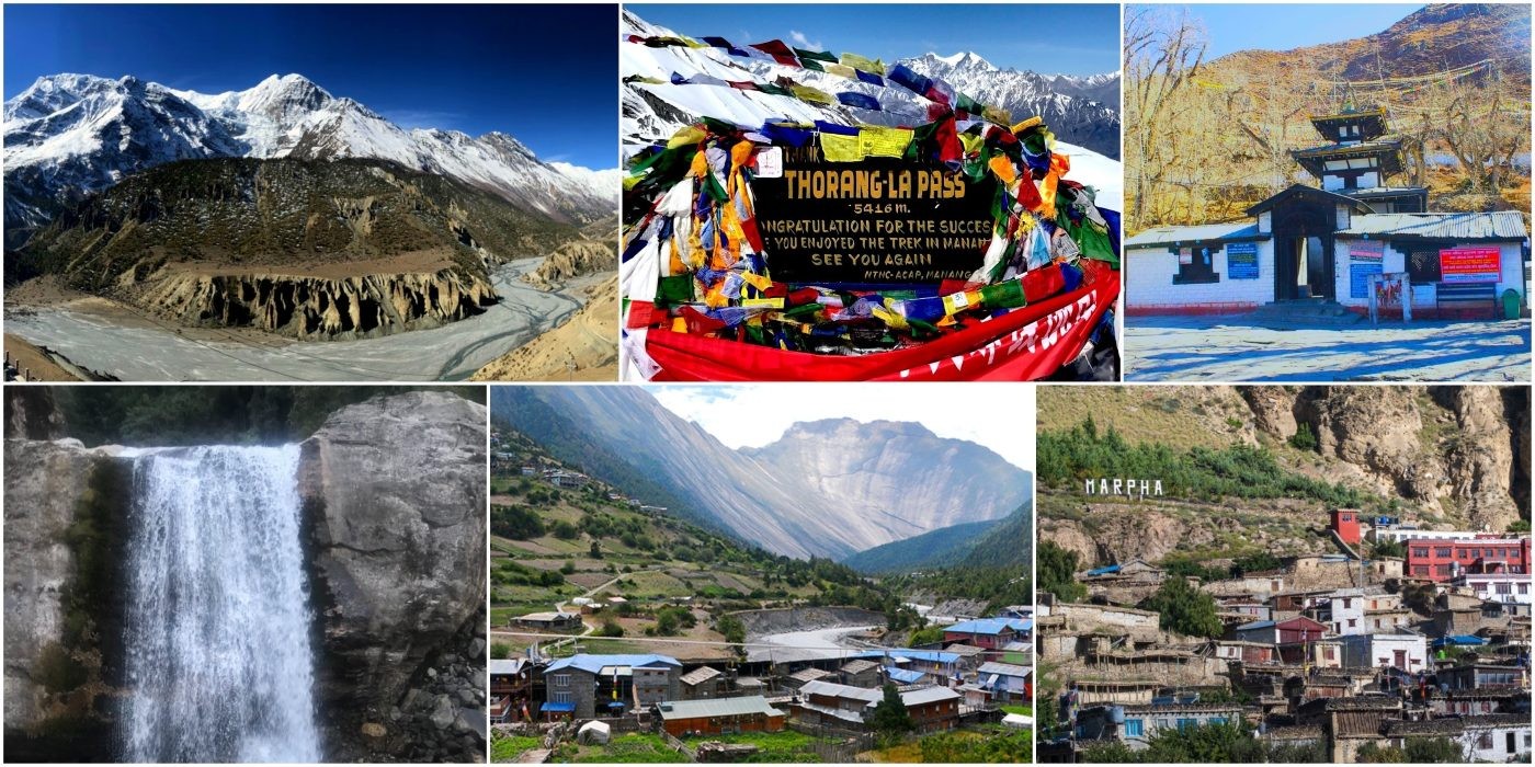
Key Trek Facts :
| Day | Route Segment | Elevation Gain/Loss | Key Highlights |
|---|---|---|
| Start in Besisahar (820m) | 1-2 Besisahar to Chame (2,670m) | +1,850m | Lush valleys, Marsyangdi River crossings. |
| Ascend to Manang | 3-5 Chame to Manang (3,540m) | +870m | Pisang village (3,300m), acclimatization hikes. |
| High altitude push | 6-8 Manang to High Camp (4,850m) | +1,310m | Yak Kharka (4,050m), views of Annapurna II (7,937m). |
| Cross Thorong La | 9 High Camp over Thorong La (5,416m) to Muktinath (3,800m) | +566m / -1,616m Highest pass, descent to Mustang. |
| Descent to end | 10-14 Muktinath to Pokhara (827m) via Jomsom (2,720m) | -2,973m | Kali Gandaki Gorge, flight or bus option. |
Elevation Milestones :
Actually, there’s just something about the Annapurna Circuit that grabs you and doesn’t let go. The mix of scenery and culture is almost unreal. One day, you’re wandering through lush Hindu villages in the lowlands. Before you know it, you’re up in the windswept Buddhist highlands, staring at peaks like Annapurna I, towering above you at 8,091 meters. The landscape never sits still—it shifts from thick forests to dry valleys that look like they belong on another planet.
Likewise, you don’t have to be a mountaineer to take this on. Sure, new roads have trimmed a few sections, but those wild, remote trails still exist. Along the way, every village feels like a genuine encounter. You meet locals, swap stories, and see how life really works in the Himalayas. The wildlife and wildflowers? They’re everywhere, and they make every day feel new. It’s not just a walk in the park—you’ll feel it in your legs—but you walk away tougher, both mentally and physically.
And with affordable teahouses dotting the trail, you never have to worry about a place to crash or a warm meal at the end of the day. If you’re chasing that big adventure, this is it.
Moreover, people from all over the world rave about this trek—and for good reason. It’s constantly ranked among the best long-distance trails out there. Where else do you start out sweating in the tropical heat at 600 meters and finish up surrounded by glaciers and icy winds? The cultural experiences run deep, too: think Gurung festivals, Buddhist prayer flags, and a kind of hospitality you just can’t fake. You get jaw-dropping views of not just Annapurna, but also Dhaulagiri at 8,167 meters—scenes that honestly rival anything you’ll see around Everest. If you want a little extra, side trips like Tilicho Lake at 4,919 meters are right there.
Here, the Annapurna Circuit Trek route’s designed to help you adjust, making it safer than many high-altitude treks. Plus, tourism gives back to the local communities, so your visit matters. Modern changes keep the trail relevant, but the heart of it stays the same. People come back again and again, always finding something new. In the end, the Annapurna Circuit isn’t just a trek—it’s the pure spirit of the Himalayas, and it never gets old.
Top Reasons for Popularity:
| Comparison with Other Treks Aspect | Annapurna Circuit | Everest Base Camp | Langtang Valley |
|---|---|---|
| Distance & Duration | 160-230 km, 10-20 days | Similar length, but more crowded | Shorter, 7-10 days. |
| Max Elevation | Thorong La (5,416m) | Khumbu Icefall area (5,364m) | Gosaikunda (4,380m). |
| Scenery Variety | High (forests to deserts) | Glacier-focused | Lakes and valleys. |
| Cultural Exposure | Diverse ethnic groups | Sherpa dominant | Tamang communities. |
Unique Attractions:
Meanwhile, the Annapurna Circuit throws a little bit of everything at you. You start out in the steamy lowlands near Besisahar, just 760 meters up. It’s all green rice paddies and thick forests at first, and there’s always another bridge to cross over the Marsyangdi River. Pretty soon, though, the trail climbs. You’re winding up rocky paths, pushing through alpine meadows, and tackling steep switchbacks and loose moraines. Once you pass Thorong La at 5,416 meters, the whole vibe changes—the landscape turns dry and almost lunar, with wide, arid plateaus. Drop down, and suddenly you’re in the depths of gorges like the Kali Gandaki. Villages pop up along the way, each one a chance to meet locals and catch your breath. Weather can mess with the trail, so good boots matter. Guides know the routes, but trekkers need to stay sharp and adjust as the terrain shifts. All in all, the circuit keeps you on your toes and builds real endurance.
Actually, altitude gives the trek its bite. Starting low helps your body ease in, so you don’t get slammed with altitude sickness. The climb’s steady, with stops in places like Manang at 3,540 meters to help you adjust. The giants loom—Annapurna I at 8,091 meters always in the background, Dhaulagiri just as massive at 8,167. Thorong La is the real test at 5,416 meters, but the views from the top make it all worth it. If you’re up for a side trip, Tilicho Lake sits up at 4,919 meters—a surreal spot. After the pass, you drop fast to Muktinath at 3,800 meters. Above 3,000 meters, the air gets thin, so taking breaks and drinking water really matters. Some people use medication for symptoms, just to be safe.
But honestly, the mix of wild scenery and mountain culture is what makes the Annapurna Circuit unforgettable. The altitude isn’t just a challenge—it’s what gives the whole adventure its edge.
Terrain Variations by Section:
| Altitude Profile and Daily Gains | Location | Elevation (m) | Typical Gain/Loss | Key Notes |
|---|---|---|
| Start | Besisahar | 760 | N/A | Subtropical start. |
| Mid | Chame | 2,670 | +1,910m from start | Forested ascent. |
| Acclimatization | Manang | 3,540 | +870m from Chame | Rest day essential. |
| High Camp | ThorongPhedi | 4,450 | +910m from Manang | Pre-pass base. |
| Peak | Thorong La | 5,416 | +966m from Phedi | Highest point, views of Annapurna II (7,937m). |
| Descent | Muktinath | 3,800 | -1,616m from pass | Temple site. |
| End | Pokhara | 827 | -2,973m total descent | Lake city finish. |
Major Highlights with Elevations:
| Risks and Tips by Altitude Zone | Zone (m) | Terrain Features Highlights | Tips |
|---|---|---|
| Low (760-2,000) | Lush valleys, forests | River crossings | Cultural villages | Hydrate well. |
| Mid (2,000-4,000) Rocky paths, meadows | Manang views | Gangapurna Lake | Acclimatize in Manang (3,540m). |
| High (4,000+) - Steep, arid | Thorong La | Panoramic peaks | Monitor for AMS, descend if needed. |
Let’s talk about the Annapurna Circuit. There’s no single “right” way to do it—people mix and match routes to fit their schedules, fitness, or just their mood. The classic trek runs 15 to 22 days, winding through 160 to 230 kilometers of Himalayan scenery. Most folks kick things off in Besisahar, way down at 760 meters, and climb up the Marsyangdi Valley. If you want to make it epic, you can tack on a side trip to Tilicho Lake, which sits at a breathtaking 4,919 meters.
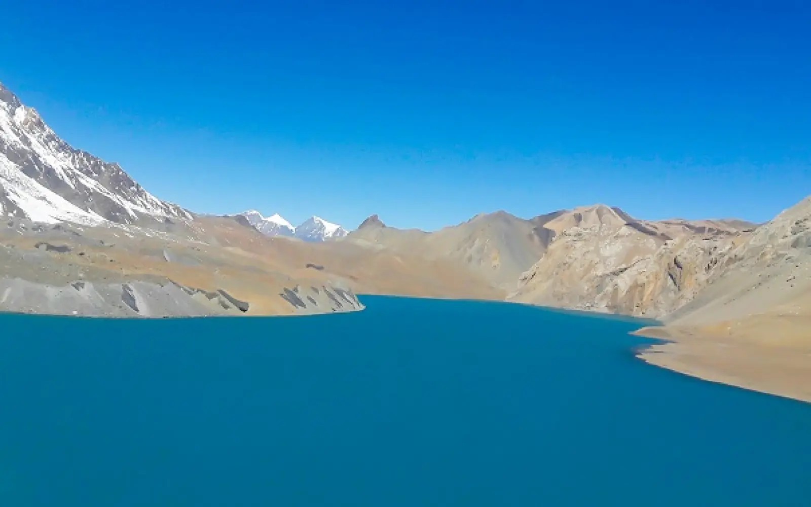
But not everyone has three weeks to spare. If you’re short on time, it’s easy to shave off the lower sections by catching a jeep straight up to Chame at 2,670 meters. Some trekkers even keep going past the main circuit, heading over to Annapurna Base Camp at 4,130 meters. Everything depends on the weather—autumn’s usually the sweet spot. Guides adjust the pace for your fitness level, and the costs? Pretty reasonable, especially once you’ve got your permits sorted out. Bottom line: there’s a version of this trek for almost everyone.
If you’re pressed for time, the short versions—six to twelve days—skip the long warm-up and get right to the good stuff. Go for the full circuit, though, and you’ll get more than just scenery; you’ll wander through villages like Manang at 3,540 meters and really get to know the culture. Want to squeeze in more highlights? Add a detour to Poon Hill at 3,210 meters, or link it up with other treks and you’re out there for 20 days or more. Don’t forget, acclimatization is crucial, especially at Thorong La Pass, which tops out at 5,416 meters. When it’s all over, you can hop a flight from Jomsom at 2,700 meters to get back quickly. Budgets usually cover teahouses and transport, and even as new options pop up every year, the heart of the route stays the same. Really, these variations let you find your own balance between adventure and comfort.
Common Itinerary Durations:
| Variation Comparison | Type | Duration (Days) - Distance (km) | Key Features | Start/End Elevations |
|---|---|---|
| Short | Jeep-assisted | 6-12 | 100-160 | Skip lowlands | Chame (2,670m) to Pokhara (827m) |
| Classic | Full loop | 15-18 | 160-200 | Cultural immersion | Besisahar (760m) to Nayapul (1,070m) |
| Extended | With ABC | 20-24 | 200-230 | Base camp views | Besisahar (760m) to Pokhara (827m) |
| Custom | Side-focused | 12-20 | Varies | Tilicho/Poon Hill | Flexible starts. |
Popular Side Trips:
| Pros/Cons of Variations | Variation | Pros | Cons |
|---|---|---|
| Short | Time-efficient, less fatigue | Misses lower cultural sections |
| Classic | Comprehensive experience | Longer commitment. |
| Extended | More highlights | Higher costs, fatigue risk. |
Meanwhile, the classic Annapurna Circuit isn’t just a trek—it’s a journey that wraps you right around the Annapurna massif. You kick things off down in the lush, subtropical lowlands near Besisahar, just 760 meters above sea level. Then, bit by bit, you climb through changing landscapes, winding your way up to the legendary Thorong La Pass at 5,416 meters. The trail swings back through the Kali Gandaki Valley, so you get the full circle.
What really sets this trek apart is how the culture shifts along the way. Early on, you’ll pass through Hindu villages, but as you climb, Buddhist communities take over. The mountains? They’re always there—Annapurna I and Dhaulagiri both tower above 8,000 meters, never letting you forget where you are. Walking the whole route, rather than skipping sections by jeep, keeps the experience genuine. If you’re up for adventure, side trips like Tilicho Lake at 4,919 meters add even more. Don’t worry, there are built-in acclimatization days to keep you healthy as you gain altitude. All in, this route gives you the most authentic taste of the Himalayas.
Here, these days, a lot of people cut the trek short by riding jeeps, but sticking with the full loop means you get the real deal. The circuit stretches 160 to 230 kilometers and usually takes about 15 to 20 days. The gradual climb helps your body adjust, and villages like Manang at 3,540 meters give you a chance to rest and soak up the local scene. Once you cross the pass, the scenery flips—suddenly you’re in the dry, dramatic Mustang region. Some trekkers tack on Poon Hill at 3,210 meters for those famous sunrise views. All along the way, teahouses offer food and shelter, while permits help protect the area. Local guides share stories and insights that bring the region to life. In the end, the full loop delivers unmatched variety, culture, and a real sense of achievement.
Core Features of the Classical Full Loop:
| Aspect | Classical Full Loop | Modern Shortened | Key Difference |
|---|---|---|
| Duration | 15-20 days | 8-14 days | Full walking vs jeep skips. |
| Start Point | Besisahar (760m) | Chame (2,670m) or Manang (3,540m) | Lower cultural immersion lost |
| Distance | 160-230 km | 100-160 km | Complete circuit experience. |
| Road Impact | Minimal (NATT trails) | Heavy jeep use | Authentic trails vs convenience |
| Acclimatization | Built-in rest days | Faster ascent risk | Safer gradual gain |
Highlights Exclusive to Full Loop:
Meanwhile, this classic 15-20 day trek takes you on a full loop through some wild Himalayan landscapes. You’ll start out with a mix of driving and walking from Kathmandu, easing into the lower hills. The trail follows the Marsyangdi River, climbing gradually. When you get to Manang at 3,540 meters, you’ll spend some time acclimatizing—trust me, you’ll appreciate this pause.
After that, things get serious as you push up to Thorong La Pass, topping out at 5,416 meters. It’s tough going, but the drop down to Pokhara, all the way to 827 meters, feels like a reward. Most days, you’ll cover anywhere from 10 to 20 kilometers. There are rest days to help you handle the altitude, and a few side-trips if you want to explore more. This route really nails the balance between adventure and enjoyment.
Likewise, you’ll notice the scenery shifts as you go. At first, you’re walking through lush, subtropical forests. Then you hit alpine meadows mid-trek—wide open, fresh air, unreal views. Up high, the air thins out and every step tests your stamina. Then, on the way down, winds pick up and you start seeing ancient temples and dry valleys. Teahouses along the way offer hot meals and a place to sleep.
If you time it right—spring or fall are best—the skies open up and the mountains put on a show. You’ll want to train ahead of time and pack the right gear, of course. Having a guide? That’s a smart move for safety, especially at high altitudes. Bottom line, this day-by-day route delivers a Himalayan adventure you won’t forget.
Sample 18-Day Classical Itinerary Overview:
| Day | Route | Elevation (m) | Distance (km) | Time (hrs) | Highlights |
|---|---|---|
| 1 | Arrival Kathmandu - 1,338 | N/A - N/A - Acclimatize, prep. |
| 3 | Besisahar to Jagat - 760 to 1,300 | 15-20 | 6-7 | River valleys. |
| 5 | Dharapani to Chame - 1,860 to 2,670 | 16 | 6-7 | Pine forests. |
| 7 | Chame to Manang | 2,670 to 3,540 | 20 | 7-8 | Annapurna views. |
| 8 | Acclimatization Manang | 3,540 | N/A - N/A - Hikes to lakes. |
| 10 | Yak Kharka to ThorongPhedi | 4,050 to 4,450 | 7 | 4-5 | Alpine ascent. |
| 11 | Cross Thorong La to Muktinath | 5,416 to 3,800 | 15 | 8-10 | Pass views, temple. |
| 13 | Jomsom to Tatopani | 2,720 to 1,190 | 20 - 7 - Hot springs. |
| 16 | Ghorepani to Poon Hill to Tadapani | 2,860 to 3,210 to 2,630 | 15 | 6-8 | Sunrise panorama. |
| 18 | Nayapul to Pokhara | 1,070 to 827 | Drive | N/A | End trek. |
Elevation Key Points:
Tips for the Classical Route:
Here, short on time but still craving the Annapurna Circuit? The 12-day accelerated trek squeezes the best of the trail into less than two weeks. Here’s how it works: you skip the lower, less exciting sections by taking a jeep, then jump right into the action—usually starting from Chame (2,670 meters) or Dharapani (1,860 meters). From there, you gain altitude fast, heading up to Manang (3,540 meters) for a crucial acclimatization break.
Actually, the real test comes at Thorong La Pass, topping out at 5,416 meters. After that, the trail drops down through famous stops like Muktinath (3,800 meters) and Jomsom (2,720 meters), before wrapping up in Pokhara (827 meters). Sometimes, you’ll pass through Ghorepani (2,860 meters) for those classic mountain views. The scenery changes constantly—lush forests, rugged alpine terrain, and those massive Annapurna I (8,091 meters) and Dhaulagiri (8,167 meters) peaks always looming in the distance. Make no mistake, this trek is tough. You’ll need solid fitness to keep up with the rapid altitude gains, but experienced guides keep things safe, and your permits help preserve the area.
Here, the big advantage here? You save days with those jeep rides but keep the heart of the adventure. The traditional trek starts way down at Besisahar (760 meters) and can take 15 to 20 days, but this version cuts the fluff and gets right to the good stuff. Expect to cover about 100 to 160 kilometers, with some serious hiking each day. Acclimatization days help you handle the altitude above 3,000 meters, and if you’ve got the energy, you can add side trips like Tilicho Lake (4,919 meters). Spring and autumn bring the clearest weather, and costs stay reasonable thanks to the region’s many teahouses.
Along the way, you’ll meet Gurung and Tibetan communities, and if you’re lucky, spot some high-altitude wildlife. Just remember—preparation is everything. Train, bring the right gear, and you’ll get the full Himalayan experience packed into just 12 days.
Key Features of 12-Day Version :
| Day Range | Key Segments | Elevation Range (m) | Highlights |
|---|---|---|
| Prep &Start 1-2 | Kathmandu (1,338) to Dharapani (1,870) | 1,338 - 1,870 | Drive through valleys. |
| Ascent 3-5 | Dharapani to Manang (3,540) | 1,870 - 3,540 | Pisang (3,200), acclimatization. |
| High Push 6-8 | Manang to Muktinath (3,800) via Thorong La (5,416) | 3,540-5,416-3,800 | Pass crossing, temple. |
| Descent 9-12 | Muktinath to Pokhara (820) via Jomsom (2,720) | 3,800-827 | Gorge, Poon Hill (3,210). |
Elevation and Risks:
| Aspect | 12-Day Accelerated | 15-20 Day Classic |
|---|---|---|
| Duration | 12 days | 15-20 days |
| Start | Jeep to Dharapani (1,870m) | Walk from Besisahar (760m) |
| Focus | High passes, views | Full cultural loop |
| Effort | Intense daily hikes | Gradual pacing. |
Here’s how the 12-day trek unfolds, start to finish. You kick off in Kathmandu at 1,400 meters, getting your gear and head in the game. Then comes a drive—no need to slog through the lower trails—straight to Dharapani at 1,860 meters, or sometimes Chame at 2,670. From there, the real hiking begins. You climb to Pisang at 3,200 meters, then up again to Manang at 3,540. There’s a rest day here, not just for comfort, but to let your body adjust to the altitude. Next, you push on to Yak Kharka at 4,050 meters.
The big moment? Crossing Thorong La Pass at a breathtaking 5,416 meters, then dropping down to Muktinath at 3,800. You keep descending through Jomsom (2,720 meters) and Tatopani (1,190 meters), soaking in the change of scenery—and probably grateful for the easier breathing. The trail wraps up through Ghorepani at 2,860 meters before you finally land in Pokhara at 827 meters. Each day, expect to hike five to eight hours. Along the way, you catch some incredible views, like Annapurna II towering at 7,937 meters. Teahouses along the route give you a place to crash and recharge. The whole plan keeps the adventure tight and efficient.
In fact, every day comes with its own challenges and payoffs. Driving in early means you save your energy for the good stuff higher up. Taking time in Manang to acclimatize keeps altitude sickness at bay. On the day you cross the pass, you set out before dawn—it’s tough, but worth it. When the trail heads downhill, you finally get to relax a bit, wandering through deep gorges. Dhaulagiri, at 8,167 meters, puts on a side show as you go. Keeping an eye on the weather is a must for safety, and having the right gear—like trekking poles—makes those steep parts manageable. The villages you pass aren’t just pit stops; they add real flavor and culture to the trip. All in all, this guide lays out a fast-paced, rewarding trek from beginning to end.
Daily Preparation Tips :
| Day | Route | Elevation (m) | Distance/Time | Key Notes |
|---|---|---|
| 1 | Arrive Kathmandu - 1,338 | N/A | Prep, briefing. |
| 2 | Drive to Dharapani/Chame - 1,860/2,670 | 8-10 hrs drive | Skip low trek. |
| 3 | Chame to Pisang - 2,670-3,200 | 13km/5hrs | Forest paths. |
| 4 | Pisang to Manang - 3,200-3,540 | 17km/6hrs | Annapurna views. |
| 5 | Acclimatization Manang 3,540 | N/A | Hike to lake. |
| 6 | Manang to Yak Kharka - 3,540-4,050 | 10km/4hrs | Alpine meadows. |
| 7 | Yak Kharka to ThorongPhedi - 4,050-4,450 | 6km/4hrs | Pre-pass base. |
| 8 | Phedi over Thorong La to Muktinath | 4,450-5,416-3,800 | 15km/8hrs | High point, descent. |
| 9 | Muktinath to Pokhara - 3,800 - 820 | 195 km/6hrs | Temple, winds. |
| 10 | Pokhara Rest day -820 | Shopping and optional activities. |
| 11 | Pokhara to Kathmandu - 820 - 1,338 | 220 km | Enjoy bus journey with river view |
| 12 | Departure to Homeward | ---------------- |
Elevation Milestones:
If you want the best of the Annapurna Circuit without spending weeks on the trail, this is the way to do it. Start in Manang, already up at 3,540 meters, so you’ve got a head start on acclimatization. From there, you tackle Thorong La Pass, which sits at a lung-busting 5,416 meters. The views up there? Absolutely unreal. After that, the trail drops down toward Muktinath, famous for its sacred temple and perched at 3,800 meters. You’ll watch the scenery shift from lush alpine meadows into the dry, wild valleys of Mustang. Massive peaks like Annapurna II and Dhaulagiri seem to follow you the whole way—just towering above, impossible to ignore.
Once you hit Jomsom or Muktinath, you can hop in a jeep and head straight back to Pokhara. It’s a smart move if you’re pressed for time. You get all the adventure, the thrill of crossing the legendary pass, but skip the longer, lower valley stretches that eat up days. Just remember, spending time in Manang to acclimatize isn’t optional—it’s how you stay safe at altitude.
Actually, this route packs the classic highlights into four to six days of trekking. Most people drive up the lower sections now, so you don’t waste energy or time before hitting the main event. Thorong La will test you with its steep climbs, but the payoff—both the view and the sense of achievement—is worth every step. The descent brings you back to villages with their own unique culture and warmth. Teahouses along the way are basic but welcoming, and you’ll need a couple of permits sorted before you go.
Here, weather can get rough above 4,000 meters, so don’t skimp on warm gear. Having a guide isn’t just helpful; it’s smart, especially when you’re that high up. All in all, this version delivers a concentrated dose of Himalayan adventure—no filler, just the good stuff.
Core Elements of the Short Itinerary:
| Short Itinerary Overview (5-6 Days Trekking) | Day | Segment | Elevation (m) | Distance/Time | Key Notes |
|---|---|---|
| Acclimatized Start | Day 1 | Manang to Yak Kharka | 3,540 to 4,050 | 10km / 4-5 hrs | Gradual ascent, meadows. |
| Build Up | Day 2 | Yak Kharka to ThorongPhedi/High Camp | 4,050 to 4,450-4,925 | 7-10km / 4-6 hrs | Alpine terrain, views. |
| Pass Crossing | Day 3 | High Camp to Muktinath via Thorong La | 4,925 to 5,416 to 3,800 | 15km / 7-9 hrs | Steep up/down, panoramas. |
| Descent Option | Day 4 | Muktinath to Jomsom | 3,800 to 2,720 | 20km / 6 hrs | Arid gorge, fossils. |
| Return | Day 5-6 | Jomsom/Muktinath drive to Pokhara | 2,720/3,800 to 820 | 5-7 hrs drive | Scenic roads, end. |
Elevation Profile Highlights:
| Pros and Cons | Aspect | Pros - Cons |
|---|---|---|
| Time Efficiency | Short duration | Fits busy schedules - Less gradual acclimatization. |
| Highlights Focus | Pass and temple | Core thrills - Misses lower culture. |
| Logistics | Drive return | Saves energy - Road conditions vary. |
Meanwhile, a quick journey through Manang leads up toward Muktinath - high but tight in scope. Beginning where air thins, near Manang’s 3,540-meter mark. Moving upward step by slow step until reaching Thorong La, perched at 5,416 meters cold. From there, the path drops sharply into Muktinath, resting lower at 3,800. Each day unfolds without rush because steady progress keeps bodies safe.
High above, the Annapurna range rises, some summits touching 8,091 meters. Along the way, villages add depth to every turn. Afterward, descending by road to Pokhara - sitting at 827 meters - brings closure. Built for strong walkers who like rhythm. Cramming a grand mountain crossing into fewer days. Fitness training shapes your readiness alongside knowing about altitude risks. Because of this, the high mountains give moments worth remembering.
Here, footsteps grow stronger with each mile. In the beginning, progress comes fast through high meadows. Crossing the ridge means waking before dawn to beat storms. Coming down feels lighter, paths leading past old stone shrines. Team leaders watch how everyone breathes and moves. Sleep stops happen in small lodges where food warms you up. Morning light lifts the landscape most in spring or autumn. Still, the route builds a brief journey that feels both steady and full of spark.
Step-by-Step Preparation Tips:
| Step/Day | Route | Elevation Change (m) | Duration | Highlights & Tips |
|---|---|---|
| 1 - Manang to Yak Kharka | 3,540 to 4,050 (+510) | 4-5 hrs | Meadows, Annapurna views; easy pace. |
| 2 - Yak Kharka to ThorongPhedi/High Camp | 4,050 to 4,450-4,925 (+400-875) | 4-6 hrs | Rocky paths; rest early for pass. |
| 3 - High Camp to Muktinath via Thorong La | 4,925 to 5,416 (+491) then to 3,800 (-1,616) | 7-9 hrs | Steep climb, epic views; celebrate at top. |
| 4 - Muktinath exploration & to Jomsom | 3,800 to 2,720 (-1,080) | 5-6 hrs | Temple visit, arid descent; fossils. |
| 5 - Drive Jomsom to Pokhara | 2,720 to 820 | 5-7 hrs drive | Scenic Kali Gandaki, end in Pokhara. |
Key Facts and Safety:
| Aspect | Manang-Muktinath Short | Full Classic |
|---|---|---|
| Days Trekking | 4-5 | 10-15 for this section. |
| Focus | Pass crossing | Entire loop diversity. |
| Return | Drive to Pokhara | Continue to Ghorepani/Poon Hill. |
Meanwhile, here’s a smarter way to tackle the Annapurna Circuit—mixing trekking with a jeep ride to save time and energy, without missing the best parts. Start in Besisahar at 760 meters. From there, hike up through the Marsyangdi Valley to Tal (1,700 meters) or push a bit farther to Dharapani (1,860 meters). The trail’s full of waterfalls, hanging bridges, and green hills. Once you reach Tal or Dharapani, hop into a jeep and ride straight up to Manang, which sits at 3,540 meters. This way, you skip the tougher, dustier road sections, but you still get all the views. You’ll hit the high-altitude zone faster, so acclimatization in Manang becomes the next priority. Annapurna II—standing tall at 7,937 meters—shows up early on the horizon, reminding you why you came.
Actually, this approach cuts out extra walking days, but you don’t miss the villages, the river, or the local Gurung culture on the first stretch. Swapping the tiring mid-section for a drive gets you to Manang sooner, where you can actually rest and enjoy the scenery. The Annapurna massif keeps you motivated the whole way. You’ll need to book your jeep ahead of time. Permits are still a must, no shortcuts there. Guides help keep the trip running smoothly. In the end, this personalized route gives you the best of the Annapurna Circuit—adventure, efficiency, and unforgettable views—all tailored for today’s traveler.
Key Segments of the Customized Itinerary:
| Day | Activity Elevation (m) | Distance/Time | Highlights |
|---|---|---|
| 1 | Kathmandu to Besisahar + start trek | 1,400 to 760 + trek | Drive 5-6 hrs | River views, subtropical start. |
| 2 | Besisahar to Jagat/Tal | 760 to 1,300/1,700 | 15-20 km / 6-7 hrs | Suspension bridges, waterfalls. |
| 3 | Jagat/Tal to Dharapani | 1,300/1,700 to 1,860 | 10-15 km / 4-6 hrs | Pine forests, Gurung culture. |
| 4 | Drive Dharapani to Manang | 1,860 to 3,540 | 4-6 hrs jeep | Dramatic valley ascent, Annapurna views. |
| 5+ | Arrive Manang, begin acclimatization | 3,540 | N/A | Rest, preparation for higher sections. |
Elevation Transitions:
| Aspect | Drive-and-Trek | Full Walking |
|---|---|---|
| Time | 4 days to Manang | 7-9 days to Manang |
| Physical Demand | Moderate trekking + drive | Continuous daily ascents |
| Scenery | Preserves key valley views | More gradual immersion |
| Risk | Lower fatigue early | Better natural acclimatization |
Meanwhile, acclimatizing in Manang isn’t just a box to tick—it’s what keeps trekkers safe at 3,540 meters. You come up from places like Dharapani, which sits way lower at 1,860 meters, and your body needs time to catch up with the thin air. Those two days in Manang? They’re not wasted. Your red blood cells get a chance to multiply, and your system slowly adapts. You head out on short hikes, work your lungs a bit, but you don’t push it. Headaches and other AMS symptoms fade with proper rest. Clinics are there if you need help, and the town actually teaches you a thing or two about altitude sickness. And the views—Gangapurna towering at 7,455 meters—remind you why you’re here, even when you’re just taking it easy.
Likewise, these two days really boost your chances of finishing the trek strong. The guides are big on the “climb high, sleep low” rule, and for good reason. Day hikes up to Ice Lake at 4,600 meters really help your body adjust. You’ve got to stay hydrated and eat well—above 3,000 meters, you feel it if you don’t. Skip acclimatizing, and you risk serious problems like HAPE or HACE. Manang’s teahouses make the downtime comfortable, and locals often share useful tips. Autumn’s weather usually lets you explore, too. Keep an eye on your oxygen levels with a pulse oximeter if you have one. Honestly, this break in Manang turns what could be a dangerous gamble into a smart, manageable step toward Thorong La Pass at 5,416 meters.
Benefits of Two-Day Acclimatization :
| AMS Symptoms and Prevention | Symptom | Cause | Prevention in Manang |
|---|---|---|
| Headache | Low oxygen | Hydrate, rest two days. |
| Nausea | Rapid ascent | Ascend 300-500m/day max. |
| Fatigue | Body adjustment | Hike to 4,000m+, sleep low. |
| Insomnia | Altitude stress | Diamox if needed, consult clinic. |
Recommended Activities:
| Location | Elevation (m) | Oxygen Level % | Two-Day Benefit |
|---|---|---|
| Dharapani | 1,860 | 85% | Baseline adjustment. |
| Manang | 3,540 | 70% | Allows body to adapt. |
| Thorong La | 5,416 | 55% | Reduces illness risk. |
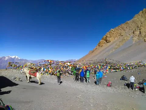
Actually, crossing Thorong La Pass—towering at 5,416 meters—really is the heart of the Annapurna Circuit. You set out before sunrise, usually from High Camp or Thorong Phedi. The climb? It’s steep, tight switchbacks, thin air biting at your lungs. But when you reach the top, the world opens up: snow-capped Annapurna I on one side, massive Dhaulagiri on the other. Prayer flags whip in the wind, and the view just stuns you.
Then it’s all downhill, fast and relentless, dropping to Muktinath at 3,800 meters. You finally stumble into the temple complex after seven, maybe nine hours—completely spent, but grinning. This part of the trek pushes you hard, but the payoff is pure Himalayan magic. It’s the moment everyone remembers.
From Muktinath, most people pile into jeeps or buses and head for Pokhara or sometimes straight on to Kathmandu. The road hugs the Kali Gandaki Valley, passing through Jomsom and Beni. It’s rough in places—dust, rocks, hairpin turns, deep gorges—but that’s all part of the ride. Getting to Pokhara takes anywhere from eight to twelve hours if you’re lucky with traffic and landslides; Kathmandu might run you sixteen. Some just catch a flight from Jomsom to Pokhara if the weather’s on their side.
This last stretch? It’s less about the adrenaline and altitude, more about soaking up the landscape as you bounce along. The wild trek gives way to a long, sometimes bumpy drive—efficient, maybe not glamorous, but it gets the job done. That transition, from epic pass to winding valley road, wraps up the journey with just the right mix of adventure and relief.
Key Facts of Thorong La Crossing:
| Thorong La Crossing Day Breakdown: Segment | Elevation (m) | Time Estimate | Difficulty | Highlights |
|---|---|---|
| Early Morning Ascent | High Camp to Pass | 4,900–5,000 → 5,416 | 3–5 hrs | Strenuous | Sunrise over peaks |
| Summit Experience | Thorong La Pass | 5,416 | 30–60 min | Moderate | 360° panorama, prayer flags. |
| Descent | Pass to Muktinath | 5,416 → 3,800 | 3–4 hrs | Moderate–steep | Arid landscape, temple arrival. |
| Return Drive Options | Muktinath/Jomsom → Pokhara | 3,800/2,720 → 820 | 8–9 hrs | Road travel | Kali Gandaki gorge views. |
Drive Back Options:
If you’re heading out on the Annapurna Circuit, a bit of smart prep goes a long way. You need permits—not just for the paperwork, but because they actually help protect you and the region. Packing’s a balancing act. Bring enough to keep warm up high, but don’t overload yourself with things you won’t use. Safety’s not negotiable up here. Stick to the acclimatization schedule, know the signs of altitude sickness, and keep some basic meds in your bag. Drink plenty of water. Simple stuff, but it makes a difference.
Honestly, good guides and porters are worth every rupee. They know the trails and can spot trouble before you do. So much of this trek comes down to planning. The more you do now, the safer—and more fun—it gets.
No matter which version of the Annapurna Circuit you choose, a few basics always apply. Everyone needs two main permits, which you can sort out in Kathmandu or Pokhara. Your clothes should work for both chilly passes and warm valleys. Take it slow—rushing just leads to problems. Always check the weather before you set out. Get insurance that actually covers emergencies, not just lost luggage. And don’t forget to respect local customs; a little courtesy goes a long way. In the end, these essentials make every trek on the circuit smoother and a whole lot more rewarding.
Required Permits:
| Packing Essentials by Category | Category | Recommended Items | Notes | Quantity Suggestion |
|---|---|---|
| Clothing | Warm layers | Down jacket, fleece, thermal base layers | Essential above 3,500 m | 2–3 layers |
| Clothing | Lower valley | Quick-dry T-shirts, trekking pants | Breathable for heat | 3–4 sets |
| Footwear | Main | Waterproof trekking boots | Good ankle support | 1 pair |
| Accessories | Head & hands | Warm hat, gloves, buff / neck gaiter | Wind protection | 1 each |
| Gear | Sleep | Lightweight sleeping bag (–5°C comfort) | Teahouses have blankets - 1 |
| Gear | Walking | Trekking poles | Knee support on descent - 1 pair |
| Health | Medicines | Diamox, ibuprofen, rehydration salts, blister kit | Consult doctor | Personal dose. |
Safety & Altitude Tips:
| Season | Pros | Risks | Best Safety Practice. |
|---|---|---|
| Spring (Mar – May) | Clear views, rhododendrons | Afternoon cloud, occasional rain | Start early, carry rain gear. |
| Autumn (Oct – Dec) | Stable weather, best visibility | Cold nights, early morning frost | Layer heavily, start before sunrise. |
| Winter (Jan – Feb) | Fewer crowds | Heavy snow, extreme cold | Avoid unless experienced. |
| Monsoon (Jun - Sep) | Lush greenery | Landslides, leeches, poor visibility | Not recommended for pass crossing. |
Meanwhile, the Annapurna Circuit isn’t a one-size-fits-all trek. Some travelers crave the full, classic journey, soaking in every village and mountain view along the way. Others? They want the thrill but need to move fast, so they cut the route short and hop on jeeps to get to the heart of the action at Thorong La Pass (5,416 m). There are folks who tack on side trips—maybe Poon Hill (3,210 m) for those sunrise views or Annapurna Base Camp (4,130 m) for a taste of the high-altitude drama. Basically, this trek bends to fit you: your fitness, your schedule, your wish list. The only thing that stays the same is the mountains—they’re always there, towering and unforgettable.
Likewise, picking the right Annapurna Circuit Trek route makes all the difference. You want a balance: enough challenge to feel proud, but not so much you risk your health, especially once you’re climbing above 3,500 meters. Match the trek to your time, your budget, and your own limits. No matter which version you pick, you’ll find yourself surrounded by giants—Annapurna I (8,091 m), Dhaulagiri (8,167 m), Machapuchare (6,993 m). The memories stick with you: the wild landscapes, the people you meet, the feeling of being out there in the middle of it all. At the end of the day, the biggest step is just deciding to go. Your perfect Annapurna adventure is out there—so go find it.
Which Version Should You Choose? Quick Comparison Guide:
| Your Situationb | Recommended Version | Duration | Max Elevation | Physical Demand | Cultural Depth Wow-factor |
|---|---|---|
| I have 18–22 days + good fitness | Classic Full Circuit | 15–21 days | 5,416 m | Medium–High |
| I have 12–15 days | Accelerated / Hybrid | 10–14 days | 5,416 m | High |
| I have only 7–10 days total | Manang → Muktinath short version | 5–7 days | 5,416 m | Very High |
| I want the famous sunrise photo | ny version + Poon Hill extension | +2–3 days | 3,210 m Medium |
| First time in Himalaya + moderate fitness | Hybrid + Poon Hill | 12–15 days | 5,416 m | Medium–High |
| Very experienced + want maximum challenge | Classic + Tilicho Lake + ABC add-on | 20–25 days | 5,416 m / 4,919 m / 4,130 m | Very High. |
Final Quick Checklist Before You Book:
1. What is the Annapurna Circuit Trek?
The Annapurna Circuit Trek is a trail that goes around the Annapurna mountains in Nepal. It starts from Besisahar. Takes you through many different types of landscapes like valleys, forests and high plateaus. You cross Thorong La Pass, which's 5,416m high. On this trek you get to experience the culture of Gurung and Tibetan villages see views of Annapurna I and Dhaulagiri and stay in comfortable teahouses. Many people have done this trek with our help.
2. How Days Does the Annapurna Circuit Trek Take?
The Annapurna Circuit Trek usually takes 15 to 20 days. If you want a trip it can be 8 to 12 days with jeep rides. Some people do it in than 20 days if they want to hike extra. We make plans that fit your fitness, time and interests. We make sure you have time to get used to the high places so you can enjoy the trek safely.
3. What is the Best Itinerary for Annapurna Circuit Trek?
The best plan is the 15 to 18-day trek from Besisahar to Pokhara via Thorong La. This way you get to experience everything. You get to stay in Manang for a bit and see Tilicho Lake if you want. We suggest this for people who do the trek for the time because it is a good mix of adventure and comfort. Our guides make sure every detail is safe and fun.
4. What is the Highest Point on the Annapurna Circuit?
The highest point is Thorong La Pass at 5,416 meters. When you cross it you see views of the Himalayas. Our guides make sure you get used to the places and start early so it is safe and memorable. Then you go down to Muktinath, which's a great part of the trek.
5. Is the Annapurna Circuit Trek Difficult?
The Annapurna Circuit Trek is moderately hard. It is good for people who're fit and have good stamina. You walk for 5 to 8 hours a day. Go up steadily. The hard parts are the places and long days but it is easier than many other high Himalayan treks because you go up gradually and stay in teahouses. Our guides and plans help many people do the trek successfully.
6. When is the Best Time for Annapurna Circuit Trek?
The best times are in the spring (March to May). Autumn (September, to November). The weather is stable the skies are clear and the trails are dry. These seasons have mountain views and comfortable temperatures. We have guided treks in all seasons. Suggest these times for safety and a great experience.
7. What Permits Do I Need for Annapurna Circuit Trek?
You need an Annapurna Conservation Area Permit (ACAP) and a Trekkers’ Information Management System (TIMS) card. You can get these easily in Kathmandu or Pokhara. Our team takes care of all the paperwork so you can prepare. These permits help communities and keep the trails conserved.
8. What Should I Pack for Annapurna Circuit Trek?
You should pack clothes that you can wear in layers, a down jacket, strong boots for trekking, rain gear, a headlamp something to purify water, sunscreen and the medications you need. It is also an idea to bring trekking poles and a comfortable backpack. We have been doing this for a time so we can give you a detailed list of what to pack and it will depend on the time of year you go. If you have the gear you will be comfortable and safe on your trip to the Himalayas.
9. How to Acclimatize on the Annapurna Circuit?
We make sure you get used to the altitude by having rest days in Manang and by not climbing too much each day. We tell you to walk drink a lot of water and listen to your body. Our guides keep an eye on everyone and will change the plan if they need to. We have been doing this for a time and we have a great record of keeping people safe on the Annapurna Circuit.
10. What Are the Highlights of Annapurna Circuit Trek?
The best parts of the Annapurna Circuit Trek are crossing Thorong La Pass visiting Muktinath Temple seeing Tilicho Lake and looking at the landscapes from green valleys to deep gorges. You will see the mountains, Annapurna and Dhaulagiri and you will meet people from different cultures. These experiences will stay with you forever. We have seen many people changed by this trip.
11. Can Beginners Do the Annapurna Circuit Trek?
Yes people who are new to trekking can do the Annapurna Circuit Trek if they are fit and have an attitude. We will teach you what to do help you get used to the altitude and support you. We think it is an idea for beginners to start with shorter trips or trips that are tailored to their needs. Many beginners have gone on this trek with us. Had a great time, which shows that with the right preparation anyone can do it.
12. What is the Cost of Annapurna Circuit Trek?
The cost of the Annapurna Circuit Trek is usually between $800 and $1,500 USD depending on how you go how many people are in your group and what is included. This price includes permits, teahouses, guides, food and transportation. We are transparent about our prices. Offer good value. If you want to know how much your trip will cost you can contact us. We will give you a personalized quote.
13. What Are the Side Trips on Annapurna Circuit?
Some popular side trips are Tilicho Lake, Ice Lake and Poon Hill where you can watch the sunrise. These trips add something to your journey. We can help you plan them so they fit into your itinerary and are safe. Many people say these side trips are the part of the Annapurna Circuit.
14. How Safe is the Annapurna Circuit Trek?
The Annapurna Circuit Trek is very safe if you prepare well and have experienced guides. We follow safety rules check the altitude and make sure everyone can communicate. We have been doing this for a time and know the area well so you can trek without worrying. Safety is our priority and we want to make sure every client is safe.
15. How to Get to and From the Annapurna Circuit Trek?
You can. Drive from Kathmandu to Besisahar or Pokhara to start the Annapurna Circuit Trek. To get back you can take a drive a jeep ride, from Jomsom or a short flight. We will take care of all the transportation so your trip starts and ends smoothly. We know the area well so we can make sure your transportation is easy and reliable.
Our travel experts are ready to assist you with any questions.
Send us a message.Have a question before you book? Send your enquiry below and our travel experts will get back with the required information.