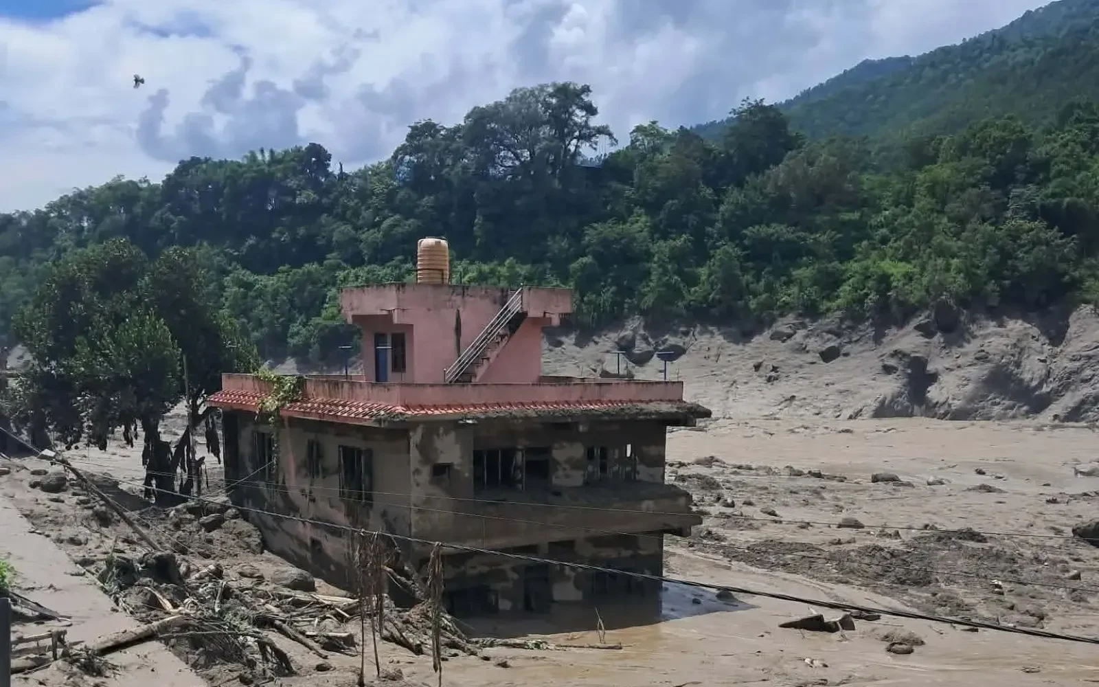
The August 26, 2026 Rasuwa flood is a recent flash-flood disaster that started in the high Himalaya near the Nepal-Tibet border, flowing down the Bhote Koshi and Trishuli rivers. It appears that scientists have confirmed that the type of flow that triggered this particular flood was a large (Himalayan) ice-rock avalanche/glacier collapse that entered the Lhende Khola, generating an extraordinary powerful surge of water and debris downstream. The cause of initiation is still under investigation.
Upstream of Rasuwa, in the high Himalaya on the Tibetan side of the border.
Based on preliminary field assessments, scientists speculate that a huge amount of debris from a rock glacier may have triggered the powerful flood that swept away entire villages and infrastructures downstream. A cascade of rock ice and debris came crashing down from a high altitude in the snow covered mountains. The possibility of a temporary dam that led to an outburst flood or a combined mechanism of such dams also cannot be ruled out.
Here, Reuters has reported that the satellite imagery revealed “that a huge amount of ice broke from a glacier about 5,200 meters above the valley and came crashing down the mountainside.”
A brief summary
High Himalayan glacier/rock ice avalanche → Lhende Khola → Bhote Koshi → Timure/Rasuwagadhi → Syabrubesi and downstream Rasuwa → Trishuli → Nuwakot and downstream areas of Dhading
It occurred on the morning of 26th of August 2026.
Based on local reports from Nepal News, it appears that at around 8:30–8:40 AM NE Time on the morning of the 26th, the people of the Timure area started witnessing the flood, while the hydrological authorities got news of the rapid rise of water levels in the Bhote Koshi basin at around 9:00 AM
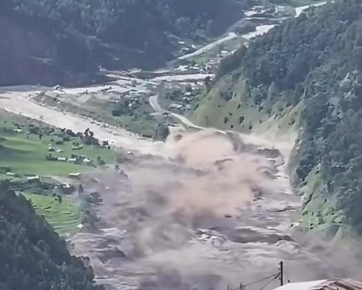
Actually, this rapid rise of water was one of the factors that contributed to the damage that the flood had caused.
| Flood surge was witnessed around | Approximate time |
|---|---|
| Timure | 8:30–8:40 AM |
| Rapid rise of water level reported | 9:00 AM |
| Flood movement | Approximate timing |
| Downstream of Timure and Syabrubesi | Morning of 26th August 2026 |
| Downstream of the Trishuli | Later part of 26th August 2026 |
Likewise, the ICIMOD reported that “the flood wave raced downstream at an astonishing speed.” According to the report, the Trishuli River at Galchhi was recorded to have risen by 9m (within 30 mins), while at Malekhu, the rise was recorded to be 7m (within 30 mins).
Unlike the typical monsoon flood that is caused by days or weeks of continuous rains, it appears that the August 26th Rasuwa disaster is a sudden high-altitude Himalayan-type flood. A huge amount of water, sediment, boulders, ice, and debris surged down the Lhende Khola, picking up speed in narrow mountainous gorges.
In fact, the Bhote Koshi river then carried the destructive force downstream toward Rasuwagadhi, damaging everything in its path. The flood then entered the Trishuli river system, surging downstream toward Nuwakot and causing dangerous overflows in the process.
The flood did not occur in just one settlement. The flood wave surged downstream through the Bhote Koshi before reaching the Trishuli corridor.
| Settlements | Impacts reported |
|---|---|
| Timure | Highly-destructive |
| Rasuwagadhi | Custom area heavily damaged |
| Syabrubesi | Infrastructure damage |
| Shantibazar | Flood impact reported |
| Betrawati | Downstream infrastructure damage |
| Trishuli Bazaar | Flood impact reported |
| Galchhi | Extremely high rise of the Trishuli river recorded |
| Nuwakot areas | Road and infrastructure damage reported |
| Dhading | Downstream flood impact reported |
| Gorkha/Chitwan areas | Downstream impact reported |
In summary, it is reported in the Online Khaabar that the flood had surged from the Timure/Rasuwa towards Nuwakot and Dhading, with further downstream impacts.
The flood has caused extensive damage to settlements, transportation, bridges, hydropower, transmission lines, security, and border areas.
Meanwhile, Timure was one of the worst-affected settlements. Eyewitnesses have reported seeing the devastating impacts of the flood in the region with the Rasuwagadhi custom area also being heavily impacted.
Likewise, the flood has also caused significant damage to transportation networks. Preliminary reports have shown that extensive damage has occurred to roads and bridges, cutting off the Rasuwa corridor.
The types of damage caused by the flood:
In summary, it is reported that several hydropower projects and transmission lines have been damaged in Rasuwa, while some settlements have also been cut off from electricity.
This is the most pertinent question for trekkers considering the Langtang Valley Trek.
Meanwhile, the flood has had a significant impact on Syabrubesi, which is the main access road to the Langtang Valley.
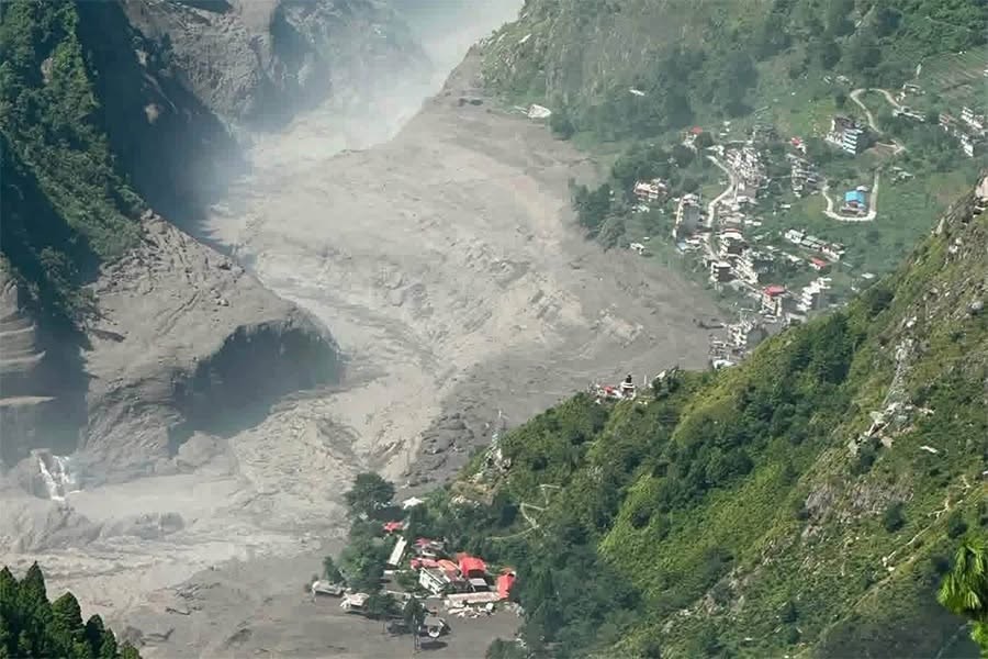
Thus, despite the damage to the upper trail not being fully assessed, it would be unwise to assume that the road from Kathmandu-Syabrubesi is open.
Therefore, it is recommended to contact local authorities for road-clearance updates before considering any trekking adventures.
With the flood occurring recently on 26th August 2026, it is too early to understand the final toll in terms of casualties and damages. Rescue agencies are currently recovering bodies while authorities are assessing the damage in the affected downstream areas.
The August 26th flood must not be considered as just another regular monsoon flood. Current scientific research suggests that an ice-rock avalanche played a critical role in the disaster with the exact cause still being investigated.
A brief summary:
The August 26, 2026 Rasuwa flood turns out to be the single most-destructive flash flood in recent Nepali history – but due to ongoing search and rescue/rescue efforts, numbers are still being revised. It is safer to say "casualty numbers are still being determined" rather than attempt a final death toll.
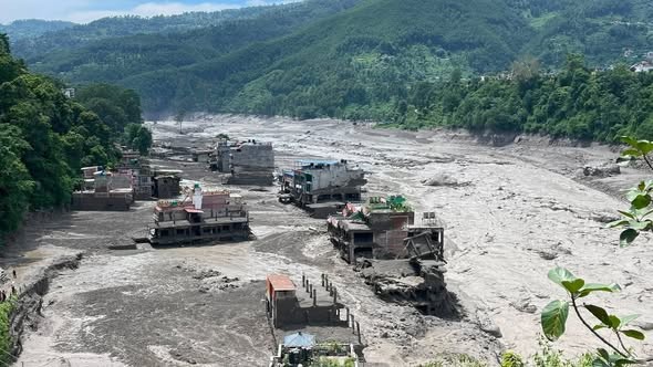
As of official numbers as of 8/27/2026, Nepalese authorities and news outlets worldwide were reporting more than 160 deaths in Nepal and hundreds of people still missing. Some estimates consider the number of missing to be considerably higher as officials reconcile lists of villagers, employees, security staff, and foreigners that were in the area.
Moreover, physical damage from the flood is also enormous. It includes the destruction of roads/bridges, houses, vehicles, hydropower facilities, electric infrastructure, border facilities and businesses. An assessment recently showed approximately 40 km of road and 19 bridges were either damaged or destroyed.
| Damage | Currently estimated as |
|---|---|
| Deaths | 160+ reported |
| Missing | Hundreds (figures still verifying) |
| Roads | Around 40 km reported damaged |
| Bridges | Around 19 reported damaged/destroyed |
| Houses | Numerous homes destroyed/damaged |
| Vehicles | Large numbers buried by flood |
| Hydropower | Major damage reported |
| Electricity | Transmission and generation infrastructure damaged |
| Border facilities | Rasuwagadhi area severely damaged |
| Businesses | Markets and commercial buildings impacted |
Yes, the damage in terms of rupees is likely to reach billions of rupees, but it is safer to avoid stating a specific official figure until the assessment is complete.
Yes. Just over a year ago, on July 8, 2025, the Rasuwa-Bhote Koshi corridor experienced yet another major and remarkably similar flash flood.
Meanwhile, the July 8, 2025 flood also originated in the Lhende River area and surged into the Bhote Koshi, destroying the Miteri/Friendship Bridge connecting Nepal and China at Rasuwagadhi, damaging the Rasuwagadhi dry port and hydropower infrastructure, and severely damaging the road between Syabrubesi and Rasuwagadhi. At least nine people were killed and 19 reported missing in early reports by Kathmandu Post.
| Factor | July 8, 2025 | August 26, 2026 |
|---|---|---|
| Location | Rasuwa/Bhote Koshi | Rasuwa/Bhote Koshi |
| Upstream area | Lhende River | Lhende/High Himalayan area |
| Flood type | Sudden flash flood | Catastrophic flash flood |
| Rasuwagadhi affected | Yes | Yes |
| Syabrubesi affected | Yes | Yes |
| Bridges damaged | Major damage | Extensive damage |
| Hydropower affected | Yes | Severe damage |
| Human casualties | At least 9 deaths initially reported | 165+ deaths reported so far |
| Missing | 19 initially reported | More than Hundreds |
| Recurrence | — | Only about 13 months later |
Here, the fact that the 2025 flood had already served as a prelude makes the 2026 event much more remarkable.
Yes. It has happened numerous times in the past, as Nepal has seen hundreds of GLOFs, landslide-dammed floods, ice avalanches and monsoon flash floods in the Himalaya. But the two recent events are especially noteworthy in the context of Rasuwa/Bhote Koshi because they involve a very similar vulnerable corridor.
Furthermore, the 2026 flood furthermore brings attention to an emerging hazard in the Himalayas: glacial instability can produce extremely rapid floods without the warning pattern seen in ordinary monsoon flooding. Recent scientific analysis has associated the 2026 disaster with a glacier/ice-rock collapse and subsequent debris surge.
The August 26, 2026 flood in Rasuwa was not an isolated occurrence in an otherwise tranquil region. The same Bhote Koshi-Lhende corridor had only just seen a similarly destructive flood in July 2025, and the recurrence within just about a year shows why Timure, Rasuwagadhi, Syabrubesi and areas downstream require enhanced early-warning systems, hazard monitoring and resilient infrastructure.
Important: Since the August 2026 event is still unfolding, casualty and financial-loss figures should continue to be updated rather than considered final.
Rescue teams were mobilized immediately after the Bhote Koshi flash flood in Rasuwa on August 26, 2026. The government deployed the Nepali Army, Armed Police Force (APF), Nepal Police, medical teams, Nepal Scouts, Nepal Red Cross Society, and local authorities. In addition, rescue workers and materials were sent from other districts.
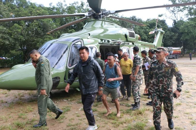
Likewise, two helicopters from the Nepali Army, and a number of helicopters from private organizations were on standby, carrying medical teams to search and rescue, and to evacuate and assist. Search and rescue operations were hindered by damaged and blocked roads, bridges, electricity, telecommunications, landing grounds, and flood debris.
| Rescue organization | Main role |
|---|---|
| Nepali Army | Helicopter rescue, evacuation and search operations |
| Armed Police Force | Search, rescue, security and evacuation |
| Nepal Police | Local rescue, coordination and public safety |
| Nepal Red Cross | Relief, medical and humanitarian assistance |
| Nepal Scouts | Volunteer support and relief coordination |
| Medical teams | Emergency treatment and casualty support |
| Local people | Immediate community rescue and assistance |
| District administration | Evacuation and emergency coordination |
In summary, authorities also advised people living in low-lying and river-side areas to move to safer places as flood and landslide risks remained.
Trekking parties are strongly advised to delay their travel to the Rasuwa and Langtang corridor until the local authorities and local operators confirm that the road and trail conditions are safe. The flood has badly damaged Syabrubesi and the Kathmandu-Rasuwa access corridor, and so the Langtang Valley Trek should not be regarded as business as usual.
| Precaution | What trekkers should do |
|---|---|
| Check weather | Check updated forecasts before departure |
| Check flood warnings | Follow official warnings |
| Ask your local operator | Confirm current road and trail conditions |
| Check Syabrubesi access | Do not assume the road is open |
| Check bridges | Confirm they have been inspected |
| Avoid riverbanks | Stay away from swollen rivers |
| Watch for landslides | Avoid unstable slopes |
| Keep flexibility | Allow extra days for delays |
| Carry communication backup | Keep a charged phone and power bank |
| Follow authorities | Obey evacuation and travel instructions |
| Avoid solo travel | Use experienced local support |
1. Check the Weather and Flood Forecast
Not just any weather app will do. Check the official weather, rainfall, river-level, and flood warnings before you leave Kathmandu. Conditions can change rapidly in the monsoon.
2. Ask Your Local Trekking Operator
This is even more important after a major disaster. A local operator can confirm the Kathmandu-Syabrubesi road, bridges, lodges, trail sections, and current conditions through local contacts.
The Nepal government has specifically advised people to avoid unnecessary travel along the Galchhi-Nuwakot-Rasuwa-Syabrubesi road due to the ongoing flood and landslide risks.
3. Never Cross a Damaged Bridge or Flooded River
Even if it looks safe, floodwater can erode the foundations of bridges and riverbanks. Don't risk it just to stick to your itinerary.
4. Keep Your Itinerary Flexible
Road closures and trail inspections following the August 26 disaster mean that travelers should allow for one or more buffer days in case of delays. Travelers should also have contingency plans and be ready to defer the trip.
Don't assume that just because it is fine in Kathmandu means it will be fine for trekking in the Langtang Valley. Conditions can be very different in the area around Syabrubesi. Always confirm locally before departing Kathmandu.
The smart move:
Check the forecast, then check official warnings, then ask your local operator, then confirm road and trail clearance, then decide whether to trek. Safety comes first.
At present, the main priority should be life safety and official clearance rather than keeping to a strict schedule for the Langtang Valley Trek.
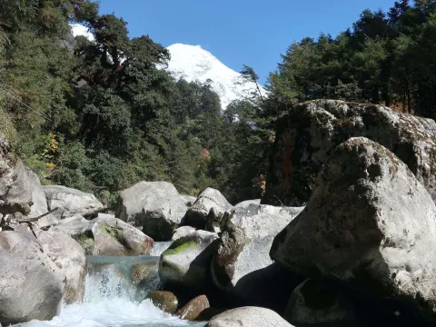
While Nepal trekking is generally safe, not every trekking region is automatically safe after the August 26 Rasuwa-Bhote Koshi disaster. The flood is local to the Rasuwa region, the Bhote Koshi corridor, Syabrubesi, and downstream areas.
Thus, it is unwise to cancel all tours and trekking activities in Nepal after the flood. Every trekking region must be evaluated separately based on the road access, weather, and trail conditions.
| Trekking region | Recommendation after Aug 26 flood |
|---|---|
| Langtang Valley | ⚠️ Postpone until official inspection |
| Gosaikunda (Rasuwa) | ⚠️ Postpone |
| Rasuwa/Kerung corridor | ❌ Avoid for now |
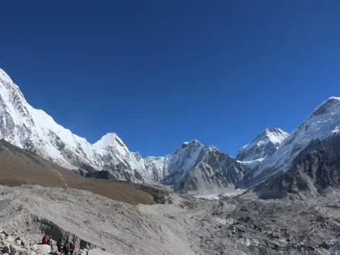
| Everest region | ✅ Separate from Rasuwa, but check weather |
| Annapurna region | ✅ Possible, if mountain passes are clear |
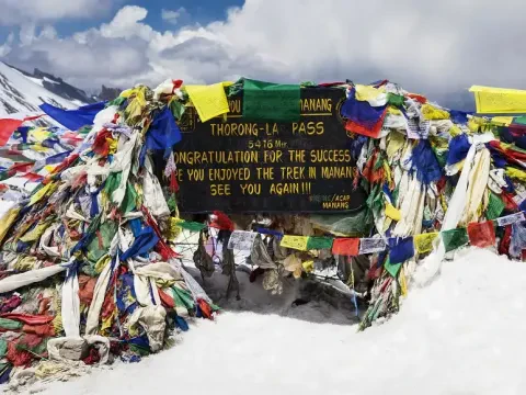
| Manaslu region | ✅Check local weather and conditions |
| Mardi Himal | ✅ Assess monsoon trail conditions |
| Poon Hill | ✅Check local rainfall and road access |
Here, the main point is that Nepal is a large country, and a flood in one region does not necessarily impact other trekking areas.
Yet, remember that August is the monsoon season, and heavy rains can trigger landslides and road washouts in many mountainous areas. Thus, it is essential to evaluate the weather forecast and road conditions for every trail before departure.
Here are additional tips for every mountain trekker:
Most importantly, remember that local weather conditions can differ significantly in Nepal, so it is unwise to rely only on the weather in Kathmandu.
For now, I suggest postponing the Langtang Valley Trek. The reason is not because the trail has been confirmed closed. Rather, the situation around the only Syabrubesi access point remains critical, and the entire Langtang trekking trail must be inspected for flood damage.
Actually, itt was reported that the Bhote Koshi flood reached Syabrubesi within a few minutes and caused significant destruction in the region.
| Concern | Risk |
|---|---|
| Kathmandu-Syabrubesi road | Disrupted |
| Syabrubesi | Flooded |
| Bridges | Inspection required |
| River crossings | Dangerous |
| Landslides | Possible |
| Trail erosion | Possible |
| Monsoon rain | Possible |
| Upper trail | Inspection required |
Meanwhile, the problem is that the flood was sudden and severe, and authorities are still assessing the damage and searching for those missing.
The Langtang Valley Trek can be available after a few days if the road access is cleared and the trail is inspected.
Prior to arrival, trekkers should contact local authorities or tour operators and ask for the following information:
Do not organize or participate in the Langtang Trek in the immediate aftermath of the disaster. Wait until the road access and trail conditions have been inspected by local authorities or trusted tour operators.
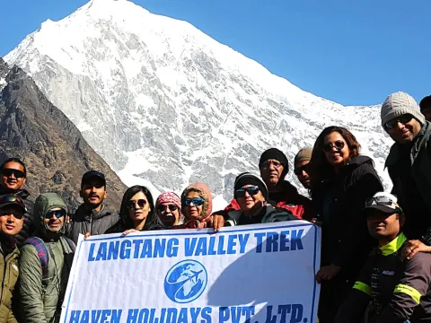
Here, this is critical for responsible tour operators such as Haven Holidays that value their clients’ safety. Instead of giving vague commitments that the Langtang trek is safe or dangerous, it is better to say:
“The Langtang Valley Trek is temporarily unavailable due to the August 26, 2026, Bhote Koshi flood. Trekkers must postpone their departure until the Syabrubesi access road and trail conditions have been inspected.”
In fact, this response is more precise and honest because, currently, authorities report flood damage around Syabrubesi, but it is still unclear if the entire upper trail is affected.
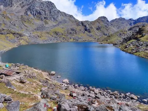
The August 26, 2026 Rasuwa-Bhote Koshi flood is a cautionary tale for hikers, but it does not necessarily mean that all trekking is hazardous in Nepal for the present moment. The disaster primarily affected the Rasuwa-Bhote Koshi corridor, with Timure and Syabrubesi being the two most severely damaged places.
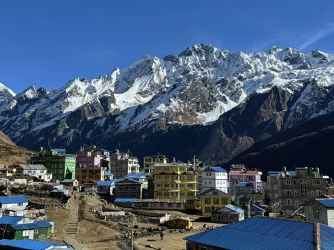
Meanwhile, Trekking to Langtang Valley requires more caution than usual because Syabrubesi is the gateway to the region.
With the flood, the region has been impacted, and the trek’s beginning points, including Syabrubesi’s village, bridges, and structures, have been damaged. Thus, hikers should not commence their journey until the roads and trails in the region, including the Kathmandu-Syabrubesi route, have been examined and certified as safe.
On the other hand, it is critical to double-check because there is no evidence that the entire Langtang Valley trek has been devastated. The most significantly damaged structures were Syabrubesi and the Rasuwa access corridor. Therefore, one can only conclude that the interior trails of the valley need further on-site assessment.
Likewise, the disaster also highlights the significance of local knowledge and flexibility in responding to Himalayan hazards. The flash flood influenced critical infrastructure, including the Syabrubesi hydroelectric project, and left an indelible mark on the area. Authorities received little early warning about the torrent before it reached the town.
Thus, while Nepal is still a trekking-friendly country, it is essential to double-check each route’s viability before exploring it. It would be best to wait for the local authorities to declare Langtang, Gosaikunda, and other Rasuwa destinations free and safe for trekking.
Additionally, you must evaluate the other Himalayan trekking areas, including Annapurna and Everest, independently.
Likewise, the most sensible counsel for hikers after the devastating flood is to check, confirm, and trek. It is essential to be pragmatic about rescheduling your adventure.
For a trekking business, the most prudent strategy is to advise clients to check the road and trail conditions and remain flexible with their itineraries.
1. Is trekking in Nepal safe after Rasuwa flood, 2026?
The trekking in Nepal after the Rasuwa flood 2026 is not entirely risky. It is true that the flood disaster has submerged the Bhotekoshi – Trishuli corridor, but there are other significant trekking areas in Nepal which do not share the same geography. You should check the local situation, trail accessibility, and weather forecast in the trekking regions before finalizing your plan.
2. Is Langtang Valley Trek safe after the Bhotekoshi flood, 2026?
The Langtang Valley Trek is considered risky after the Bhotekoshi flood 2026 as Syabrubesi, the nearest gateway to Langtang Valley, has been severely affected by the flood. The village road, bridge, and other infrastructure have been damaged. Therefore, it is safer to wait until the trek is announced open for travel by local authorities.
3. Which trekking areas have been affected by the Rasuwa flood, 2026?
The Langtang Valley Trek, and to some extent, the Everest Base Camp Trek and Annapurna Base Camp Trek, have been affected by the 2026 flood. The flood mainly damaged the villages and roads in the Rasuwagadhi, Syabrubesi, Betrawati, Timure, Mailung, and Trishuli regions. As Syabrubesi is the primary entrance to the Langtang Valley Trek, this trek route has been affected by the flood. However, the rest of the trekking areas were not severely damaged by the flood.
4. Is Everest Base Camp Trek safe after the 2026 flood in Nepal?
The Everest Base Camp Trek is generally considered safe after the 2026 flood. The EBC trek route is located primarily on the Khumbu region of Nepal which has a separate drainage system from the Bhotekoshi – Trishuli corridor.
Therefore, the EBC trek route and trails were not substantially damaged by the 2026 flood. However, you should keep a close watch on the weather forecast and Lukpa airport before finalizing your Everest Base Camp Trek schedule.
5. Is Annapurna Base Camp Trek safe after the 2026 flood in Nepal?
The Annapurna Base Camp Trek is also considered safe after the 2026 flood in Nepal, at least for now. The Annapurna region mostly shares a drainage system that is different from the Bhotekoshi – Trishuli corridor. The flood had damaged some of the local roads and villages around the Annapurna trek route, including Ghandruk. Therefore, it is a good idea to keep track of the road and weather situation in the Annapurna region before heading to the ABC trek.
6. Is Manaslu Circuit safe after the 2026 flood in Nepal?
The Manaslu Circuit is also considered safe after the 2026 flood in Nepal. Similar to the Everest Base Camp Trek and Annapurna Base Camp Trek, the Manaslu Circuit Trek region shares a separate drainage system.
However, the August 2026 monsoon season has already brought landslides and weather risks to the Manaslu Circuit trail. Therefore, keep the latest news about the Manaslu Circuit trek route and weather before finalizing your travel plan.
Updated: 2026/08/27
Our travel experts are ready to assist you with any questions.
Send us a message.Have a question before you book? Send your enquiry below and our travel experts will get back with the required information.