Generally speaking, it is good to read and take all required information in order to make your Everest Base Camp Trek successful.
So, here this article presents all guides on distances, trail conditions, duration, challenges on the trails, tips and major highlights.
Let’s stick to this article and read it thoroughly.
Now, we will see each every detail in a fully stretched form.
Generally speaking, day 01 of Everest Base Camp Trek combines a short mountain flight to Lukla [2,860m / 9,383ft] with a gentle introduction trek to Phakding [2,610m / 8,563ft].
Moreover, the trail is generally downhill along villages, forests, bridges and the Dudh Koshi valley, leading to the first overnight stop.
Day 01 Route Details
| Section | Elevation | Distance / Time | Main Features |
| Kathmandu/Manthali → Lukla | 2,860m / 9,383ft | 30–40 min flight | Mountain scenery and Lukla airstrip |
| Lukla → Chheplung | Around 2,660m / 8,727ft | 45–60 min | Sherpa villages and forest |
| Chheplung → Ghat | Around 2,530m / 8,300ft | 1–1.5 hrs | Dudh Koshi valley and bridges |
| Ghat → Phakding | 2,610m / 8,563ft | 1–1.5 hrs | Riverside trail and lodges |
| Total trekking | 2,860m → 2,610m | About 3–4 hrs | Gentle first walking day |
Trail, Views and Highlights
• Lukla airport and mountain settlements
• Chheplung [around 2,660m / 8,727ft]
• Dudh Koshi River and small suspension bridges
• Sections of pine and rhododendron forest
• Stone paths, village trails and terraced fields
• Traditional houses, mani stones, prayer flags and shrines
• Phakding [2,610m / 8,563ft] and riverside lodge area
Importantly, the trail is a net downhill of about 250m, although there are short uphill stretches along the way.
Facilities, Rest and Overnight
Phakding [2,610m / 8,563ft] has numerous teahouses, lodges, restaurants, shops and trekking services. Hence, it makes a convenient stop for resting after the flight and preparing for the much longer climb to Namche Bazaar [3,440m / 11,286ft].
• Twin-sharing teahouse or lodge room
• Dining room with hot food and drinks
• Basic charging facilities
• Water refill opportunities
• Shops for small trekking necessities
• Guide and porter support
• Overnight at local trekking lodge
Challenges, Risks and Best Tips
• Flight delays shortening the walking day
• Wet stones making slippery ground
• Careful footing on suspension bridges
. Be careful about mules caravans
• Avoid walking too quickly after landing at altitude
• Rain protection and water access should be prioritised
• Ensure boots, backpack and clothing are checked before leaving Lukla
• Afternoon should be used for rest, not unnecessary strenuous walking
Finally, if time and energy allows, take a short walk around the Phakding [2,610m / 8,563ft] and observe life of local Sherpas. An early dinner and good sleep are useful as Day 02 involves a substantial climb towards Namche.
Generally, Day 02 is the first substantial climbing day of the Lukla to EBC route, covering approximately 10–12km from Phakding [2,610m / 8,563ft] to Namche Bazaar [3,440m / 11,286ft].
Here, this includes the Dudh Koshi valley through Monjo [2,835m / 9,301ft] and Jorsale [2,740m / 8,989ft], plus the long final climb to Namche. ([Magical Nepal][2])
Day 02 Route Details
| Section | Elevation | Approx. Time | Main Features |
| Phakding → Benkar | 2,610m → ~2,700m | 1–1.5 hrs | River, forest and villages |
| Benkar → Monjo | ~2,700m → 2,835m | 1 hr | Pine forest and suspension bridges |
| Monjo → Jorsalle | 2,835m → 2,740m | 30–45 min | National Park entry area |
| Jorsalle → Hillary Bridge | ~2,740m → ~2,830m | 45–60 min | River junction and bridge |
| Hillary Bridge → Namche | ~2,830m → 3,440m | 2–3 hrs | Long, steep uphill section |
| Total | 2,610m → 3,440m | 5–7 hrs | Major elevation-gain day |
Trail, Views and Highlights
• Dudh Koshi River and forested valley
• Benkar and mountain settlements
• Monjo [2,835m / 9,301ft]
• Sagarmatha National Park checkpoint near Jorsale [2,740m / 8,989ft]
• Multiple suspension bridges
• Hillary Suspension Bridge area
• Long switchback climb to Namche
• First broader views of high Khumbu mountains
Importantly, the sleeping elevation increases by about 830m, making this a more challenging day than the first.
Checkpoints, Facilities and Rest
The Monjo/Jorsale area is where trekking permits are examined before continuing deeper into Sagarmatha National Park. Hence, keep your passport and relevant permits available and not inside your main luggage.
• Tea houses and small restaurants along the lower trail
• Rest stops around Monjo and Jorsale
• Water and snacks at several settlements
• Namche offers significantly more accommodation and services
• Twin-sharing lodge accommodation commonly available
• Dining rooms provide warm meals and drinks
Challenges, Risks and Best Tips
• Final climb to Namche is long and sustained
• Stone steps can be slippery in wet weather
• Heavy packs add fatigue on the ascent
• Altitude symptoms can start as elevation increases
• Take regular short rests rather than rushing
• Drink water regularly and eat adequately during the day
• Maintain slow steady pace on final climb
• Report headache, nausea, dizziness or unusual breathlessness to your guide
Finally, Namche Bazaar [3,440m / 11,286ft] serves more as an acclimatization stop than just another overnight village.
Moreover, reaching Namche without rushing gives a better opportunity to rest and prepare for the higher parts of the EBC trekking route.
Generally speaking, day 03 is typically an acclimatization day at Namche Bazaar [3,440m / 11,286ft] with an optional short hike to the higher altitude before heading back to sleep at the same elevation.
Meanwhile, the popular option involves a trek to Syangboche [~3,780m / 12,402ft] and Hotel Everest View [~3,880m / 12,730ft] before returning to Namche. ([Everest Base Camp Tours][2])
Day 03 Route Details
| Section | Elevation | Time | Highlights |
| Namche → Syangboche | 3,440m → ~3,780m | 1–1.5 hrs | Ridge trail, views, airstrip |
| Syangboche → Everest View Hotel | ~3,780m → ~3,880m | 30–45 min | Everest, Lhotse and Ama Dablam Views |
| Everest View → Namche | 3,880m → 3,440m | 1–1.5 hrs | Descending trail, valley views |
| Optional: Khumjung | ~3,790m | 1–2 hrs (extra) | Sherpa village, cultural exploration |
| Total | 3,440m → ~3,880m → 3,440m | 3–5 hrs | Climb high, sleep low |
Highlights, Facilities and Exploration
- Everest View Hotel panorama (weather permitting).
- Syangboche Ridge and Ex-Airstrip area.
- Views of Everest [8,848.86m / 29,031.7ft], Lhotse [8,516m / 27,940ft] and Ama Dablam [6,812m / 22,349ft].
- Optional walk to Khumjung [~3,790m / 12,434ft].
- Sherpa Culture Museum and Namche Market Area.
- Namche Cafés, bakeries, shops, pharmacies, lodges and restaurants.
Importantly, note that this is a day of gentle hiking, and the purpose is to acclimatize, so head back to your Namche lodge after the morning hike to relax and re-hydrate.
Challenges, Risks and Best Tips
- Walk slowly due to the thin air.
- Don’t force the Khumjung extension if you feel tired.
- Report headache, nausea, dizziness or unusual breathlessness.
- Keep warm during morning and evening.
- Eat well and drink regularly.
- Save the afternoon for rest and light exploration
Finally, overnight again at a Namche teahouse or lodge [3,440m / 11,286ft]. The idea of sleeping at the same elevation after visiting a higher viewpoint is consistent with the “climb high, sleep low” principle used during Himalayan acclimatization.
Generally, Day 04 involves a trek of approximately 10km from Namche Bazaar [3,440m / 11,286ft] to Tengboche [3,867m / 12,687ft] and takes around 5–6 hours.
First, the path crosses high above the Dudh Koshi valley before descending towards Phungi Tenga [~3,250m / 10,663ft] and climbing steeply again to Tengboche.
Day 04 Route Details
| Section | Elevation | Time | Main Features |
| Namche → Kyangjuma | 3,440m → ~3,570m | 1–1.5 hrs | Ridge trail, mountain views |
| Kyangjuma → Sanasa | ~3,570m → ~3,600m | 1 hr | Forest and Junction |
| Sanasa → Phungi Tenga | ~3,600m → ~3,250m | 1–1.5 hrs | Descent, river, forest |
| Phungi Tenga → Tengboche | ~3,250m → 3,867m | 1.5–2 hrs | Steep climb, monastery |
| Total | 3,440m → 3,867m | 5–6 hrs | Moderate Trekking day |
Trail, Views and Highlights
- Kyangjuma [~3,570m / 11,713ft].
- Sanasa forest and trail junction.
- Rhododendron, pine and fir woodland.
- Dudh Koshi Valley viewpoints and Phungi Tenga riverside rest area.
- Tengboche Monastery and Himalayan panorama.
- Great views of Ama Dablam [6,812m / 22,349ft], Everest [8,848.86m / 29,031.7ft], Lhotse [8,516m / 27,940ft] and Nuptse [7,861m / 25,791ft] when skies are clear.
Facilities, Rest and Overnight
Phungi Tenga is a good place to rest before the final climb and Tengboche [3,867m / 12,687ft] has several teahouses and lodges.
So, take your time to stop and have a look around before heading up the final slope and save enough time if the group is on the slow side.
- Twin-sharing lodge accommodation.
- Dining room and hot meals.
- Tea, coffee and drinking-water options.
- Basic charging facilities (lodge-dependent).
- Tengboche Monastery visit.
- Overnight at Tengboche.
Challenges, Risks and Best Tips
- The descent to Phungi Tenga uses uneven sections.
- The climb from Phungi Tenga is steep and tiring.
- Wet or icy stones are slippery.
- Keep a steady pace after the acclimatization day.
- Carry water and snacks for the final ascent.
- Arrive early to explore the monastery grounds respectfully.
Finally, Tengboche [3,867m / 12,687ft] is one of the highlights of the EBC route. If the weather and the schedule at the monastery permit, set aside some time to explore this cultural and mountain highlight instead of seeing Tengboche only as an overnight stop.
Generally, Day 05 consists of journeying from Tengboche [3,867m / 12,687ft] to Dingboche [4,410m / 14,469ft], with stops in Deboche, Pangboche, Somare and the upper Imja Valley. Moreover, the trail winds out of the forest into colder, drier alpine terrain.
Day 05 Route Details
| Section | Elevation | Time | Main Features |
| Tengboche → Deboche | 3,867m → ~3,820m | 30–45 min | Forest and monastery views |
| Deboche → Pangboche | ~3,820m → ~3,985m | 1.5–2 hrs | Imja Khola and mountain views |
| Pangboche → Somare | ~3,985m → ~4,040m | 1 hr | Open valley and stone walls |
| Somare → Dingboche | ~4,040m → 4,410m | 2 hrs | Alpine terrain and fields |
| Total | 3,867m → 4,410m | 5–6 hrs | ~10–11 km |
Trail, Views and Highlights
Deboche [~3,820m / 12,533ft] and forested trail.
Imja Khola crossing.
Pangboche [~3,985m / 13,074ft], a traditional Sherpa settlement.
Somare [~4,040m / 13,255ft], a good lunch/rest point.
Stone-walled fields around Dingboche.
Expanding views of Ama Dablam [6,812m / 22,349ft].
Views out to Island Peak/Imja Tse [6,189m / 20,305ft].
Importantly, the trail gains ~540m in sleeping elevation, therefore the last leg can be more challenging than one might expect.
Facilities and Overnight Stay
Dingboche [4,410m / 14,469ft] supports numerous teahouses, dining rooms, shops, charging and basic trekking facilities. Therefore, plan to arrive early enough to relax and prepare for the following acclimatization day.
Twin-sharing lodge accommodation.
Warm meals and drinks.
Water refill facilities.
Basic Wi-Fi or charging where available.
Small shops for trekking essentials.
Overnight at Dingboche.
Challenges, Risks and Best Tips
Expect thinner air above 4,000m.
Walk slowly through the final climb.
Take regular short rests.
Keep water and snacks accessible.
Watch for headache, nausea, dizziness or sudden breathlessness.
Avoid unnecessary hard activity on arrival.
Keep warm after sunset.
Finally, rather than a further arduous trek, spend the afternoon gently exploring around Dingboche [4,410m / 14,469ft].
Moreover, an early dinner and good night's sleep prepares you for the important acclimatization hike on Day 06.
Generally, Day 06 consists of an active acclimatization day based in Dingboche [4,410m / 14,469ft], with a gradual climb to higher altitude and then back down to the same lodge.
Here, the usual objective is Nangkartshang [about 5,083m / 16,677ft], however the exact turnaround point should be dictated by your state and your guide's assessment.
Day 06 Route Details
| Section | Elevation | Time | Main Features |
| Dingboche → lower ridge | 4,410m → ~4,600m | 1 hr | Steep open hillside |
| Lower ridge → Nangkartshang | ~4,600m → ~5,083m | 1.5–2 hrs | High-altitude viewpoint |
| Nangkartshang → Dingboche | 5,083m → 4,410m | 1.5–2 hrs | Descending ridge trail |
| Total | 4,410m → ~5,083m → 4,410m | 4–5 hrs | ~4–6 km |
Views, Highlights and Exploration
Panoramic Imja Valley views.
Ama Dablam [6,812m / 22,349ft].
Island Peak/Imja Tse [6,189m / 20,305ft].
Lhotse [8,516m / 27,940ft].
Makalu [8,485m / 27,838ft], if visible.
Open views out to the upper Khumbu.
Optional shorter ridge hike if Nangkartshang feels too demanding.
Importantly, the climb is steep and exposed, therefore a slow pace is more appropriate than attempting to reach the highest point.
Rest, Facilities and Overnight
Leave most of your luggage behind at your Dingboche lodge and only carry water, snacks, warm layers, sunscreen and basic personal items. Therefore, simply return to the same teahouse, rest during the afternoon, and prepare clothes for the higher trail ahead towards Lobuche.
Breakfast before the hike.
Water and snacks in the daypack.
Lodge dining room for lunch and dinner.
Basic charging and Wi-Fi may be available.
Optional short village exploration.
Overnight again at Dingboche [4,410m / 14,469ft].
Challenges, Risks and Best Tips
Altitude makes even short climbs arduous.
Strong wind and cold can develop quickly.
Do not continue upward if symptoms worsen.
Turn around before the summit if necessary.
Drink regularly and eat adequately.
Keep the afternoon relaxing.
Avoid alcohol and unnecessary exertion.
Finally, the goal is acclimation, not a specific summit. Moreover, climbing higher on the day and then returning to Dingboche [4,410m / 14,469ft] to sleep gives you valuable altitude time while having the same sleeping elevation.
A demanding day taking you from Dingboche [4,410m / 14,469ft] up to Lobuche [4,940m / 16,207ft] through the high alpine valley and memorial area of Thukla/Dughla.
Actually, this is a challenging trek through a high mountain valley, with a final steep climb despite the relatively short distance.
Day 07: Dingboche to Lobuche
Section | Elevation | Time| Features
Dingboche > Dughla/Thukla | 4,410m > ~4,620m | 2-2.5 hrs |Alpine valley, yak pastures, mountain views
Thukla > Memorial area |4,620m > ~4,830m| 45-60 min |Steep moraine climb and memorials
Memorial area > Lobuche |4,830m > 4,940m| 1.5-2 hrs| Rocky moraine and glacier views
Total| 4,410m > 4,940m| 5-6 hrs |Approx. 9-12 km
Trail, Views and Highlights
• Open alpine landscape around Dingboche [4,410m / 14,469ft]
• Pheriche Valley views and glacial streams
• Thukla/Dughla [~4,620m / 15,157ft]
• Steep climb to Thukla memorial area
• Memorial cairns for climbers and guides who died on Himalayan expeditions
• Khumbu Glacier and surrounding moraine
• Views toward Lobuche East, Pumori, Nuptse and other high peaks
Meanwhile, the landscape becomes increasingly barren as you leave the greener valleys behind, so keep warm layers, gloves, sunglasses, sunscreen and wind protection at the ready.
Rest, Facilities and Overnight
Thukla/Dughla makes a good rest/meal stop before the steep climb to the memorial area, while Lobuche [4,940m / 16,207ft] has basic teahouses and dining facilities.
Importantly, note that you won't find the same range of services available as at Namche Bazaar [3,440m / 11,286ft].
• Breakfast at Dingboche
• Lunch/tea break around Thukla
• Basic teahouse accommodation at Lobuche
• Shared dining room and simple meals
• Limited charging and internet facilities
• Overnight at Lobuche
Challenges, Risks and Best Tips
While it might seem a short climb, altitude makes it feel much tougher. The climb to the Thukla memorial area is steep and exhausting.
Importantly, wind and cold increase above 4,500m, and rocky ground requires good footing. Don't ignore signs of altitude sickness such as headache, nausea, dizziness or unusual breathlessness.
More importantly, you may have Khumbu cough here in this section of trekking. Khumbu cough is similar to altitude sickness but it is not in fact. Ask your guide about it.
Walk at a steady pace and avoid unnecessary side-hikes once you reach Lobuche.
Likewise, rest well after reaching Lobuche [4,940m / 16,207ft] as Day 08 is one of the most demanding stages of the EBC trek.
An early dinner, proper hydration and warm clothing will help you prepare for the high-altitude walk toward Gorak Shep [5,164m / 16,942ft] and Everest Base Camp [5,364m / 17,598ft].
The major objective day of the trek taking you from Lobuche [4,940m / 16,207ft] up to Gorak Shep [5,164m / 16,942ft], then across rocky glacial terrain to Everest Base Camp [5,364m / 17,598ft].
Here, the total walking distance is usually around 14-15km, with walking time around 7-9 hours depending on pace and trail conditions.
Day 08: Lobuche to Everest Base Camp
Section| Elevation| Time| Features
Lobuche > Gorak Shep| 4,940m > 5,164m| 2-2.5 hrs| Rocky moraine and glacier views
Gorak Shep rest/check-in| 5,164m| 20-40 min| Leave heavy luggage and prepare daypack
Gorak Shep > EBC| 5,164m > 5,364m| 2-3 hrs| Khumbu Glacier and Icefall scenery
EBC > Gorak Shep| 5,364m > 5,164m| 2-3 hrs| Return across moraine
Total |4,940m > 5,364m| 7-9 hrs| Approx. 14-15 km
Trail, Views and Highlights
• High-altitude rocky trail from Lobuche
• Gorak Shep [5,164m / 16,942ft], the last major settlement before EBC
• Pumori [7,161m / 23,494ft] and Nuptse [7,861m / 25,791ft] views
• Khumbu Glacier and surrounding moraine
• Khumbu Icefall near Everest Base Camp
• Prayer flags and expedition activity at EBC during climbing seasons
• Everest Base Camp [5,364m / 17,598ft], the main trekking objective
Actually, Everest Base Camp itself isn't the best viewpoint of Mount Everest [8,848.86m / 29,031.7ft] because surrounding peaks and ridges block the summit from certain positions.
Here, the following day's Kala Patthar [5,545m / 18,192ft] hike is normally used for the classic Everest panorama.
Facilities, Rest and Overnight
Gorak Shep only has high-altitude teahouses, so facilities aren't as plentiful as those available in lower villages. Leave your main luggage at the lodge to carry only essentials for the EBC excursion.
• Breakfast at Lobuche
• Short rest at Gorak Shep
• Lunch/snacks at Gorak Shep
• Basic teahouse room with shared facilities
• Limited electricity, charging and internet
• Hot meals/drinks where available
• Overnight at Gorak Shep [5,164m / 16,942ft]
Challenges, Risks and Best Tips
The entire day is above 4,900m, meaning the rocky moraine makes for slow and tiring walking. Wind and cold can be severe, so keep your pace deliberately slow to conserve energy.
Meanwhile, carry all your essential items for the EBC excursion, including warm layers, gloves, water, snacks and sun protection.
Importantly, don't underestimate the return walk from EBC, and report worsening altitude symptoms as soon as possible. Avoid unnecessary stops that make you too cold.
Here, reaching Everest Base Camp [5,364m / 17,598ft] is a major milestone, but the return to Gorak Shep is still part of the day's work.
Moreover, start early, follow your guide's pace and leave enough daylight and energy for the complete EBC return before settling overnight at Gorak Shep.
In conclusion, day 9 is one of the most crucial days of the EBC itinerary, involving the early morning climb to Kala Patthar followed by the long descent back towards Pheriche.
Day 9 begins before sunrise with the steep ascent from Gorak Shep [5,164m / 16,942ft] to Kala Patthar [5,545m / 18,192ft], the highest altitude point of the EBC trekking route and one of the most popular viewpoints for Everest, Nuptse, Pumori and the Khumbu Glacier.
Here, retracing the trail back via Lobuche [4,940m / 16,207ft], Thukla [~4,620m / 15,157ft] and the wide valley to Pheriche [4,240m / 13,911ft] allows lower altitude recovery time before continuing towards the following days.
Retracing back to Pheriche Highlights
Section| Elevation| Approx. time| Main trail / highlights
Gorak Shep → Kala Patthar| 5,164m → 5,545m| 1.5-2 hrs| Steep rocky ascent
Kala Patthar → Gorak Shep| 5,545m → 5,164m| 45-60 min |Sunrise views and descent
Breakfast/rest at Gorak Shep| 5,164m| 45-60 min| Warm meal and repack
Gorak Shep → Lobuche |5,164m → 4,940m| 1.5-2 hrs| Moraine and glacial valley
Lobuche → Thukla| 4,940m → ~4,620m| 45-60 min| Descending high-alpine trail
Thukla → Pheriche |4,620m → 4,240m| 1.5-2 hrs| Wider valley and easier breathing
Total walking| 5,545m → 4,240m| 7-8 hrs Approx.| 14-16km
Early morning Kala Patthar hike
Waking around 4:00-4:30 AM and preparing with headlamp, warm layers, gloves, hat and water is an essential beginning for the early morning walk.
Start climbing from Gorak Shep [5,164m / 16,942ft] around 4:30-5:00 AM depending on sunrise, weather and group pace.
The trail immediately becomes rocky and steep as you head towards the Kala Patthar ridge.
While not a long climb, walking above 5,000m / 16,404ft requires frequent yet short rests and a steady, slow pacing to adjust to the altitude.
Meanwhile, several short rocky climbs can give the impression of reaching the summit before the actual viewpoint area, so be prepared to slow down when the trail appears to flatten out.
Here, arriving at Kala Patthar [5,545m / 18,192ft] with its prayer flags offers spectacular views of Mount Everest [8,848.86m / 29,031.7ft], Nuptse [7,861m / 25,791ft], Pumori [7,161m / 23,494ft], Lhotse [8,516m / 27,940ft], Khumbu Glacier and surrounding Himalayan peaks.
Notably, the view of Everest from Kala Patthar is arguably more impressive than the viewpoint at the EBC itself.
Restrict time at the summit to what is comfortably achievable considering the wind conditions, cold temperatures and general altitude sickness risk.
Begin the careful descent due to slippery rock and ice at this high altitude point.
In conclusion, the climb up from Gorak Shep to Kala Patthar gains approximately 380m, but the combination of high altitude and thin air makes this short climb much more challenging than at lower elevations.
Return to Gorak Shep and breakfast
Following a sunrise viewpoint at Kala Patthar, descend back to Gorak Shep [5,164m / 16,942ft] for breakfast and a much-needed rest period.
Actually, this afternoon walk section is significantly longer than the morning walk, hence the need for a full recovery at Gorak Shep before continuing.
Have a warm breakfast and drink.
Refill water bottles or hydration packs.
Rep ack your daypack before continuing the trail.
Use the lodge toilet and confirm all personal belongings are present.
Discuss any medical concerns with your guide before the long descent begins.
Keep warm clothing accessible despite rising temperatures as it can still be quite cold before dawn.
Gorak Shep to Lobuche and Thukla
From Gorak Shep, follow the familiar rocky trail back towards Lobuche [4,940m / 16,207ft]. The trail gently descends the high Khumbu countryside before continuing towards Thukla [~4,620m / 15,157ft], where a teahouse provides a convenient rest and lunch stop.
Moreover, the trail passes the memorial area above Thukla, where stone memorials and prayer flags commemorate climbers and mountaineers who lost their lives in the Everest region.
While not as busy as the summit viewpoint, this part of the trail has historical and cultural value, so consider taking time to appreciate the memorials.
Thukla to Pheriche
From Thukla, follow the valley trail back towards Pheriche [4,240m / 13,911ft], passing the teahouse and continuing along the changing Khumbu countryside. As the altitude reduces, breathing becomes significantly easier and vegetation becomes more prevalent, making the final section much more comfortable than the morning walk.
Thukla: good stop for tea, snacks or lunch
Dughla/Thukla area: basic teahouses and toilets
Pheriche: more options for teahouses and lodges
Pheriche has restaurants, dining rooms, hot drinks, charging facilities and basic internet depending on the lodge.
Actually, seasonal medical support is also available in Pheriche, making it a good place to seek assessment if experiencing altitude-related issues higher on the route.
Overnight in a teahouse/lodge at Pheriche [4,240m / 13,911ft].
Views and highlights
• Sunrise over Everest [8,848.86m / 29,031.7ft] from Kala Patthar
• Close views of Nuptse [7,861m / 25,791ft] and Pumori [7,161m / 23,494ft]
• Panoramic views towards Lhotse [8,516m / 27,940ft] and surrounding peaks
• Khumbu Glacier and high Himalayan valleys
• Prayer-flag-covered Kala Patthar viewpoint
• Thukla memorial area and mountaineering history
• Gradual change from barren high-altitude terrain towards the greener Pheriche valley
• Significant elevation loss for recovery after several nights above 4,900m
Challenges and risks
The main challenge is the early morning walk up to Kala Patthar, as you are gaining height around 380m above the EBC, and this is typically the coldest time of the day at high altitude.
Meanwhile, the long descent section thereafter places considerable strain on the knees, ankles and quadriceps, especially after several days of trekking.
Likewise, unsteady ground, freezing patches of ice, strong wind conditions, lack of visibility and tiredness can contribute to the risk of a fall, and trekking poles offer particular assistance during this section.
Watch for persistent headaches, vomiting, severe dizziness, unusual confusion, difficulty walking or breathing problems as these are signs that descending and informing your guide would be safer than continuing with significant altitude sickness.
In summary, the considerable descent to Pheriche usually provides much easier breathing, but do not assume this is a substitute for appropriate response to serious altitude issues.
Checkpoints and trail management
There are no significant additional permit checkpoints comparable to the lower Sagarmatha National Park entry point on this section, but guides should keep permits and identification accessible as official checks can take place along the trekking route.
Here, ptractical considerations are therefore your guide's management of pace and conditions, daylight planning and overall assessment of each trekker's condition.
Extra exploration if time and energy allow
If arriving at Pheriche earlier than expected and with remaining energy, a short, easy walk around the village is a better option than attempting another demanding climb.
Likewise, you can explore the views, fields, stone-walled settlement and valley while conserving energy for the following descent to Namche rather than wasting valuable altitude on an unnecessary climb.
Best tips for Day 9
• Prepare your headlamp and warm clothing beside your bed the night before
• Start early enough to reach Kala Patthar around sunrise without rushing
• Wear multiple warm layers as wind chill can be severe before sunrise
• Carry only essential items during the Kala Patthar climb
• Safeguard your phone and camera batteries from the cold
• Take short, regular steps and avoid racing other trekkers
• Do not remain unnecessarily long at 5,545m / 18,192ft
• Have breakfast and a proper rest at Gorak Shep before continuing
• Use trekking poles during the long descent section
• Take lunch or a substantial break around Thukla
• Hydrate regularly even though you are descending
• Inform your guide immediately if developing significant altitude symptoms
• Keep enough daylight for the final walk to Pheriche
• Arrange your Pheriche accommodation in advance during peak trekking seasons
• Overnight: Pheriche [4,240m / 13,911ft]
• Meals: Breakfast, lunch and dinner
• Accommodation: Mountain teahouse/lodge
• Highest point: Kala Patthar [5,545m / 18,192ft]
• Walking time: Approximately 7-8 hours
• Walking distance: Approximately 14-16km, depending on the exact lodge, route and viewpoint turnaround. Current route itineraries report figures ranging from about 14km to 16km for this day.
Optional Itinerary: Helicopter Return
Rather than continuing the trek from Pheriche towards Namche Bazaar and Lukla, trekkers who wish to avoid the return walk can arrange a helicopter flight from the Everest region.
Depending on the operator, weather conditions, aircraft limitations and operational considerations, the helicopter may fly from Pheriche towards Lukla [2,860m / 9,383ft] for further flight arrangements or operate a direct routing towards Kathmandu, with some services utilising a Lukla refuelling stop.
• Option 1: Pheriche → Lukla by helicopter, then continue to Kathmandu by scheduled flight when available
• Option 2: Pheriche → Kathmandu by helicopter, subject to aircraft capacity, weather and operational approval
• Helicopter operations are strongly weather-dependent, particularly in the Everest region
• Confirm the pickup location, flight routing, baggage allowance, passenger limit and total cost before departure
• Maintain some flexibility as reduced visibility or strong winds can delay helicopter operations
• If using a helicopter to shorten the return journey, retain enough contingency time in Kathmandu for possible weather-related delays
• This option removes the long descent through Pheriche → Namche → Lukla, saving several days of walking while completing the high-altitude EBC and Kala Patthar section of the trek
• Some current EBC helicopter-return itineraries specifically use Pheriche as the trekking endpoint before flying towards Lukla and/or Kathmandu, although the exact routing depends on the day's conditions and flight arrangements
On day 10 of the EBC Trek, you will trek from Pheriche [4,240m / 13,911ft] back to Namche Bazaar [3,440m / 11,286ft] along a long but increasingly comfortable descent through the Imja and Dudh Koshi valleys.
While you will lose around 800m of net elevation, the route does feature several uphill segments, notably around Tengboche [3,867m / 12,687ft] and after Phunki Tenga [~3,250m / 10,663ft].
Section| Approx. elevation| Approx. time| Trail / distance
Pheriche → Somare| 4,240m → ~4,010m| 1–1.5 hrs| Descending valley trail
Somare → Pangboche |4,010m → ~3,985m| 30–45 min| Open trail between the Imja Valley
Pangboche → Deboche |3,985m → ~3,820m| 1–1.5 hrs| Descending to the forest
Deboche → Tengboche |3,820m → 3,867m| 45–60 min| Shortly uphill in the forest
Tengboche → Phunki Tenga| 3,867m → ~3,250m| 1–1.5 hrs| Steep forest descent
Phunki Tenga → Sanasa| 3,250m → ~3,600m| 1–1.5 hrs| Uphill after the Dudh Koshi
Sanasa → Kyangjuma |3,600m → ~3,570m| 30–45 min| Forested trail
Kyangjuma → Namche |3,570m → 3,440m| 45–60 min| Final gradual approach
Total |4,240m → 3,440m| 6–8 hrs| Approx. 14–20km
Trail, views and highlights
Begin the day after the breakfast, which is normally around 7:30–8:00 AM, as this is a long walking day.
Follow the trail from Pheriche through Orsho and the open upper Imja valley.
Visit the small teahouses at Somare [~4,010m / 13,156ft] for a light morning stop.
Arrive at Pangboche [~3,985m / 13,074ft], one of the major Sherpa settlements on the trail.
The vegetation gradually becomes greener as you descend into a valley featuring shrubs, juniper, pine and rhododendron trees.
Continue through Deboche [~3,820m / 12,533ft] and a short climb to Tengboche [3,867m / 12,687ft].
Tengboche makes a good place for tea, lunch or a rest, and you can also revisit the Tengboche Monastery if you did not have time on the way up.
From Tengboche, head steeply downhill through the forest towards Phunki Tenga [~3,250m / 10,663ft].
Cross the Dudh Koshi river and begin the gentle climb towards Sanasa.
Here, the trail contours through forest and hillside settlements around Kyangjuma prior to reaching Namche.
On clear days, you will again see Ama Dablam [6,812m / 22,349ft], Thamserku [6,608m / 21,680ft], Kangtega [6,685m / 21,932ft] and other Khumbu peaks.
As you approach Namche, the landscape becomes greener, and the warmer air contains noticeably more oxygen.
Facilities, rests and accommodation
Pangboche: Teahouses, restaurants, toilets, tea, coffee, snacks and simple lunch facilities.
Deboche: Fewer teahouses and useful resting points, although the facilities are more limited than in Namche.
Tengboche: Multiple lodges, teahouses, restaurants, toilets and monastery facilities.
Phunki Tenga: Useful stop for drinks, snacks and lunch depending on your walking schedule.
Sanasa/Kyangjuma: Small lodges and teahouses for short breaks.
Namche Bazaar: The most comprehensive range of facilities on the trail, including comfortable teahouses, restaurants, bakeries, cafes, hot showers, charging facilities, internet services and shops.
Overnight accommodation is normally a teahouse or lodge in Namche Bazaar [3,440m / 11,286ft].
However, you can get some comfortable and luxury accommodation at Namche Bazaar.
Checkpoints, challenges and risks
You will be returning via the Sagarmatha National Park trail route, so ensure your permits and identification are accessible if requested by park officials.
The main challenge is not the altitude but the distance and accumulated fatigue after several demanding days above 4,000m.
The forest passage can be stiff on the knees, while the short climb after Phunki Tenga can be surprisingly tiring.
Slippy patches are possible around forested slopes, particularly in the morning or after rainfall.
Yak, mule and porter traffic can make narrow sections quite busy, so you might want to stay on the uphill side.
Even though the altitude is dropping, continue to monitor for signs of altitude sickness, including headache, extreme tiredness, dizziness or other symptoms.
Extra exploration and best tips
If you arrive in Namche with enough daylight, stroll around the main market streets and visit the Sagarmatha National Park Museum/Viewpoint above the village.
Enjoy a proper hot shower and more substantial meal, as Namche has considerably more facilities than the higher villages.
You may want to keep your trekking poles handy, as the frequent downhill section can be harder on the knees than expected.
Set out early and keep a steady pace rather than rushing to complete the day because you are descending.
Carry enough water and a small amount of snacks, although food and drinks are available at several settlements.
Keep your warm layer clothing accessible because the weather can still change around Tengboche and the forested ridges.
Namche makes an excellent place to rest properly ahead of the final trekking day to Lukla.
Overnight: Namche Bazaar [3,440m / 11,286ft].
Meals: Breakfast, lunch and dinner.
Accommodation: Teahouse/lodge.
Approximate walking time: 6–8 hours.
Approximate distance: 14–20km depending on the route and lodge location.
The final trekking day on the tour takes you from Namche Bazaar [3,440m / 11,286ft] back down to Lukla [2,860m / 9,383ft] along the Dudh Koshi valley.
Meanwhile, the walking distance is approximately 18–20km and it normally takes around 6–8 hours to complete, but the numerous short climbs, bridges and accumulated fatigue can make it feel longer than the altitude change suggests.
Namche to Lukla: Trail Guide
Section| Approx. elevation| Approx. time| Trail / highlights
Namche → Kyangjuma| 3,440m → ~3,570m| 45–60 min| Trekking along hillside trail
Kyangjuma → Sanasa |3,570m → ~3,600m| 30–45 min| Forest and mountain views
Sanasa → Phunki Tenga |3,600m → ~3,250m| 1–1.5 hrs| Long forest descent
Phunki Tenga → Jorsalle |3,250m → 2,740m| 1.5–2 hrs| Dudh Koshi valley
Jorsalle → Monjo| 2,740m → 2,835m| 30–45 min |River trail and park checkpoint
Monjo → Phakding| 2,835m → 2,610m| 45–60 min| Villages and suspension bridges
Phakding → Ghat/Chheplung |2,610m → ~2,700m| 1–1.5 hrs| Dudh Koshi valley
Chheplung → Lukla |2,700m → 2,860m| 45–60 min| Final uphill approach
Total| 3,440m → 2,860m| 6–8 hrs| Approx. 18–20km
Trail, views and highlights
Begin the day after the breakfast, ideally around 7:00–8:00AM because the day involves considerable walking.
Exit Namche along the hillside trail towards Kyangjuma [~3,570m / 11,713ft].
Continue through Sanasa [~3,600m / 11,811ft] as the trail begins its longer descent towards the Dudh Koshi.
The path passes through pine and rhododendron woodlands towards Phunki Tenga [~3,250m / 10,663ft].
Cross the river and continue along the lower Khumbu valley past Jorsale [2,740m / 8,989ft].
The trail follows the river towards Monjo [2,835m / 9,301ft], where the Sagarmatha National Park checkpoint is located.
Continue through Benkar and the familiar suspension bridges towards Phakding [2,610m / 8,563ft].
Pass Ghat [~2,530m / 8,300ft] and continue towards Chheplung [~2,700m / 8,858ft].
The final section includes a gentle climb towards Lukla [2,860m / 9,383ft].
Around the lower route, you will again cross several suspension bridges over the Dudh Koshi and its tributaries.
Here, the landscape becomes progressively greener, featuring cultivated fields, stone walls, pine forests and traditional Sherpa villages.
Clear weather can provide final views towards Thamserku [6,608m / 21,680ft], Kusum Kanguru [6,367m / 20,889ft] and the surrounding Khumbu peaks.
Reaching Lukla completes the trekking section of the Everest Base Camp tour.
Facilities, rests and accommodation
Kyangjuma/Sanasa: Small teahouses and restaurants for tea, coffee and snacks.
Phunki Tenga: Convenient stop for a longer break or early lunch.
Jorsale: Small lodges and restaurants, although the facilities are more basic than in Namche.
Monjo: Restaurants, teahouses, toilets and the national park checkpoint.
Phakding: Many teahouses, lodges, restaurants, bakeries and cafes.
Ghat: Small lodges and teahouses for a short break.
Chheplung: Useful stop for final refreshments before Lukla.
Lukla: Extensive range of teahouses, hotels, restaurants, cafes, shops, bakeries, charging facilities and hot showers.
Overnight accommodation is normally booked in a teahouse or lodge in Lukla [2,860m / 9,383ft].
Checkpoints, challenges and risks
Keep permits and identification accessible at Monjo, particularly if asked to check by park officers.
The largest challenge is cumulative fatigue, as this is still a long walking day following the high-altitude section of the tour.
Avoid assumptions that this day is all downhill, as there are still several short climbs around Kyangjuma and the approach to Lukla.
Stepping on stairs or uneven rocks can put significant pressure on tired knees and ankles.
Busy sections around the suspension bridges allow time for trekkers, porters, yaks and mules to pass safely.
Wet stones and muddy patches can be particularly slippery in damp weather, while loose gravel can also increase the risk of a twisted ankle.
Lukla is at a much lower altitude than the previous trekking locations, so breathing should no longer be a challenge.
Extra exploration and best tips
If you arrive in Lukla with enough daylight, take a relaxed walk around the town and view the airport from a safe public vantage point.
Celebrate the completion of the trek with your guide and porter, but allow a relaxed evening ahead of your morning flight out of Lukla.
Confirm your Lukla flight details with your guide or tour company in the evening and keep your personal belongings secure.
Carry your passport, flight documents, phone, money and other valuables in your daypack, rather than in a porter’s satchel.
Avoid an exhausting side expedition on the first afternoon when your legs will already have completed a long final day.
Allow flexibility for the next morning because Himalayan flights can be cancelled due to weather, visibility or other factors.
Drink enough water during the day even though you are descending to lower altitudes.
Take your time over the final kilometers because the objective is a safe arrival rather than speed.
Overnight: Lukla [2,860m / 9,383ft].
Meals: Breakfast, lunch and dinner.
Accommodation: Teahouse/lodge.
Approximate walking time: 6–8 hours.
Approximate distance: 18–20km depending on the trail and lodge location.
Day 12 of Everest Base Camp Trek completes the trekking element of the Everest Base Camp journey with a short mountain flight from Lukla [2,860m / 9,383ft] returning toward Kathmandu [~1,400m / 4,593ft].
Meanwhile, the flight itself is normally only 25-35 minutes long, but the complete transfer process involves several hours of airport check-in, weather considerations, flight sequencing, delays and, during peak seasons, the Ramechhap/Manthali connection.
Day 12: Fly from Lukla to Kathmandu
Day 12 begins with an early morning departure from Lukla [2,860m / 9,383ft] giving you one final view of the Khumbu mountains before leaving the Everest region.
Here, the flight to Kathmandu is short but trekkers should keep the whole morning open as Lukla flights are dependent on visibility, wind and operating conditions.
Lukla to Kathmandu Flight Summary:
| Section | Elevation | Approx. timing | Duration / details |
| Wake up in Lukla | 2,860m / 9,383ft | 5:30-6:30 AM | Breakfast and preparation |
| Walk to Tenzing-Hillary Airport | 2,860m / 9,383ft | 15-30 min before check-in | Short town walk |
| Airport check-in | 2,860m / 9,383ft | Early morning | Baggage and boarding |
| Lukla → Kathmandu | 2,860m → ~1,400m | Morning | Approx. 25-35 min flight |
| Arrival in Kathmandu | ~1,400m / 4,593ft | Morning-afternoon | Transfer to hotel |
| Hotel check-in/rest | ~1,400m | After arrival | Recovery and free time |
| Total travel time | 2,860m → ~1,400m | Several hours | Depends on flight operation |
Morning preparation in Lukla
Wake early and have breakfast at your lodge before checking your flight status with your guide, trekking company or airline representative.
Importantly, keep your passport, flight ticket, phone, wallet, camera and other valuables in your small daypack as checked baggage arrangements can vary with the aircraft and operating conditions.
• Check the latest flight status before leaving the lodge.
• Keep your luggage packed and ready the night before.
• Have breakfast early because departure times can change.
• Keep warm clothing accessible during the airport wait.
• Confirm where your porter will leave or hand over your luggage.
• Keep your passport and travel documents easily accessible.
• Do not leave the lodge without confirming the latest airport instructions.
Walking to Tenzing-Hillary Airport
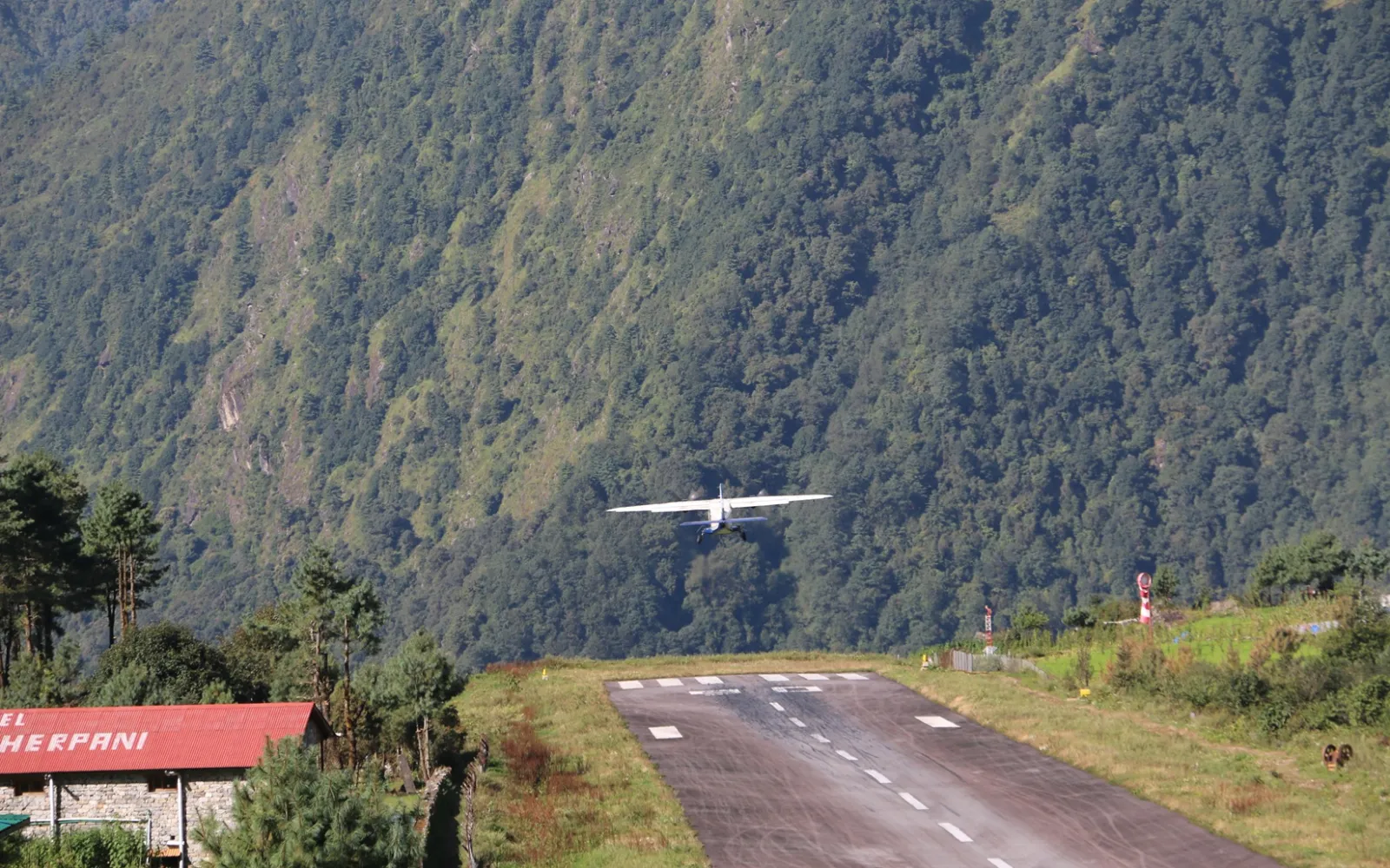
Tenzing-Hillary Airport [~2,860m / 9,383ft] is close to Lukla's main settlement and the walk to the airport is short.
Actually, the airport has a small mountain airfield and a short sloping runway therefore passengers should be prepared for a very different experience than a large international airport.
Likewise, there is normally little need for a long transfer, but you should always arrive according to the airline or guide's requested check in-time.
During busy trekking periods ( Autumn and Spring), several flights can operate in succession so the actual boarding time may be different to the original schedule.
The Lukla to Kathmandu flight
The Lukla to Kathmandu fixed-wing flight normally takes approximately 25-35 minutes when operating directly between these two points.
From the air, you may see steep Himalayan valleys, ridges, forests and distant mountain peaks before transitioning into the wider hills and valleys around Kathmandu.
In fact, the return flight can often be one of the most memorable parts of the trek as you look back over the region you have just crossed on foot.
However, visibility can change quickly around Lukla so flights should never be regarded as guaranteed at an exact departure time.
Peak-season flight arrangements
During some major trekking periods, especially the busy spring and autumn windows, Lukla flights may operate from Manthali Airport in Ramechhap rather than Tribhuvan International Airport in Kathmandu.
Actually, the flight from Lukla would then arrive at Manthali and the ground transfer toward Kathmandu would be roughly 4-5 hours depending on traffic and road conditions.
Therefore, the final travel day can be much longer than the flight itself. Your trekking company should confirm the departure airport and ground-transfer arrangements before the trek and again near the end of the trip.
Views and highlights from the flight
Although the Lukla flight is short, sit by the window if possible as the changing landscape provides a final summary of the journey.
• Lukla's mountain runway and surrounding hills.
• Deep valleys and steep Himalayan slopes.
• Dudh Koshi Valley and lower Khumbu landscapes.
• Forested hills gradually replacing the high-alpine terrain.
• Terraced farmland in the lower mountain region.
• Wider valleys approaching Kathmandu.
• A final aerial perspective of the landscape you crossed on foot.
• The contrast between Lukla [2,860m / 9,383ft] and Kathmandu [~1,400m / 4,593ft].
Facilities and accommodation
Lukla has substantially more facilities than the higher villages so you can have breakfast, coffee, snacks or a meal before departure. Likewise, the town has restaurants, bakeries, shops, cafés, charging facilities, internet services and various hotels and teahouses.
After arriving in Kathmandu your accommodation is normally a hotel in Kathmandu where you can take a shower, rest, organize your luggage and recover after the trek.
If your international flight is the following day, staying in Kathmandu rather than heading elsewhere straight away gives you useful flexibility.
Challenges and risks
The challenge on Day 12 is generally flight uncertainty rather than trekking issues. The Lukla flight operates under visual conditions and can be delayed or cancelled when cloud, wind or other weather conditions prevent safe operation.
• Do not schedule an international departure immediately after the Lukla flight.
• Keep at least one or two buffer days when your international travel is important.
• Be prepared for a long airport wait if the weather changes.
• Keep essential medication and valuables in your hand luggage.
• Do not become concerned if the flight time changes; your guide or airline will provide updated instructions.
• If the flight is cancelled, follow the airline/operator's rebooking arrangements rather than attempting to arrange an independent transfer immediately.
• Helicopter alternatives may be available in some circumstances, but they are also weather-dependent and normally cost more.
Checkpoints and airport procedures
There is no trekking checkpoint comparable to the Sagarmatha National Park entry point on this final day, but normal airport procedures apply. Your identification, ticket and baggage should be ready with your guide or trekking company able to assist with check-in and flight coordination.
Rest and extra exploration in Kathmandu
If you arrive in Kathmandu early, avoid an exhausting programme immediately after the flight because your body has just completed a demanding high-altitude trek.
Instead, take a proper shower, rest at your hotel and have a relaxing meal before thinking about a short walk around the city.
If your schedule allows, you can spend the afternoon or evening on a gentle activity such as visiting Thamel, enjoying a Nepali meal or purchasing souvenirs.
More substantial Kathmandu sightseeing tour is best kept for another day, especially if your Lukla flight has been delayed and you arrive late.
Best tips for Day 12
• Pack everything the night before.
• Confirm the flight status early in the morning.
• Keep your passport and ticket accessible.
• Keep valuables and essential items in your daypack.
• Carry a warm layer because the airport can be cool while waiting.
• Do not depend on the originally published flight time.
• Keep your international flight separate from the Lukla return day.
• Allow 1-2 spare days for weather-related disruption.
• If flying via Manthali, prepare for the additional road journey to Kathmandu.
• Drink water and eat properly after the flight.
• Rest well after reaching your Kathmandu hotel.
• Thank your guide and porter before concluding the trek.
• Keep some time for Kathmandu sightseeing if your onward schedule allows.
• Most importantly, treat the flight as a flexible part of the itinerary rather than a fixed appointment.
Overnight: Kathmandu [~1,400m / 4,593ft].
Accommodation: Hotel in Kathmandu.
Meals: Breakfast, with lunch and dinner depending on your arrival time and package.
Flight duration: Approximately 25-35 minutes when flying directly between Lukla and Kathmandu.
Total transfer time: Several hours ( Approx. 6-7) depending on check-in, flight operations, weather and (when applicable) the Manthali-Kathmandu road transfer.
Trek completion: Lukla → Kathmandu marks the completion of the standard walking section of the Everest Base Camp Trek.
The Lukla to Everest Base Camp Trek is more than just a walk to a famous destination because the journey passes through Sherpa villages, Buddhist monasteries, suspension bridges, alpine valleys, glaciers and some of the world's highest mountains.
From Lukla [2,860m / 9,383ft] to Everest Base Camp [5,364m / 17,598ft] and Kala Patthar [5,545m / 18,192ft], every section delivers different terrain, altitude and mountain scenery.
Meanwhile, the key to completing the route comfortably is not simply walking fast or covering long distances, but allowing your body to adjust to increasing elevations.
Therefore, a steady pace, proper acclimatization, adequate hydration, suitable clothing, nutritious meals and attention to your guide's advice are more important than rushing toward the destination.
In addition to, the return journey is equally important because fatigue can set in after reaching Base Camp and Kala Patthar.
Moreover, the descent through Pheriche, Tengboche, Namche Bazaar and Lukla still involves long walking days, uneven trails, suspension bridges and repeated uphill sections.
Finally, keep flexibility in your travel schedule because the Lukla flight can be affected by mountain weather.
A sensible buffer before an international flight gives you considerably more flexibility if the return flight is delayed or cancelled.
With good preparation, realistic expectations and responsible altitude management, the Lukla to Everest Base Camp route offers a complete Himalayan experience rather than simply a visit to one destination.
Importantly, the memories of the trail, Sherpa communities, mountain landscapes, Kala Patthar sunrise and the achievement of reaching Everest Base Camp often stay with you long after the final flight leaves Lukla.
FAQS
1. What Is the Everest Base Camp Trek Day-by-Day Itinerary?
The Everest Base Camp Trek normally takes place over 12-16 days from and back to Kathmandu, departing and returning from Lukla and passing through Phakding, Namche Bazaar, Tengboche, Dingboche, Lobuche, Gorakshep, Everest Base Camp, and Kala Patthar, with acclimatization days at Namche Bazaar and Dingboche.
2. What Happens on Day 1 of the Everest Base Camp Trek From Lukla?
The first day of the Everest Base Camp Trek normally starts at Lukla (2,850-2,860 m), with a gradual walk toward Phakding (2,610 m) following the Dudh Koshi Valley through Sherpa villages, forests, and bridges, ending at a village stay the night.
3. How Many Days Does It Take to Trek From Lukla to Namche Bazaar?
The journey from Lukla toward Namche Bazaar usually involves two walking days and one overnight stay at Phakding or elsewhere, departing through Monjo and into Sagarmatha National Park at Jorsale before a steady climb to Nameche Bazaar (around 3,440-3,500 m).
4. What Do You Do on the Namche Bazaar Acclimatization Day?
The acclimatization day in Namche Bazaar focuses on the gradual adjustment to the altitude, meaning many trekkers take a side-trip toward Everest View Hotel, Syangboche, Khumjung, or Khunde before returning to Namche Bazaar for dinner, hydration, and an overnight stay.
Also, people like going to Thame Monstery.
5. What Is the Route From Namche Bazaar to Tengboche and Dingboche?
The route from Namche Bazaar toward Tengboche and Dingboche runs primarily along the Imja Khola, passing through forests and mountain views, with the destination Tengboche Monastery at around 3,860 m before the trail lowers and rises further to reach Dhingboche or Pheriche overnight.
6. What Happens on the Dingboche Acclimatization Day?
A similar acclimatization day in Dingboche gives trekkers another chance to adjust to the higher altitude, typically involving a gradual hike toward Nagarjun Hill or Chhukung before returning to Dingboche for lunch, rest, hydration, and preparation for the higher ground leading to Lobuche and Gorakshep.
7. How Do You Trek From Dingboche to Lobuche and Gorakshep?
The trail from Dingboche or Pheriche leads gradually upward toward Khumbu Glacier and Lobuche (around 4,910 m) as the next destination, before continuing on to Gorakshep (around 5,164 m), the final settlement before Everest Base Camp, with an overnight stay either prior or following a visit to the camp.
8. How Do You Reach Everest Base Camp From Gorakshep?
From Gorakshep, the trail leads across the Khumbu Glacier and moraine to Everest Base Camp at around 5,364-5,367 m, with the return trip more difficult than the outbound due to the higher altitude and rougher terrain, and conditions along the glacier may slow progress; therefore, trekkers should follow their guide and allow enough time.
9. When Do You Hike Kala Patthar and What Can You See From the Viewpoint?
Climbing Kala Patthar (5,545 m) is often reserved for early morning from Gorakshep so trekkers can enjoy the sunrise and views, with the best perspectives of Mount Everest, Lhotse, Nuptse, Pumori, and other peaks, as well as one of the most popular viewpoints of Everest.
10. What Is the Day-by-Day Return Route From Everest Base Camp to Lukla?
The return trip from Everest Base Camp follows the same trail, generally taking 3-4 walking days, although some itineraries allow for an additional night at certain points on the way back through Gorakshep, Lobuche, Pheriche or Dingboche, Pangboche, Tengboche, Namche Bazaar, and back to Lukla.
Our travel experts are ready to assist you with any questions.
Send us a message.Have a question before you book? Send your enquiry below and our travel experts will get back with the required information.