Normally, Everest Base Camp Trek formally begins from Lukla after a short domestic flight from Kathmandu or Manthali.
In order to succeed over Everest Base Camp (EBC), one needs to know the distance, itinerary, elevation and all the trail conditions in detail from Lukla to EBC.
So, this article here explains you about the trail conditions, route, elevation and distance in detail.
Most importantly, I hope you will enjoy this reading and help you set your EBC Trek Itinerary accordingly.
Let’s see each and every detail Lukla to EBC Tour from different perspectives.
Generally speaking, the Lukla to Everest Base Camp route follows Lukla [2,860m / 9,383ft] → Phakding [2,610m / 8,563ft] → Monjo [2,835m / 9,301ft] → Jorsale [2,740m / 8,989ft] → Namche Bazaar [3,440m / 11,286ft] → Tengboche [3,867m / 12,687ft] → Pangboche [3,985m / 13,074ft] → Dingboche [4,410m / 14,469ft] → Lobuche [4,910m / 16,109ft] → Gorak Shep [5,164m / 16,942ft] → Everest Base Camp [5,364m / 17,598ft].
Moreover, the classic Lukla EBC route runs past the Dudh Koshi valley, Sagarmatha National Park, Sherpa settlements, rhododendron and pine forests, high alpine valleys, and the Khumbu Glacier area.
Importantly, the trail does not simply lead to a mountain peak, because every section has its own landscape, culture, and trail character.
After Lukla [2,860m / 9,383ft], the lower parts are more wooded and settled, while the scenery becomes colder and more exposed closer to Lobuche [4,910m / 16,109ft] and Gorak Shep [5,164m / 16,942ft].
In a similar way, the journey takes trekkers close to traditional Sherpa life around Namche Bazaar [3,440m / 11,286ft], Khumjung [3,790m / 12,434ft], Khunde [3,840m / 12,598ft], and other Khumbu villages.
Thus, the Lukla to Everest Base Camp route is as much a cultural experience as a high-altitude trail, with Buddhist monasteries, prayer wheels, mani walls, suspension bridges, stone-built village, and mountain communities.
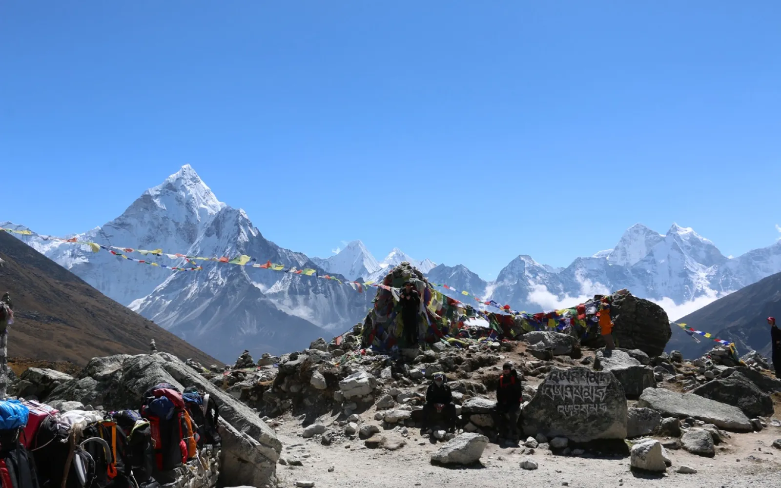
Likewise, one unique part of the trail begins after Namche Bazaar [3,440m / 11,286ft], following the Imja Khola valley with views of Thamserku, Kangtega, Ama Dablam, Lhotse, and Everest.
In a similar way, Tengboche [3,867m / 12,687ft] offers one of the main cultural highlights of the journey, because its famous monastery is perched on a ridge with outstanding Himalayan views.
Above Dingboche [4,410m / 14,469ft], the trail condition changes significantly, because forested areas give way to increasingly rocky alpine terrain.
Finally, the route passes through Lobuche [4,910m / 16,109ft] and Gorak Shep [5,164m / 16,942ft] towards the Everest Base Camp [5,364m / 17,598ft] area on the edge of the Khumbu Glacier, where careful trail navigation and proper altitude adjustments become even more important.
Key Features of the Lukla to EBC Route
Starting point: Lukla [2,860m / 9,383ft]
Destination: Everest Base Camp [5,364m / 17,598ft]
Major Sherpa hub: Namche Bazaar [3,440m / 11,286ft]
Major Buddhist landmark: Tengboche [3,867m / 12,687ft]
Main river valleys: Dudh Koshi and Imja Khola
Protected area: Sagarmatha National Park
High-altitude section: Dingboche [4,410m / 14,469ft] onward
Final settlements: Lobuche [4,910m / 16,109ft] and Gorak Shep [5,164m / 16,942ft]
Glacier environment: Khumbu Glacier area
Trail Features: Forests, suspension bridges, stone paths, local settlements, alpine valleys, moraines, and glacier terrain
Therefore, the Lukla to Everest Base Camp route is significantly more than a simple walk to Everest, because the trail gradually passes through low Himalayan forests, Sherpa villages, Buddhist history, high-altitude valleys, and glacial landscapes.
Moreover, the time spent on the EBC trekking route allows more flexibility and better safety than trying to follow a fixed daily schedule.
Importantly, the Lukla to Everest Base Camp route is also affected by the altitude, which is why every itinerary must include time for acclimatization and proper adjustments above 3,000m. Most practical Lukla to EBC days, therefore, dedicate some time to slow walking and rest, rather than simply heading upward.
Generally speaking, the Lukla to Everest Base Camp duration is about 7–9 trekking days one way, depending on the average walking pace, altitude adjustments, weather conditions, and overnight stays.
However, the complete classic EBC trek normally takes around 12–14 trekking days from Lukla to Lukla, because the return journey and altitude adjustments are included in the overall itinerary.
Importantly, the journey is not planned simply according to the kilometres covered, because altitude is increasingly important above 3,000m.
Thus, most practical Lukla to EBC days dedicate some time to acclimatization around Namche Bazaar [3,440m / 11,286ft] and Dingboche [4,410m / 14,469ft] rather than continuing upward every day.
Here, a typical EBC trek 12 days itinerary might use two days for acclimatization and relatively fast walking stages, while a 14-day EBC trek can include more flexibility and slower stages.
Moreover, experienced trekkers may be able to complete some stages faster, but simply reducing the number of acclimatization days is not a sensible option at high altitude.
Meanwhile, the first part of the journey from Lukla [2,860m / 9,383ft] to Namche Bazaar [3,440m / 11,286ft] tends to take two walking days, passing through Phakding [2,610m / 8,563ft], Monjo [2,835m / 9,301ft], and Jorsale [2,740m / 8,989ft].
In a similar way, the upper route continues through Tengboche [3,867m / 12,687ft], Pangboche [3,985m / 13,074ft], Dingboche [4,410m / 14,469ft], Lobuche [4,910m / 16,109ft], and Gorak Shep [5,164m / 16,942ft] before reaching Everest Base Camp [5,364m / 17,598ft].
At the same time, the route becomes increasingly demanding with altitude, because the air pressure drops and the landscape becomes more exposed.
A realistic Lukla to Everest Base Camp route should, therefore, allow enough time for acclimatization, weather delays, slow walking days, and individual differences rather than following a strict 12- or 14-day walking plan.
Typical Lukla to EBC Trek Duration
| Trek section | Typical walking plan | Main feature |
|
| Lukla [2,860m / 9,383ft] → Phakding [2,610m / 8,563ft] | 1 day | Dudh Koshi valley |
| Phakding [2,610m / 8,563ft] → Namche Bazaar [3,440m / 11,286ft] | 1 day | Sagarmatha National Park and suspension bridges |
| Namche Bazaar [3,440m / 11,286ft] | 1 acclimatization day | Sherpa culture and short hikes |
| Namche → Tengboche [3,867m / 12,687ft] | 1 day | Ama Dablam views and monastery |
| Tengboche → Dingboche [4,410m / 14,469ft] | 1 day | Imja Khola valley and alpine terrain |
| Dingboche [4,410m / 14,469ft] | 1 acclimatization day | High-altitude adaptation |
| Dingboche → Lobuche [4,910m / 16,109ft] | 1 day | Khumbu Glacier and moraine landscape |
| Lobuche → Gorak Shep [5,164m / 16,942ft] → EBC [5,364m / 17,598ft] | 1 day | Final high-altitude approach |
| Return to Lukla | 3–4 days | Descending through the Khumbu |
Consequently, the one-way Lukla to Everest Base Camp trek generally takes about 7–9 walking days, while the full Lukla-to-Lukla journey commonly fits into approximately 12–14 trekking days.
Moreover, the Nepal Tourism Board describes the classic EBC journey as a roughly two-week trek starting and ending at Lukla, which reflects the significance of acclimatization and altitude rather than simply distance.
Generally the Lukla to EBC itinerary should take about 12–14 trekking days including acclimatization and the return to Lukla [2,860m / 9,383ft].
Moreover, the classic route gradually follows the Dudh Koshi River, climbs to Namche Bazaar [3,440m / 11,286ft], passes through the Imja Khola valley and then ascends the high alpine terrain toward Everest Base Camp [5,364m / 17,598ft].
Lukla to Everest Base Camp Itinerary at a Glance
| Day | Route and Overnight
| Elevation | Approx. Distance | Walking Time | Key Trail Features |
| Day 1 | Lukla [2,860m / 9,383ft] → Phakding [2,610m / 8,563ft] | 2,860 → 2,610m | 7–8 km | 3–4 hrs | Dudh Koshi valley, Sherpa villages, short descent |
| Day 2 | Phakding [2,610m / 8,563ft] → Namche Bazaar [3,440m / 11,286ft] | 2,610 → 3,440m | 10–12 km | 5–7 hrs | Monjo, Jorsale, Sagarmatha National Park, suspension bridges |
| Day 3 | Namche acclimatization | 3,440m | 4–5 km local hike | 4–5 hrs | Sherpa culture, Syangboche/Khumjung area, mountain viewpoints |
| Day 4 | Namche Bazaar [3,440m / 11,286ft] → Tengboche [3,867m / 12,687ft] | 3,440 → 3,867m | 9–10 km | 5–6 hrs | Imja Khola, rhododendron forest, Ama Dablam views, Tengboche Monastery |
| Day 5 | Tengboche [3,867m / 12,687ft] → Dingboche [4,410m / 14,469ft] | 3,867 → 4,410m | 10–11 km | 5–6 hrs | Pangboche, alpine valley, mani walls, Ama Dablam |
| Day 6 | Dingboche acclimatization | 4,410m | 4–6 km local hike | 3–5 hrs | Nangkartshang viewpoint or Chhukung side trip |
| Day 7 | Dingboche [4,410m / 14,469ft] → Lobuche [4,910m / 16,109ft] | 4,410 → 4,910m | 11–12 km | 5–6 hrs | Thukla, memorial area, Khumbu Glacier moraine |
| Day 8 | Lobuche [4,910m / 16,109ft] → Gorak Shep [5,164m / 16,942ft] → Everest Base Camp [5,364m / 17,598ft] → Gorak Shep | 4,910 → 5,364m | 13–15 km | 7–9 hrs | Khumbu Glacier, moraine, Base Camp, high-altitude terrain |
| Day 9 | Gorak Shep [5,164m / 16,942ft] → Kala Patthar [5,545m / 18,192ft] → Pheriche [4,240m / 13,911ft] | 5,164 → 5,545 → 4,240m | 12–14 km | 7–8 hrs | Everest sunrise viewpoint, glacial valley, long descent |
| Day 10 | Pheriche [4,240m / 13,911ft] → Namche Bazaar [3,440m / 11,286ft] | 4,240 → 3,440m | 14–16 km | 6–7 hrs | Pangboche, Tengboche, Imja Khola, forest trail |
| Day 11 | Namche Bazaar [3,440m / 11,286ft] → Lukla [2,860m / 9,383ft] | 3,440 → 2,860m | 17–19 km | 6–8 hrs | Dudh Koshi, suspension bridges, Phakding, final Khumbu villages |
| Day 12 | Lukla [2,860m / 9,383ft] → Kathmandu | — | — | — | Flight out of the Everest region |
Generally, Day 1 involves a reasonably short walk from Lukla [2,860m / 9,383ft] to Phakding [2,610m / 8,563ft] to allow trekkers to relax out of the long journey.
However, the trail rapidly gains substantial elevation the following day through Monjo [2,835m / 9,301ft] and Jorsale [2,740m / 8,989ft] before the steep climb to Namche Bazaar [3,440m / 11,286ft].
Importantly, Jorsale [2,740m / 8,989ft] is associated with the entrance and permit checkpoint for Sagarmatha National Park and the route beyond runs along the Dudh Koshi toward Namche.
Moreover, the final leg into Namche involves some suspension bridges and a sustained uphill passage, which represents one of the first genuinely challenging days of the Lukla to EBC route.
Days 3–6: Acclimatization at the High Khumbu Region
Generally, the Namche acclimatization day is used for a short hike rather than staying in the village, with options around Syangboche [3,720m / 12,205ft], Khumjung [3,790m / 12,434ft] or Khunde [3,840m / 12,598ft].
Therefore, trekkers can gain some extra altitude during the day and return to Namche Bazaar [3,440m / 11,286ft] to sleep at a lower height.
After Namche, the trail runs along the Imja Khola valley toward Tengboche [3,867m / 12,687ft], which includes the Tengboche Monastery as one of the cultural highlights of the journey.
Similarly, the trail passes through Pangboche [3,985m / 13,074ft] toward Dingboche [4,410m / 14,469ft], but the landscape visibly opens out as the trail leaves the forested region.
At Dingboche [4,410m / 14,469ft], another acclimatization day is normally included before the trek reaches Lobuche [4,910m / 16,109ft].
Moreover, a short hike to Nangkartshang or Chhukung [4,730m / 15,518ft] can provide valuable daytime altitude exposure without another night at a higher elevation. ([Nepal Tourism Board][1])
Days 7–9: Lobuche, Everest Base Camp and Kala Patthar
Generally the Dingboche [4,410m / 14,469ft] to Lobuche [4,910m / 16,109ft] section involves progressively rockier terrain, ending with the start of the lateral moraine of the Khumbu Glacier.
Therefore, the trail feels quite different to the lower Khumbu in terms of the vegetation and weather.
Here, the Lobuche [4,910m / 16,109ft] to Everest Base Camp [5,364m / 17,598ft] day is normally one of the longest and most challenging because the trail first reaches Gorak Shep [5,164m / 16,942ft] before going on to Base Camp.
Importantly, the Nepal Tourism Board notes that the glacier section requires careful walking because of the problems with route finding and the hazards of the icy terrain.
After returning to Gorak Shep [5,164m / 16,942ft], many itineraries continue on early the following morning toward Kala Patthar [5,545m / 18,192ft] before descending toward Pheriche [4,240m / 13,911ft].
Moreover, Kala Patthar provides a well-known high viewpoint for Everest and surrounding peaks but the time needed to walk there depends substantially on the weather and conditions.
Days 10–12: Returning Through the Khumbu
Generally, the return route uses the same main trail through Pheriche [4,240m / 13,911ft], Pangboche [3,985m / 13,074ft], Tengboche [3,867m / 12,687ft] and Namche Bazaar [3,440m / 11,286ft].
However, the descent normally feels different to the ascent because the air gets progressively thicker and the walking pace can increase after leaving the highest elevations.
Finally, the route descends from Namche Bazaar [3,440m / 11,286ft] through Jorsale [2,740m / 8,989ft], Monjo [2,835m / 9,301ft] and Phakding [2,610m / 8,563ft] before reaching Lukla [2,860m / 9,383ft].
Therefore, the complete Lukla to Everest Base Camp daily itinerary can be understood as a gradual ascent, two major acclimatization stages, a high altitude Base Camp excursion and a measured descent rather than a simple distance hike.
Important Planning Note
Here, the distances and walking hours above are approximate planning figures, because the actual trail can vary according to the overnight lodge, side trips, weather, trail conditions, rest stops, and the individual walking pace.
Moreover, the Nepal Tourism Board itself describes the classic Everest Base Camp journey as a roughly two-week trek beginning and ending at Lukla, while its route description emphasizes gradual acclimatization rather than rushing between settlements.
Generally, the Lukla to EBC elevation increases from about 2,860m [9,383ft] at Lukla [2,860m / 9,383ft] to 5,364m [17,598ft] at Everest Base Camp [5,364m / 17,598ft], but the important point is not merely the final altitude.
, the trail steadily gains elevation through Phakding [2,610m / 8,563ft], Namche Bazaar [3,440m / 11,286ft], Tengboche [3,867m / 12,687ft], Dingboche [4,410m / 14,469ft], Lobuche [4,910m / 16,109ft] and Gorak Shep [5,164m / 16,942ft]. ([Nepal Tourism Board][1])
Lukla to EBC Elevation Chart
| Place | Approx. Elevation | Approx. Feet | Elevation Character |
| Lukla | 2,860m | 9,383ft | Trek begins |
| Phakding | 2,610m | 8,563ft | Lower Dudh Koshi valley |
| Namche Bazaar | 3,440m | 11,286ft | Major acclimatization point |
| Tengboche | 3,867m | 12,687ft | High Buddhist and mountain viewpoint |
| Dingboche | 4,410m | 14,469ft | High-altitude acclimatization point |
| Lobuche | 4,910m | 16,109ft | Khumbu Glacier and moraine zone |
| Gorak Shep | 5,164m | 16,942ft | Last settlement before Base Camp |
| Everest Base Camp | 5,364m | 17,598ft | Trek's main destination |
| Kala Patthar | 5,545m | 18,192ft | High viewpoint above Gorak Shep |
Importantly, Phakding [2,610m / 8,563ft] is slightly lower than Lukla [2,860m / 9,383ft], so the elevation does not steadily increase from the first step.
Nevertheless, the overall impression becomes one of a sustained climb after Phakding with the most significant altitude exposure from Dingboche [4,410m / 14,469ft] onward.
How Does the Altitude Change Along the Trail?
Generally the first major altitude jump occurs between Phakding [2,610m / 8,563ft] and Namche Bazaar [3,440m / 11,286ft], which is why Namche is normally used for acclimatization.
Moreover, the route then climbs progressively through Tengboche [3,867m / 12,687ft] and Dingboche [4,410m / 14,469ft] before encountering the much higher terrain around Lobuche [4,910m / 16,109ft] and Gorak Shep [5,164m / 16,942ft].
Above 5,000m, the environment is increasingly dominated by bare rock, snow, ice and glacial terrain rather than forest.
Therefore, the final approach from Gorak Shep [5,164m / 16,942ft] to Everest Base Camp [5,364m / 17,598ft] should be considered as a high-altitude walk even though the numerical gain in elevation is fairly small.
Why Is Kala Patthar Higher Than Everest Base Camp?
Interestingly, Kala Patthar [5,545m / 18,192ft] is higher than Everest Base Camp [5,364m / 17,598ft], even though Base Camp is the main destination of the trek.
Moreover, Kala Patthar is climbed mainly for its panoramic mountain viewpoint while Everest Base Camp is the historic expedition staging area on the Khumbu Glacier.
Therefore, trekkers should not assume that reaching Everest Base Camp [5,364m / 17,598ft] represents the highest point of a standard Lukla EBC trek.
In contrast, the route that includes Kala Patthar [5,545m / 18,192ft] adds approximately 181m [594ft] to the altitude of Everest Base Camp, which makes acclimatization and pacing particularly important.
Key Lukla to EBC Altitude Points
Lukla [2,860m / 9,383ft]: Starting point and main gateway to the Everest region.
Phakding [2,610m / 8,563ft]: First common overnight village and lower Dudh Koshi section.
Namche Bazaar [3,440m / 11,286ft]: Major Sherpa trading centre and acclimatization stop.
Tengboche [3,867m / 12,687ft]: Famous for Tengboche Monastery and views of Ama Dablam.
Dingboche [4,410m / 14,469ft]: Important high-altitude acclimatization village.
Lobuche [4,910m / 16,109ft]: High settlement beside the Khumbu Glacier moraine.
Gorak Shep [5,164m / 16,942ft]: Final settlement before Everest Base Camp.
Everest Base Camp [5,364m / 17,598ft]: Main trekking destination beside the Khumbu Glacier.
Kala Patthar [5,545m / 18,192ft]: Higher viewpoint traditionally visited for Everest panoramas.
Ultimately, the EBC altitude chart shows why the trek becomes progressively harder even if the daily distances are not extreme.
Therefore, a well-planned Lukla to Everest Base Camp route should emphasize gradual elevation gain, acclimatization, hydration, sensible pacing and flexibility rather than simply completing the trail as fast as possible.
Generally, the Lukla to EBC distance is approximately 62-65km (39-40 miles) one-way, depending on exact trail, overnight stops, and minor route variations.
Therefore, trekkers following the classic trail from Lukla [2,860m / 9,383ft] to Everest Base Camp [5,364m / 17,598ft] should expect around 125-130km (78-81 miles) round-trip when returning to Lukla [2,860m / 9,383ft].
Importantly, it is essential to note that this distance figure does not mean that you will be walking 62-65km continuously towards Base Camp, due to the trail being split into manageble daily segments with acclimatization stops.
Moreover, it should be remembered that the trail involves frequent ascents and descents, and that the actual physical effort required is greater than the simple horizontal distance shown.
Lukla to EBC Distance at a Glance
Distance | Approximate figure
Lukla [2,860m / 9,383ft] → Everest Base Camp [5,364m / 17,598ft] |62-65 km
Everest Base Camp [5,364m / 17,598ft] → Lukla [2,860m / 9,383ft] | 62-65 km
Complete Lukla–EBC–Lukla Trek |125-130 km
One-way miles (approximate) |39-40 miles
Round trip miles (approximate | 78-81 miles
Generally, the lower section from Lukla [2,860m / 9,383ft] follows the Dudh Koshi valley through Phakding [2,610m / 8,563ft] and Monjo [2,835m / 9,301ft], and then continues to Namche Bazaar [3,440m / 11,286ft].
After Namche, the trail heads towards Tengboche [3,867m / 12,687ft], Pangboche [3,985m / 13,074ft], and Dingboche [4,410m / 14,469ft].
Similarly, the upper section of the trail continues from Dingboche [4,410m / 14,469ft] through Lobuche [4,910m / 16,109ft] and Gorak Shep [5,164m / 16,942ft] before reaching Everest Base Camp [5,364m / 17,598ft].
Therefore, while the distance is relatively modest in long-distance trekking terms, the increasing altitude and rugged terrain make the final kilometres considerably more demanding than the lower trail.
Why Does the EBC Trek Distance Vary?
Generally, published Everest Base Camp trek distance figures may vary slightly, due to some guides taking slightly different approaches to certain lodge access points and side trails, viewpoints, and acclimatization hikes.
Moreover, it is common for a standard distance calculation to omit optional walks around Namche Bazaar [3,440m / 11,286ft] and Dingboche [4,410m / 14,469ft] or the additional climb to Kala Patthar [5,545m / 18,192ft].
Importantly, the Nepal Tourism Board specifically describes the classic Everest Base Camp journey as a two-week trek that begins and finishes at Lukla [2,860m / 9,383ft].
Therefore, when calculating your Lukla to EBC kilometers, use approximations of 62-65 km each way as a practical guide rather than attempting to apply a single published figure as a baseline for all itineraries.
Generally, the main Lukla to EBC villages are Lukla [2,860m / 9,383ft], Phakding [2,610m / 8,563ft], Monjo [2,835m / 9,301ft], Jorsale [2,740m / 8,989ft], Namche Bazaar [3,440m / 11,286ft], Tengboche [3,867m / 12,687ft], Pangboche [3,985m / 13,074ft], Dingboche [4,410m / 14,469ft], Lobuche [4,910m / 16,109ft], and Gorak Shep [5,164m / 16,942ft].
Moreover, each settlement represents a different phase of the journey, from the lower Dudh Koshi villages and forest trails to the exposed high-altitude Khumbu landscape.
Major Villages on the Lukla to EBC Route
Village / Trail Stop | Approx. Elevatio | What Makes It Different
Lukla | 2,860m / 9,383f | Main gateway, airport, lodges and shops
Phakdin | 2,610m / 8,563f | Lower Dudh Koshi valley and first common overnight stop
Monj | 2,835m / 9,301f | Sagarmatha National Park entry area
Jorsal | 2,740m / 8,989f | Trail checkpoint and final major stop before Namche
Namche Bazaa | 3,440m / 11,286f | Sherpa trading centre and major acclimatization base
Tengboche | 3,867m / 12,687f | Famous monastery and Ama Dablam backdrop
Pangboch | 3,985m / 13,074f | Traditional Sherpa settlement in the upper Imja valley
Dingboch | 4,410m / 14,469f | Major high-altitude village and acclimatization stop
Lobuch | 4,910m / 16,109f | High settlement beside the Khumbu Glacier moraine
Gorak She | 5,164m / 16,942f | Last settlement before Everest Base Camp
Generally, Lukla [2,860m / 9,383ft] is more than simply a starting point, as it is the primary gateway into the Everest region and features a concentration of lodges, shops, guides, porters, and transport services.
Following the trail away from Lukla, the route drops slightly to Phakding [2,610m / 8,563ft] before continuing along the Dudh Koshi valley.
Likewise, Phakding [2,610m / 8,563ft] and Monjo [2,835m / 9,301ft] are typical first stops, with Jorsale [2,740m / 8,989ft] being particularly notable as the Sagarmatha National Park entrance checkpoint lies just beyond Monjo.
Moreover, the trail begins to climb more seriously after the suspenison bridge near Jorsale before arriving at Namche Bazaar [3,440m / 11,286ft].
In addition to, Namche Bazaar [3,440m / 11,286ft] is one of the most distinctive villages in the Khumbu region, as it serves as a major Sherpa trading and tourism centre rather than simply a trekking overnight stop.
Therefore, many trekkers choose to spend an additional acclimatization day in Namche Bazaar and may visit the nearby communities of Khumjung [3,790m / 12,434ft], Khunde [3,840m / 12,598ft], or Syangboche [3,720m / 12,205ft].
Continuing past Namche Bazaar [3,440m / 11,286ft], the route enters the Imja Khola valley and continues to Tengboche [3,867m / 12,687ft], particularly famous for Tengboche Monastery and its mountain backdrop.
Moreover, the monastery is an important Buddhist centre in the Khumbu area and offers views over Everest, Lhotse, and Ama Dablam.
From Tengboche [3,867m / 12,687ft], the trail moves on to Pangboche [3,985m / 13,074ft] and then continues to Dingboche [4,410m / 14,469ft] or, on some itineraries, Pheriche [4,240m / 13,911ft]. Dingboche [4,410m / 14,469ft] is particularly valuable for acclimatization purposes, as the trail now enters a much higher and more exposed alpine terrain.
Above Dingboche [4,410m / 14,469ft], the settlements become smaller and the landscape is increasingly dominated by rock, moraine, snow, and ice.
Similarly, Lobuche [4,910m / 16,109ft] is located beside the lateral moraine of the Khumbu Glacier, and is a much higher-altitude overnight stop compared with the lower forested villages.
Finally, Gorak Shep [5,164m / 16,942ft] marks the final settlement on the main Everest Base Camp trail before continuing towards Everest Base Camp [5,364m / 17,598ft] and Kala Patthar [5,545m / 18,192ft].
Therefore, the villages on the Everest Base Camp trek are not merely places of accommodation but show the transition from Sherpa communities and cultivated valleys to the stark glacial environment above 5,000m.
What Makes the EBC Villages Special?
Lukla [2,860m / 9,383ft]: The practical gateway to the classic Everest trekking route.
Phakding [2,610m / 8,563ft]: A lower valley settlement surrounded by the Dudh Koshi landscape.
Monjo [2,835m / 9,301ft]: An important trail stop near the Sagarmatha National Park entrance.
Jorsale [2,740m / 8,989ft]: A small settlement and checkpoint before the climb toward Namche.
Namche Bazaar [3,440m / 11,286ft]: A lively Sherpa trading centre with lodges, shops, cafes, and acclimatization trails.
Tengboche [3,867m / 12,687ft]: A Buddhist cultural centre famous for Tengboche Monastery and mountain views.
Pangboche [3,985m / 13,074ft]: One of the traditional settlements along the upper Imja Khola.
Dingboche [4,410m / 14,469ft]: A major acclimatization village surrounded by high Himalayan terrain.
Lobuche [4,910m / 16,109ft]: A small high-altitude settlement near the Khumbu Glacier moraine.
Gorak Shep [5,164m / 16,942ft]: The final settlement before the Base Camp and Kala Patthar sections.
Consequently, the EBC villages illustrate the transition along the trail from forests, rivers, and permanent settlements to a high-altitude glacial landscape.
Moreover, the gradual experience of these places is an important part of the Lukla to Everest Base Camp journey, as the route combines Sherpa culture, Buddhist heritage, mountain livelihoods, and progressive altitude gain in a continuous trail.
The two main stops on the standard Lukla to Everest Base Camp route for altitude adjustment are normally Namche Bazaar [3,440m / 11,286ft] and Dingboche [4,410m / 14,469ft].
Meanwhile, these stops break up the continuous ascent and give the body time to adjust before the trail heads into the higher ground of the Khumbu towards Lobuche [4,910m / 16,109ft] and Gorak Shep [5,164m / 16,942ft].
Namche Bazaar Acclimatization
The day of adjustment at Namche is more of an active recovery than a full rest day, and trekkers normally take a short walk to a higher altitude around Syangboche [3,720m / 12,205ft], Khumjung [3,790m / 12,434ft], Khunde [3,840m / 12,598ft] or the Everest View Hotel area before heading back down to Namche Bazaar [3,440m / 11,286ft] for the night.
Importantly, the idea is often referred to as 'climb high and sleep low' since the walking during the day provides additional altitude exposure, while the overnight accommodation remains at a lower height.
However, the specifics of the hike should be determined by the weather, conditions of the trail, the energy of the group and how each individual is responding to altitude.
Likewise, Namche Bazaar [3,440m / 11,286ft] is also good for getting to know the local environment before heading into the upper Khumbu, and trekkers can enjoy viewpoints, explore the settlement, prepare equipment, drink fluids, and discuss the route ahead with their guide.
Dingboche Acclimatization
The altitude adjustment at Dingboche becomes necessary as the sleeping elevation is already at 4,410m [14,469ft].
In fact, many itineraries include an additional short hike towards Nangkartshang (roughly 5,000m / 16,404ft) or a similar viewpoint before returning to Dingboche [4,410m / 14,469ft].
At this height, an extensive sightseeing walk is not recommended, and a controlled uphill walk followed by a return to the same lodge is a better option than increasing the sleeping elevation unnecessarily.
What Do Trekkers Do on Acclimatization Days?
Walk to a higher altitude: A short hike provides additional altitude exposure.
Return to the same village: Trekkers normally sleep again at Namche Bazaar [3,440m / 11,286ft] or Dingboche [4,410m / 14,469ft].
Walk at a controlled pace: The goal is adaptation, not speed.
Hydrate regularly: Regular fluid intake supports normal activity at altitude.
Eat properly: Regular meals provide energy for the following high-altitude stages.
Monitor symptoms: Headache, nausea, unusual fatigue, dizziness, or worsening breathlessness should be taken seriously.
Follow the guide's assessment: A planned hike can be shortened or cancelled when weather or health conditions make it inappropriate.
EBC acclimatization is, therefore, an active part of the trekking itinerary rather than a day indoors.
Moreover, the allocation of these adjustment stops gives trekkers the opportunity to adapt gradually before encountering the far higher ground around Lobuche [4,910m / 16,109ft], Gorak Shep [5,164m / 16,942ft] and Everest Base Camp [5,364m / 17,598ft].
The difficulty of the route tends to increase in stages, and the main parts that become more challenging are those that include a combination of uphill and downhill walking, rocky trails, long days, cold temperatures and - especially - the higher altitude.
1. Phakding to Namche Bazaar
The first significant physical challenge on the trail is the climb from Phakding [2,610m / 8,563ft] towards Namche Bazaar [3,440m / 11,286ft], which involves crossing several bridges and following the Dudh Koshi valley before a sustained uphill walk to Namche.
In factThis section can be tiring because of the overall increase in elevation and the mix of uphill and downhill walking. Consequently, maintaining a steady pace rather than rushing seems to be the best strategy.
2. Namche to Tengboche
The trail from Namche Bazaar [3,440m / 11,286ft] to Tengboche [3,867m / 12,687ft] appears to be less demanding, but the change in altitude makes the walking noticeably different to what trekkers are used to in the lower Khumbu.
Likewise, the route also includes sections of descent and then ascent again, especially in the Dudh Koshi and Imja Khola valleys.
In addition to, the climb to Tengboche monastery [3,867m / 12,687ft] includes a significant increase in elevation after crossing the river, but the forested trail, Buddhist monuments and views towards Ama Dablam can make this seem like a varied section of the trail.
3. Dingboche to Lobuche
The increase in altitude becomes more of a factor after Dingboche [4,410m / 14,469ft], and vegetation becomes sparser as the trail moves into more open alpine ground. A walking distance that would not be particularly strenuous at a lower elevation now requires much more effort.
Here, the route towards Lobuche [4,910m / 16,109ft] passes through the Thukla or Dughla area before heading up towards the memorials for climbers who died on Everest and other Himalayan peaks.
Moreover, the trail becomes rocky and uneven as it approaches the Khumbu Glacier moraine.
4. Lobuche to Gorak Shep to Everest Base Camp
The section from Lobuche to Gorak Shep and Everest Base Camp tends to be one of the most physically demanding parts of the EBC trail since it is both a long day and at a very high altitude. Gorak Shep [5,164m / 16,942ft] is already over 5,000m, and reaching Everest Base Camp [5,364m / 17,598ft] will involve additional walking on rocky and glacial ground.
Meanwhile, the route from Gorak Shep [5,164m / 16,942ft] to Everest Base Camp [5,364m / 17,598ft] does not involve a huge increase in elevation, but the thin air can make even a relatively small uphill section feel extremely tiring.
Moreover, trekkers normally walk slowly, take regular breaks, and follow their guide's assessment of the trail and weather conditions.
5. Gorak Shep to Kala Patthar
In itineraries including a visit to Kala Patthar [5,545m / 18,192ft], the morning walk can be yet another challenging section since this viewpoint is higher than Everest Base Camp [5,364m / 17,598ft].
Actually, the issue here is altitude rather than distance, so a slow and steady climb, appropriate clothing, sufficient acclimatization and regular monitoring of the body's response to the environment become important factors.
Hardest Sections of the EBC Trek at a Glance
Section| Main Challenge | Why It Feels Difficult
Phakding [2,610m / 8,563ft] → Namche [3,440m / 11,286ft] | Long uphill climb | Elevation gain, bridges and sustained ascent
Namche [3,440m / 11,286ft] → Tengboche [3,867m / 12,687ft] | Repeated climbs and descents | Higher altitude and uneven terrain
Dingboche [4,410m / 14,469ft] → Lobuche [4,910m / 16,109ft] | High-altitude walking | Thin air, exposed terrain and moraine
Lobuche [4,910m / 16,109ft] → Gorak Shep [5,164m / 16,942ft]| High elevation | Rocky trail, Khumbu Cough and reduced oxygen availability
Gorak Shep [5,164m / 16,942ft] → EBC [5,364m / 17,598ft] | Long high-altitude day | Thin air, rocky/glacial terrain
Gorak Shep [5,164m / 16,942ft] → Kala Patthar [5,545m / 18,192ft] | Highest climb | Very high altitude and steep uphill sections
However, the hardest section of the EBC trek depends on the individual since fitness, acclimatization, weather, sleep, hydration and altitude response are different for everyone.
Moreover, the upper trail cannot be assessed purely on the basis of kilometres since altitude becomes a much greater factor as soon as the route reaches above 4,000m and, in particular, over 5,000m.
The Lukla to EBC trail changes considerably as you gain altitude, covering village paths, forest sections, suspension bridges and stone-paved trails, becoming increasingly rocky and exposed above Dingboche [4,410m / 14,469ft].
Actually, the trail isn't one continuous type of path either, with the surface changing with elevation, weather, river crossings, local construction and the condition of the mountain itself.
Lukla to Phakding: Forests, Villages and River Trails
The trail from Lukla [2,860m / 9,383ft] to Phakding [2,610m / 8,563ft] is generally a relatively developed mountain trail through small settlements and cultivated areas.
Here, this means trekkers encounter stone steps, dirt paths, village lanes, suspension bridges and sections alongside the Dudh Koshi River rather than high-altitude terrain.
Actually, the trail begins in a somewhat greener landscape with pine, rhododendron and other Himalayan vegetation. The lower Khumbu has more trees, farmland, stone houses, prayer wheels, mani stones and teahouses, giving the start of the EBC trekking trail a distinctly rural flavour.
Phakding to Namche: Bridges and the Long Climb
The trail continues towards Monjo [2,835m / 9,301ft] and Jorsale [2,740m / 8,989ft], following the Dudh Koshi valley and crossing several suspension bridges.
In fact, the trail becomes substantially more demanding after the suspension bridge near Jorsale, climbing steadily towards Namche Bazaar [3,440m / 11,286ft].
Importantly, the approach to Namche involves uneven stone surfaces, uphill forest paths, steps and exposed trail above the river.
More importantly, good trekking shoes with reliable grip are more useful than simply choosing heavy footwear, especially when the trail surface is wet or slippery.
Namche to Tengboche: Forest and Stone Trails
After Namche Bazaar [3,440m / 11,286ft], the Khumbu trail follows the Imja Khola valley, passing through forest sections before descending towards the river and climbing again towards Tengboche [3,867m / 12,687ft]. The trail alternates between relatively smooth sections, stone steps, exposed hillside paths and forest trails.
Meanwhile, the Tengboche [3,867m / 12,687ft] area is surrounded by pines, azaleas and rhododendrons but vegetation becomes progressively thinner as the route continues higher.
Here, this section combines natural trail conditions with Buddhist features such as mani walls, prayer wheels, chortens and the approach to Tengboche Monastery.
Tengboche to Dingboche: Increasingly Alpine Terrain
The trail descends towards the Imja Khola from Tengboche [3,867m / 12,687ft], climbing through Pangboche [3,985m / 13,074ft] towards Dingboche [4,410m / 14,469ft]. Trekkers should expect a mixture of stone paths, compact dirt, rocky sections, gradual climbs and occasional steps rather than a smooth hiking trail.
Likewise, trees become less common as elevation increases and the landscape opens out into a broad alpine valley. The route around Dingboche [4,410m / 14,469ft] feels considerably more exposed than the forested trail below Tengboche [3,867m / 12,687ft].
Dingboche to Lobuche: Rock, Moraine and High-Altitude Trail
The trail becomes noticeably rougher after Dingboche [4,410m / 14,469ft], climbing towards Lobuche [4,910m / 16,109ft]. Here, this section enters the high-altitude landscape around the Khumbu Glacier, where rock, gravel, moraine and bare ground replace much of the vegetation seen lower down.
Importantly, the climb around Thukla [approximately 4,600m / 15,092ft] is another recognizable feature, with the trail rising towards the memorial area before continuing towards Lobuche [4,910m / 16,109ft]. Trekkers should expect slower progress here even when the actual distance is not particularly large.
Lobuche to Gorak Shep and Everest Base Camp
The trail is predominantly rocky and exposed from Lobuche [4,910m / 16,109ft] to Gorak Shep [5,164m / 16,942ft] with sections alongside the moraine of the Khumbu Glacier.
Here, the approach from Gorak Shep [5,164m / 16,942ft] towards Everest Base Camp [5,364m / 17,598ft] involves rough glacial and moraine terrain where careful route finding is important.
Moreover, the Nepal Tourism Board specifically warns that the glacier approach can be difficult to navigate and the surface can be slippery, so this section should not be treated like an ordinary village trail. Conditions can change with weather and seasonal glacier movement, making it important to follow the current route used by the local guide rather than relying on an old map or GPS track.
Lukla to EBC Trail Conditions at a Glance
| Route section | Typical trail surface | Main feature |
| Lukla [2,860m / 9,383ft] → Phakding [2,610m / 8,563ft] | Dirt, stone paths and village trails | Green lower Khumbu and Dudh Koshi |
| Phakding [2,610m / 8,563ft] → Namche [3,440m / 11,286ft] | Stone, dirt, steps and bridges | River crossings and sustained climb |
| Namche [3,440m / 11,286ft] → Tengboche [3,867m / 12,687ft] | Forest trail, stone and dirt | Rhododendron forest and river valley |
| Tengboche [3,867m / 12,687ft] → Dingboche [4,410m / 14,469ft] | Stone, dirt and rocky sections | Open alpine valley |
| Dingboche [4,410m / 14,469ft] → Lobuche [4,910m / 16,109ft] | Rocky and moraine terrain | High-altitude landscape |
| Lobuche [4,910m / 16,109ft] → Gorak Shep [5,164m / 16,942ft] | Rock, gravel and moraine | Khumbu Glacier environment |
| Gorak Shep [5,164m / 16,942ft] → EBC [5,364m / 17,598ft] | Rocky, glacial and moraine terrain | Final high-altitude approach |
Consequently, the EBC trail conditions become progressively rougher and more exposed as the route climbs from Lukla [2,860m / 9,383ft] towards Everest Base Camp [5,364m / 17,598ft].
Here, trekkers should prepare for uneven ground, changing weather, stone steps, loose rock and high-altitude terrain rather than a consistently well-maintained hiking path.
The EBC trek highlights are generally spread across the entire route rather than around Everest Base Camp [5,364m / 17,598ft] specifically. Actually, the journey includes Sherpa settlements, Buddhist monasteries, mountain viewpoints, memorials, glaciers and high-altitude landscapes with different places offering different types of experiences.
1. Namche Bazaar
Namche Bazaar [3,440m / 11,286ft] is one of the most important cultural and practical stops on the Everest Base Camp route.
Here, it is worth exploring the settlement itself with its curved hillside streets, lodges, shops, local businesses and surrounding viewpoints rather than simply considering it as an overnight stop.
Likewise, Namche is also a major Sherpa trading centre and an important acclimatization base. Nearby Syangboche [approximately 3,720m / 12,205ft], Khumjung [3,790m / 12,434ft] and Khunde [3,840m / 12,598ft] provide opportunities to experience traditional settlements and mountain life above Namche.
2. Syangboche and the Everest View Area
The Syangboche [approximately 3,720m / 12,205ft] area provides an important viewpoint section above Namche Bazaar [3,440m / 11,286ft]. Everest visibility is dependent on weather, cloud cover and atmospheric conditions, so trekkers should not expect a clear Everest panorama on every visit.
In fact, the wider viewpoint area can provide views towards Everest, Lhotse, Ama Dablam, Thamserku and other Khumbu peaks on a clear day. This is particularly useful as an acclimatization excursion because the hike provides additional daytime elevation while allowing trekkers to return to Namche for the night.
3. Tengboche Monastery
Tengboche [3,867m / 12,687ft] is one of the most significant cultural stops on the Lukla to EBC route because Tengboche Monastery is a leading Buddhist centre in the Khumbu.
Here, the monastery sits on a ridge with a particularly prominent backdrop of Ama Dablam [6,812m / 22,349ft] and views towards Everest and Lhotse in suitable conditions.
Importantly, the surrounding pines, azaleas and rhododendrons also make the setting noticeably different from the higher, more barren sections of the route.
Likewise, visitors should remember that the monastery is a functioning religious site, so quiet behaviour and respect for worshippers are appropriate.
4. Ama Dablam Viewpoints
Ama Dablam [6,812m / 22,349ft] becomes one of the most recognizable mountains along the route, particularly between Namche Bazaar [3,440m / 11,286ft], Tengboche [3,867m / 12,687ft], Pangboche [3,985m / 13,074ft] and Dingboche [4,410m / 14,469ft].
Actually, the best experience is not necessarily one single viewpoint because the mountain changes appearance as the trail moves through the valley.
Here, the Nepal Tourism Board specifically identifies views of Thamserku, Kangtega, Ama Dablam, Lhotse and Everest from the trail beyond Namche. Cloud, snowfall, haze and seasonal weather can block some or all of these peaks on a particular day.
5. Pangboche
Pangboche [3,985m / 13,074ft] is a traditional Sherpa settlement on the route between Tengboche [3,867m / 12,687ft] and Dingboche [4,410m / 14,469ft]. The village provides a useful glimpse of the settled upper Imja Khola valley before the landscape becomes more openly alpine.
Here, the trail surroundings also provide changing views of Ama Dablam [6,812m / 22,349ft] and the high valley. This makes Pangboche valuable as a cultural and geographical stop even though it doesn't have the same profile as Namche Bazaar or Tengboche Monastery.
6. Thukla Memorial Area
The Thukla [approximately 4,600m / 15,092ft] memorial area is one of the more serious and reflective places along the upper Everest route.
Meanwhile, the memorials commemorate climbers and mountaineers who died in the Everest and wider Himalayan region, so the site should be approached respectfully.
Here, the trail climbs from the Thukla [approximately 4,600m / 15,092ft] area towards the memorials before continuing towards Lobuche [4,910m / 16,109ft]. This section combines a physically demanding climb with an important reminder of the risks associated with high-altitude mountaineering.
7. Khumbu Glacier and Moraine
The Khumbu Glacier becomes a defining geographical feature around Lobuche [4,910m / 16,109ft], Gorak Shep [5,164m / 16,942ft] and Everest Base Camp [5,364m / 17,598ft]. The trail changes from greener valley paths to rocky moraine and glacial terrain as it approaches the Base Camp area.
In fact, this is also where trail conditions require greater attention because loose rock, uneven ground, ice and changing glacial surfaces can make route finding more complicated. Trekkers should stay with their guide and use the current established route rather than walking independently across unfamiliar glacier terrain.
8. Gorak Shep
Gorak Shep [5,164m / 16,942ft] is the last settlement on the classic route before Everest Base Camp [5,364m / 17,598ft]. Consequently, the settlement serves as the practical base for both the Base Camp excursion and the early-morning climb towards Kala Patthar [5,545m / 18,192ft].
In summary, the surroundings are very different from the lower Khumbu because the landscape is dominated by rock, moraine, snow and high mountain peaks. Its importance comes primarily from its location and access to the final attractions rather than being a large village itself.
9. Everest Base Camp
Everest Base Camp [5,364m / 17,598ft] is the principal destination of the trek and sits beside the Khumbu Glacier. The appearance of Base Camp varies significantly by season because it functions as a mountaineering camp during expedition periods rather than a permanent village.
Here, trekkers can see the surrounding glacier and high Himalayan terrain, while expedition activity may be visible during the climbing season.
However, the summit of Mount Everest [8,848.86m / 29,031.7ft] is not necessarily visible from the Base Camp area itself because surrounding terrain and the Khumbu Glacier environment can block the direct view. Trekkers shouldn't expect Base Camp alone to provide the classic unobstructed Everest photograph.
10. Kala Patthar
Kala Patthar [5,545m / 18,192ft] is one of the most important viewpoints on the standard EBC itinerary because it provides a much broader perspective towards Mount Everest [8,848.86m / 29,031.7ft] and the surrounding peaks.
Meanwhile, the viewpoint is higher than Everest Base Camp [5,364m / 17,598ft], making the climb physically demanding despite the relatively short distance from Gorak Shep [5,164m / 16,942ft]. ([Nepal Tourism Board][2])
Here, early morning is commonly chosen for the climb because light conditions can create strong mountain views when the sky is clear.
However, weather remains the deciding factor, so even a carefully timed Kala Patthar [5,545m / 18,192ft] climb cannot guarantee a clear view of Everest.
Main EBC Trek Highlights at a Glance
| Place | Approx. Elevation | Main Experience |
| Namche Bazaar | 3,440m / 11,286ft | Sherpa culture, trading centre and acclimatization |
| Syangboche | ~3,720m / 12,205ft | High viewpoint and acclimatization hike |
| Tengboche Monastery | 3,867m / 12,687ft | Buddhist heritage and Ama Dablam setting |
| Pangboche | 3,985m / 13,074ft | Traditional Sherpa settlement |
| Thukla Memorial Area | ~4,600m / 15,092ft | Mountaineering memorials and high-altitude landscape |
| Lobuche / Khumbu Glacier area | 4,910m / 16,109ft | Moraine and glacial terrain |
| Gorak Shep | 5,164m / 16,942ft | Last settlement and Base Camp access |
| Everest Base Camp | 5,364m / 17,598ft | Khumbu Glacier and expedition area |
| Kala Patthar | 5,545m / 18,192ft | High viewpoint towards Everest and surrounding peaks |
Consequently, the places to visit on the EBC trek are not limited to Everest Base Camp because the route itself contains some of the strongest cultural, geographical and mountain experiences.
However, conditions and visibility change quickly in the Khumbu, so a realistic itinerary should allow time to enjoy these places without assuming that every viewpoint will provide clear mountain views every day.
Generally speaking, the Lukla to Everest Base Camp route can be made suitable for beginners who have the right level of fitness and a realistic itinerary.
However, the EBC trek for beginners is not an easy hike since the trail runs up to Everest Base Camp [5,364m / 17,598ft] and includes many long days walking, steep sections, and high altitude.
Beginner Readiness for the Lukla to EBC Route
Factor | What Beginners Should Know
-- -- --
Fitness | Good walking fitness is necessary
Hiking Experience |Previous hiking helps, but is not essential
Walking hours | Expect 5 - 8 hours on many trekking days
Altitude | The route goes above 5,000m and acclimatization is essential
Itinerary | A properly paced 12 - 14 day itinerary makes more sense than rushing
Terrain | Stone steps, rocky trails, bridges, and uneven ground are part of the route
Weather | Be prepared for rapidly changing weather at higher elevations
Altitude response | Fitness alone is not a guarantee against altitude problems
What Beginners Should Prepare For
Build walking fitness in the months before the trek
Include regular walking, both uphill and downhill, in your training
Practice carrying a daypack with some weight
Break in your boots before coming to Nepal
Follow the planned acclimatization days at Namche Bazaar [3,440m / 11,286ft] and Dingboche [4,410m / 14,469ft]
Walk at your own pace, not trying to keep up with more experienced people
Stay hydrated, and eat regularly throughout the trek
Tell your guide if you have any strange altitude-related symptoms
Moreover, a beginner Everest Base Camp trek is made more pleasant when the itinerary is properly paced to allow gradual elevation gain and sufficient rest.
Accordingly, beginners should focus on walking pace, altitude, and body awareness rather than speed.
Why Altitude Matters for Beginners
The route goes from Lukla [2,860m / 9,383ft] up through Namche Bazaar [3,440m / 11,286ft], Dingboche [4,410m / 14,469ft], Lobuche [4,910m / 16,109ft], and Gorak Shep [5,164m / 16,942ft].
Consequently, altitude is one of the reasons why the Lukla to EBC route requires more preparation than a typical mountain hike.
Importantly, prior hiking experience and fitness level does not predict with any certainty how a person will respond to altitude.
Therefore, a reasonable itinerary, proper acclimatization, rest days, and open communication with your guide are all important in EBC preparation.
Practical Tips for First-Time Trekkers
Start training with some regular walks
Gradually build up distance and incline
Only bring the gear you really need on the trek
Dressed warmly and kept dry when temperatures drop
Take the acclimatization days seriously
Build in extra days into your schedule for weather or flight issues
Invest in travel insurance that covers high altitude trekking
Listen to your guide if your condition changes
Overall, the Lukla to Everest Base Camp route can be tackled by a well-prepared beginner, but it is best approached as a serious high altitude trek rather than a simple walking holiday.
With appropriate EBC preparation, a properly paced itinerary, and responsible walking, first-time trekkers can have a more positive experience on the mountain.
Generally speaking, the Lukla to EBC packing list should be based on variable temperatures, altitude, and trail conditions rather than simply the number of trekking days.
Here, the trail around Lukla [2,860m / 9,383ft] can be quite pleasant, but the upper Khumbu around Gorak Shep [5,164m / 16,942ft] can be quite cold, windy, and exposed.
Essential EBC Trek Gear
Equipment | Why You Need It
-- -- --
Broken-in trekking boots | For grip and support on the uneven mountain trails
Trekking socks | To Keep feet warm and reduce friction
Base layers | To manage sweat and fluctuating temperatures
Fleece or warm mid-layer | For additional insulation
Down jacket | For cold mornings, evenings, and high altitude
Waterproof jacket and trousers | Protection from rain, snow, and wind
Warm gloves | For dropping temperatures at higher elevations
Warm hat and sun hat | Protection from cold and strong sunlight
Sunglasses | Protection from intense mountain sunlight
Headlamp | For early mornings and power failures
Trekking poles | For navigating rocky steps, downslopes, and uneven ground
Water bottles or hydration system | For staying hydrated on long walking days
Sleeping bag | Extra warmth in mountain lodges at higher elevations
Sunscreen and lip balm | Protection from powerful UV radiation
Personal first-aid supplies | For minor injuries and personal use
Comfortable daypack | To hold water, layers, snacks, and daily essentials
Clothing and Footwear
Choose comfortable, broken-in trekking boots rather than new boots
Pack sweat-wicking base layers for regular walking
Bring a warm fleece or insulated mid-layer
Pack a good down jacket for high altitude nights
Pack waterproof gear for unpredictable mountain weather
Pack warm gloves and a hat for higher elevations
Pack several pairs of quality trekking socks
Pack light clothing for warmer areas around lower elevations
Moreover, layering is a more practical option than a single heavy jacket for the whole trek. As the trail climbs from Lukla [2,860m / 9,383ft] toward Everest Base Camp [5,364m / 17,598ft], you should be able to add or remove layers according to walking conditions and temperature.
Personal and Trekking Equipment
Sunglasses with good UV protection
Headlamp with spare batteries or a good rechargeable battery
Trekking poles for stability and support
Reusable water bottles or a hydration system
Sunscreen and a high SPF lip balm
Personal medicines and first-aid supplies
Small towel and personal hygiene items
Power bank and charging cables
Water purification tablets or another suitable treatment
Small dry bags or waterproof covers for electronics and clothing
Importantly, your daypack should be comfortable since you will be carrying it for several hours each day.
Moreover, make sure that your most-used items, including water, sunscreen, snacks, gloves, sunglasses, and an extra layer, are easily accessible.
Why Gear Changes Along the Route
The trail from Lukla [2,860m / 9,383ft] through Phakding [2,610m / 8,563ft] and Namche Bazaar [3,440m / 11,286ft] has more vegetation, villages, and sheltered areas. The trail above Dingboche [4,410m / 14,469ft] becomes more exposed and rocky, and the area around Lobuche [4,910m / 16,109ft] and Gorak Shep [5,164m / 16,942ft] requires more protection from wind and cold.
Therefore, the Everest Base Camp trekking equipment should be selected to provide warmth, weather protection, and comfort without being overly bulky or heavy.
In fact, a practical Lukla to EBC packing list does not have to be overwhelming since unnecessary weight makes long days of walking more challenging.
On the other hand, a proper EBC trek gear selection will help you stay warm, dry, and comfortable throughout the mountain trek.
Smart Packing Tips
Keep your overall luggage as light as reasonably possible
Use packing cubes or waterproof bags to organize your clothing
Keep important documents and valuables protected
Always carry rain protection even when the forecast looks good
Pack spare socks within easy reach
Keep essential medicines in your daypack
Do not assume that lodge facilities will provide personal gear
Check all your items before leaving Kathmandu
Finally, the right EBC trek gear should contribute to warmth, dryness, comfort, and preparedness for variable conditions along the route.
However, the best equipment cannot compensate for proper acclimatization, a realistic walking pace, hydration, and general preparedness for the altitude.
In general, Spring and Autumn seasons are generally the most popular EBC Trekking seasons as these tend to offer the best walking conditions, visibility, and mountain views at the same time.
But there are pros and cons to each EBC season depending on the kind of adventure you are looking for when trekking from Lukla to Everest Base Camp.
EBC Trekking Seasons Comparison
| Season | Weather & Visibility | Crowds | Trail Conditions | Practical Notes |
| Spring | Generally good | Moderate | Mostly favorable | Great trekking season, mountain views |
| Autumn | Mostly clear after monsoon | High | Generally dry | One of the most popular trek seasons (October-November) |
| Winter | Cold conditions, snow possible | Low | Snow, freezing temperatures | Ideal cold weather gear required |
| Monsoon | Rains, overcast | Low | Wet, muddy trails | Flights and visibility may be affected by weather |
Here, the main thing about Trekking to EBC from Lukla is that the conditions can change dramatically depending on the time of year.
As mentioned in the table above, April is a popular month for EBC trekking due to the generally warmer conditions, but EBC in October generally offers clearer post-monsoon mountain visibility.
Notably, Nepal Tourism Board designates spring and autumn as prime EBC seasons, and Sagarmatha National Park information designates October-November as well as March-May as the peak season for treks to Everest.
What to consider before choosing the EBC season
April: spring warmth and blooming rhododendrons on the lower slopes.
October: post-monsoon mountain clarity and visibility.
Winter: cold nights and potential snow on the trails.
Monsoon: increased chances of rain and cloud cover.
Peak seasons: more trekkers mean busier tea houses and higher occupancy rates.
So, October and April seem like great months for most people, but it's important to remember that weather can be unpredictable in these mountains, and appropriate clothing and flexibility are key along the way.
Generally, trekkers heading to EBC from Lukla will need to have permits for the Everest Region, which will include a Sagarmatha National Park Permit as well as the Khumbu Pasang Lhamu Rural Municipality Permit.
Importantly, it is currently noted by Nepal Tourism Board that the Everest Base Camp Trek is one of the designated routes where trekkers are required to have a guide and a TIMS Card issued by a trekking agency.
EBC Permits and Documents Overview
| Permit / Document | Purpose | Where it matters |
| --- | --- | --- |
| Sagarmatha National Park Permit | Access to the national park | Around Monjo/Jorsale |
| Khumbu Pasang Lhamu Rural Municipality Permit | Local area pass | Everest/Khumbu region |
| TIMS Card | Trekker identification system | Required by current regulations |
| Passport | Personal identification | Throughout the trek |
| Nepal visa | Entry-level document for Nepal | Upon entering Nepal |
Importantly, it seems that the Sagarmatha National Park entry is just past Monjo [2,835m / 9,301ft] at the Jorsale [2,740m / 8,989ft] checkpoint, and that's where the passport and permits will be needed, so they should probably not be at the very bottom of your bag.
Practical Permit Notes
Have your passport ready
Keep the permit information accessible
Always trek with a guide per current regulations
Make sure your agency provides the required TIMS Card
Verify the permits' current cost as government charges may fluctuate
Keep a digital and paper copy of your important documents
Important: Note that the current Nepal Tourism Board park entry guidelines provide a foreigner entry fee for Sagarmatha National Park, whereas the local Khumbu permit is a separate document.
Generally speaking, the Lukla flight for the EBC route is often the fastest way of reaching the start of the classic Everest Base Camp trek.
Although the flight from Kathmandu to Lukla is short, mountain weather, visibility, airport conditions, and seasonal operating considerations can influence the schedule.
Lukla Flight Information at a Glance
Factor | What Trekking Groups Should Know
Flight route | Kathmandu or, depending on the season, Ramechhap/Manthali to Lukla
Flight time | The direct flight takes around 30-minutes when operating normally
Weather | Clouds, wind, rain, and visibility can impact operations
Baggage | Mountain flights have limited baggage allowance; confirm with operating airline
Peak seasons | Flights can get busy during spring and autumn
Delays | Contingency time before and after the trek is recommended
Airport | Lukla serves as the primary air gateway for the classic EBC route
Important Things Before Your Flight Goes
Confirm your departing airport with your trekking agency.
Check your flight status before leaving your hotel.
Keep hand luggage within easy reach.
Do not schedule an international flight immediately after returning to Lukla.
Leave at least one or two days open when possible.
Keep your passport and flight documents within reach.
Confirm the current baggage allowance with your operating airline (10 kg baggage and 5 kg handcarry)
Moreover, mountain aircraft have generally more restricted baggage allowances ( 10 kg baggage and 5 kg handcarry) than many international carriers, so trekkers are advised not to overpack.
Thus, confirming the specific allowance with the operating airline or trekking agency is always a good idea, as mountain flight allowances and operating considerations can vary.
Why Flight Delays Matter
Importantly, EBC flight delays can impact the whole trekking schedule, as the Lukla to EBC route only commences after the arrival at Lukla [2,860m / 9,383ft].
Therefore, allowing a contingency day before the start of the trek and a buffer after returning to Lukla can ease any disruption due to weather conditions.
Generally speaking, the classic route from EBC to Lukla usually follows the reverse of the trekking trail through Gorak Shep [5,164m / 16,942ft], Pheriche [4,240m / 13,911ft] or Dingboche [4,410m / 14,469ft], Tengboche [3,867m / 12,687ft], Namche Bazaar [3,440m / 11,286ft] and Lukla [2,860m / 9,383ft].
Returning is usually quicker as acclimatized trekkers are descending, although prolonged downhill journeys can be fatiguing.
Typical EBC to Lukla Return Route
Day Route | Approximate Walking Time
1 Gorak Shep → Pheriche | 5–7 hrs
2 Pheriche → Namche Bazaar | 6–8 hrs
3 Namche Bazaar → Lukla | 6–8 hrs
4 Lukla → Kathmandu | Flight day
What to Expect on the Descent
Retrace the main EBC trekking trail
Expect easier breathing as you descend
Allow time for steep downhill sections
Protect your knees on long descents
Keep drinking water even as you lose altitude
Set off early on the longer walking days
Leave some flexibility for weather or flight delays
Consider an extra night if tired or the weather deteriorates
Moreover, a variation of the classic route through Phortse [approximately 3,810m / 12,500ft] rather than strictly retracing the whole trail is also an option, although it is a variation rather than the normal EBC to Lukla return journey.
In addition to, Nepal Tourism Board specifically mentions Phortse as an alternative while returning from the Everest region.
Walking Back or Using Transport?
As part of the classic Everest Base Camp return journey, walking back to Lukla is the normal option and allows more time to appreciate the villages and landscapes.
However, alternative transport options in the Everest region can vary due to seasonal, weather, availability, and currently relevant considerations and should be treated separately from the classic EBC to Lukla itinerary.
So, the Lukla to Everest Base Camp route is quite an adventure! You can expect to see a range of landscapes and places while trekking in the lap of nature.
Also, it becomes less challenging if you give yourself enough days for acclimatization and adjust your trekking schedule to the weather.
Meanwhile, the mountain trail from Lukla [2,860m / 9,383ft] to Everest Base Camp [5,364m / 17,598ft] offers an insight into the Himalayan culture and tradition and is an excellent opportunity to see and do various things.
Hence, the right preparations, gear, guide, and mindset can make this trek safe and memorable for you.
Lastly, we can never deny the fact that the weather, operational flights, trails, and individual reactions to high altitudes may vary from person to person.
Importantly, we at Haven Holidays Pvt. Ltd. are committed to helping you have a once-in-a-lifetime experience with responsible trekking, sustainable travel, and respect for local culture and customs.
Lukla to Everest Base Camp Route FAQs
How far is Lukla to Everest Base Camp?
The distance from Lukla to Everest Base Camp is roughly 62-65km one way, depending on your specific route and any side excursions that you might want to take. The trail runs through the Dudh Koshi and Imja valleys, going past Namche, Tengboche, Dingboche, Lobuche, and Gorak Shep en route to Everest Base Camp.
How many days from Lukla to Everest Base Camp?
Most people require about 7-9 days of walking to go from Lukla to Everest Base Camp (including acclimatization at Namche and Dingboche). A normal Kathmandu-to-Kathmandu trek will take around two weeks, due to travel, acclimatization, the hike back, and potential flight delays.
What is the route from Lukla to EBC?
The standard route goes Lukla → Phakding → Monjo → Namche Bazaar → Tengboche → Pangboche → Dingboche → Lobuche → Gorak Shep → Everest Base Camp. As you go, the trail gently ascends into higher and colder terrain, and then Namche and Dingboche are great places to acclimatize before the final push.
What villages are between Lukla and Everest Base Camp?
The villages on the way between Lukla and Everest Base Camp are Phakding, Monjo, Namche Bazaar, Tengboche, Pangboche, Dingboche, Lobuche, and Gorak Shep (some people swap Pheriche in for Dingboche). They're good spots to stop and rest, grab a meal, or just admire the view as you slowly climb towards the Khumbu Glacier.
How difficult is Lukla to Everest Base Camp?
The trek from Lukla to Everest Base Camp is definitely quite demanding, but not particularly technical. Long days of walking, climbing, and descending rocky mountain paths, as well as dealing with the effects of high altitude will tax your endurance the most.
Thus, proper acclimatization is vital, as the trail climbs from roughly 2,850m at Lukla to over 5,300m at Everest Base Camp.
What is the highest point on the EBC trek?
The highest point on the usual Everest Base Camp trek is Kala Patthar at around 5,545m (18,192ft), instead of Everest Base Camp itself. Everest Base Camp proper is at around 5,364-5,367m, with Kala Patthar being a popular climb to see the view of Everest.
Where do you acclimatize on the EBC trek?
You will normally acclimatize on the EBC trek at Namche Bazaar and Dingboche. You'll stay at each of these places for an extra night and do a short hike up to a slightly higher altitude before returning to sleep at a lower altitude - this is a slower process, and a better way to get used to the altitude than rushing upwards.
Can beginners trek from Lukla to Everest Base Camp?
Beginners can walk from Lukla to Everest Base Camp, provided they're prepared and follow a slower schedule. It's not necessary to have high-altitude trekking experience beforehand, but it is a good idea to build up your stamina for walking uphill and to give yourself enough time to acclimate. You should also pack appropriately for the chilly temperatures and bring all of the gear you'll need for the duration of the trek, and be prepared to cut the trek short if you're experiencing altitude sickness.
How many kilometers do you walk each day on EBC trek?
How many kilometers of walking you do on the EBC trek depends on the itinerary you follow, the terrain, and your acclimatization schedule, as well as whether or not you want to take any side adventures. It's common for many trek days to cover around 8-15km of distance, though the side trip from Gorak Shep to Everest Base Camp can be quite taxing as well.
What is the elevation gain from Lukla to Everest Base Camp?
The elevation gain from Lukla to Everest Base Camp is about 2,500m, from roughly 2,850m at the beginning to around 5,364-5,367m at the end. However, the trek is not a steady climb, and involves a number of descents and ascents as well - this is why it's important to follow a slow schedule and allow yourself to acclimate properly.
What is the route from Lukla to EBC without a flight?
If you mean without a flight to Lukla, then traditionally there is a route following the road from Kathmandu towards Jiri/Salleri, before trekking into the Khumbu region. A more modern alternative might be Kathmandu → Salleri → Surke then trekking the standard way towards Phakding and Namche; the road conditions determine how far you'll be able to go via vehicle.
How long does it take to return from EBC to Lukla?
The return walk from EBC to Lukla normally takes around 3-4 days of walking, depending on your itinerary. A standard route would be Gorak Shep → Pheriche/Dingboche/Phakding → Namche Bazaar → Lukla, though it might change slightly to better accommodate tired legs on the way down.
Our travel experts are ready to assist you with any questions.
Send us a message.Have a question before you book? Send your enquiry below and our travel experts will get back with the required information.