[{"name":"Everest Base Camp Helicopter Tour","duration":"1","image_url":"https:\/\/www.havenholidaysnepal.com\/storage\/trip-galleries\/1\/thumb_6cd53005d75a86e373d31419d1b14d78.webp","offer_price":1195,"url":"https:\/\/www.havenholidaysnepal.com\/trips\/everest-base-camp-helicopter-tour"},{"name":"Everest Mountain Flight","duration":"1","image_url":"https:\/\/www.havenholidaysnepal.com\/storage\/trip-galleries\/4\/thumb_3b0b4f1d6f72b0ad224daf4752f2c6e0.jpg","offer_price":285,"url":"https:\/\/www.havenholidaysnepal.com\/trips\/everest-mountain-flight"},{"name":"Everest Short Trek","duration":"9","image_url":"https:\/\/www.havenholidaysnepal.com\/storage\/trip-galleries\/5\/thumb_BXPP3621.JPEG0.02033800 1727957098.webp","offer_price":895,"url":"https:\/\/www.havenholidaysnepal.com\/trips\/everest-short-trek"},{"name":"Gokyo Valley Trek","duration":"12","image_url":"https:\/\/www.havenholidaysnepal.com\/storage\/trip-galleries\/6\/thumb_10bc469b14731f23d3ce84a7092ad53f.jpg","offer_price":1195,"url":"https:\/\/www.havenholidaysnepal.com\/trips\/gokyo-valley-trek"},{"name":"15 days Annapurna Base Camp Trek","duration":"15","image_url":"https:\/\/www.havenholidaysnepal.com\/storage\/trip-galleries\/7\/thumb_87d1533bc45faf070990aef0579e4be4.jpg0.81855100 1728285496.webp","offer_price":785,"url":"https:\/\/www.havenholidaysnepal.com\/trips\/15-days-annapurna-base-camp-trek"},{"name":"Nepal Pilgrimage Tour","duration":"14","image_url":"https:\/\/www.havenholidaysnepal.com\/storage\/trip-galleries\/8\/thumb_02c3bcf2ad2e8a4c1703e90ae747b5f1.jpg","offer_price":1475,"url":"https:\/\/www.havenholidaysnepal.com\/trips\/nepal-pilgrimage-tour"},{"name":"UNESCO World Heritage Site Tour","duration":"10","image_url":"https:\/\/www.havenholidaysnepal.com\/storage\/trip-galleries\/9\/thumb_unesco-world-heritage-site-Lumbani-temple-buddhists-hindus-kathmandu-nepal0.36988600 17347617740.93089500 1737469667.webp","offer_price":715,"url":"https:\/\/www.havenholidaysnepal.com\/trips\/unesco-world-heritage-site-tour"},{"name":"Island Peak Climbing","duration":"16","image_url":"https:\/\/www.havenholidaysnepal.com\/storage\/trip-galleries\/11\/thumb_Island peak0.53947000 1734692503.webp","offer_price":2495,"url":"https:\/\/www.havenholidaysnepal.com\/trips\/island-peak-climbing"},{"name":"Upper Mustang Trek","duration":"18","image_url":"https:\/\/www.havenholidaysnepal.com\/storage\/trip-galleries\/12\/thumb_upper mustang 7 Oct-2024.jpg0.95398900 1728286166.webp","offer_price":2995,"url":"https:\/\/www.havenholidaysnepal.com\/trips\/upper-mustang-trek"},{"name":"Annapurna Circuit Trek","duration":"16","image_url":"https:\/\/www.havenholidaysnepal.com\/storage\/trip-galleries\/15\/thumb_tibetan-flags.jpg0.04843900 1728289138.webp","offer_price":985,"url":"https:\/\/www.havenholidaysnepal.com\/trips\/annapurna-circuit-trek"},{"name":"Gosainkunda Lake Trek","duration":"10","image_url":"https:\/\/www.havenholidaysnepal.com\/storage\/trip-galleries\/16\/thumb_5A8083B3-C007-41A8-853F-D0C37C97D235_1_105_c.jpeg0.52581200 1731845258.webp","offer_price":595,"url":"https:\/\/www.havenholidaysnepal.com\/trips\/gosainkunda-lake-trek"},{"name":"Zip-lining in Pokhara and Dhulikhel","duration":"1","image_url":"https:\/\/www.havenholidaysnepal.com\/storage\/trip-galleries\/18\/thumb_215f765e2ebc995dd5c800b4bfdbacc3.jpg","offer_price":82,"url":"https:\/\/www.havenholidaysnepal.com\/trips\/zip-lining-in-pokhara-and-dhulikhel"},{"name":"Annapurna Heli Tour","duration":"1","image_url":"https:\/\/www.havenholidaysnepal.com\/storage\/trip-galleries\/19\/thumb_d71a6bbb9fd4da8d1b567a5cdbdec85d.jpg","offer_price":555,"url":"https:\/\/www.havenholidaysnepal.com\/trips\/annapurna-heli-tour"},{"name":"Paragliding in Pokhara","duration":"1","image_url":"https:\/\/www.havenholidaysnepal.com\/storage\/trip-galleries\/20\/thumb_de788d2dd9726783431f882c007efae1.jpg","offer_price":65,"url":"https:\/\/www.havenholidaysnepal.com\/trips\/paragliding-in-pokhara"},{"name":"Ultra-Flight in Pokhara","duration":"1","image_url":"https:\/\/www.havenholidaysnepal.com\/storage\/trip-galleries\/21\/thumb_e27a9fb572a5c21611bb2a3c18e4b8f0.jpeg","offer_price":175,"url":"https:\/\/www.havenholidaysnepal.com\/trips\/ultra-flight-in-pokhara"},{"name":"Sarangkot Hiking","duration":"1","image_url":"https:\/\/www.havenholidaysnepal.com\/storage\/trip-galleries\/22\/thumb_100ef822fea19987166c6c1366215f15.jpg","offer_price":55,"url":"https:\/\/www.havenholidaysnepal.com\/trips\/sarangkot-hiking"},{"name":"Mera Peak Climbing","duration":"18","image_url":"https:\/\/www.havenholidaysnepal.com\/storage\/trip-galleries\/24\/thumb_d16ae3895f678cf26ffbf2455f541fb5.jpg0.31883400 1732617790.webp","offer_price":2475,"url":"https:\/\/www.havenholidaysnepal.com\/trips\/mera-peak-climbing"},{"name":"Lower Dolpo Trek","duration":"18","image_url":"https:\/\/www.havenholidaysnepal.com\/storage\/trip-galleries\/26\/thumb_Dolpo Galary - 1.JPG0.37725200 1727939952.webp","offer_price":2995,"url":"https:\/\/www.havenholidaysnepal.com\/trips\/lower-dolpo-trek"},{"name":"Nagarkot Sunrise\/Sunset Tour","duration":"1","image_url":"https:\/\/www.havenholidaysnepal.com\/storage\/trip-galleries\/27\/thumb_5147a5532644283a380f2e86f3857c13.jpg0.17748000 1728488108.webp","offer_price":30,"url":"https:\/\/www.havenholidaysnepal.com\/trips\/nagarkot-sunrise-sunset-tour"},{"name":"16 day Everest Base Camp Trek","duration":"16","image_url":"https:\/\/www.havenholidaysnepal.com\/storage\/trip-galleries\/28\/thumb_IMG_4311.JPG0.64984800 1727942213.webp","offer_price":1475,"url":"https:\/\/www.havenholidaysnepal.com\/trips\/16-day-everest-base-camp-trek"},{"name":"Ghorepani Poon Hill trek with Jungle Safari and Trishuli River Rafting -13 days","duration":"13","image_url":"https:\/\/www.havenholidaysnepal.com\/storage\/trip-galleries\/29\/thumb_Ghorepani Poon hill.jpg0.48460800 1728281439.webp","offer_price":795,"url":"https:\/\/www.havenholidaysnepal.com\/trips\/ghorepani-poon-hill-trek-with-jungle-safari-and-trishuli-river-rafting--13-days"},{"name":"Mardi Himal Trek","duration":"12","image_url":"https:\/\/www.havenholidaysnepal.com\/storage\/trip-galleries\/30\/thumb_s1.jpg0.62112600 1728200721.webp","offer_price":795,"url":"https:\/\/www.havenholidaysnepal.com\/trips\/mardi-himal-trek"},{"name":"Langtang Valley Trekking","duration":"10","image_url":"https:\/\/www.havenholidaysnepal.com\/storage\/trip-galleries\/31\/thumb_IMG_4702.JPG0.84916500 1727958504.webp","offer_price":685,"url":"https:\/\/www.havenholidaysnepal.com\/trips\/langtang-valley-trekking"},{"name":"Real Adventure Tour in Nepal","duration":"9","image_url":"https:\/\/www.havenholidaysnepal.com\/storage\/trip-galleries\/32\/thumb_ebd1b8cc78d90abe8b9003dd9a2f25bf.jpg0.82151300 1728213516.webp","offer_price":695,"url":"https:\/\/www.havenholidaysnepal.com\/trips\/real-adventure-tour-in-nepal"},{"name":"Luxury Tour in Nepal","duration":"10","image_url":"https:\/\/www.havenholidaysnepal.com\/storage\/trip-galleries\/33\/thumb_8574e61b252b18676b042caf30d830df.jpg","offer_price":1675,"url":"https:\/\/www.havenholidaysnepal.com\/trips\/luxury-tour-in-nepal"},{"name":"Luxury Everest Panorama Trek With EBC Heli Sightseeing","duration":"8","image_url":"https:\/\/www.havenholidaysnepal.com\/storage\/trip-galleries\/34\/thumb_URZL2397.JPEG0.01209600 1728027820.webp","offer_price":2575,"url":"https:\/\/www.havenholidaysnepal.com\/trips\/luxury-everest-panorama-trek-with-ebc-heli-sightseeing"},{"name":"13 day Everest Base Camp Trek with Helicopter","duration":"13","image_url":"https:\/\/www.havenholidaysnepal.com\/storage\/trip-galleries\/35\/thumb_IMG_4292.JPG0.70131500 1728029276.webp","offer_price":2095,"url":"https:\/\/www.havenholidaysnepal.com\/trips\/13-day-everest-base-camp-trek-with-helicopter"},{"name":"Manaslu Circuit Trek","duration":"16","image_url":"https:\/\/www.havenholidaysnepal.com\/storage\/trip-galleries\/36\/thumb_Mt Manaslu 03-Oct-2024.jpg0.65804900 1727938470.webp","offer_price":955,"url":"https:\/\/www.havenholidaysnepal.com\/trips\/manaslu-circuit-trek"},{"name":"Kanchenjunga Base Camp Trek","duration":"21","image_url":"https:\/\/www.havenholidaysnepal.com\/storage\/trip-galleries\/37\/thumb_Kanchanjunga Trek -!.jpg0.54744400 1727938497.webp","offer_price":2275,"url":"https:\/\/www.havenholidaysnepal.com\/trips\/kanchenjunga-base-camp-trek"},{"name":"Ganesh Himal and Sing-La Trek","duration":"18","image_url":"https:\/\/www.havenholidaysnepal.com\/storage\/trip-galleries\/38\/thumb_Ganesh Himal slider-1.jpg0.43764500 1727937722.webp","offer_price":2975,"url":"https:\/\/www.havenholidaysnepal.com\/trips\/ganesh-himal-and-sing-la-trek"},{"name":"Island Peak Climb with Everest Base Camp Trek","duration":"21","image_url":"https:\/\/www.havenholidaysnepal.com\/storage\/trip-galleries\/39\/thumb_2be428730fe83525bc85a010564f99de.jpg","offer_price":2750,"url":"https:\/\/www.havenholidaysnepal.com\/trips\/island-peak-climb-with-everest-base-camp-trek"},{"name":"Students' Adventure Tour in Nepal","duration":"12","image_url":"https:\/\/www.havenholidaysnepal.com\/storage\/trip-galleries\/41\/thumb_a926d22fbfe08cba271c41ac289b3fd2.jpg","offer_price":995,"url":"https:\/\/www.havenholidaysnepal.com\/trips\/students-adventure-tour-in-nepal"},{"name":"7 Day Poonhill Trek","duration":"7","image_url":"https:\/\/www.havenholidaysnepal.com\/storage\/trip-galleries\/42\/thumb_6196bd69036473293a2c24cc21ed57d7.jpg0.10880600 1728205378.webp","offer_price":555,"url":"https:\/\/www.havenholidaysnepal.com\/trips\/7-day-poonhill-trek"},{"name":"7 Days Annapurna Base Camp Trek","duration":"7","image_url":"https:\/\/www.havenholidaysnepal.com\/storage\/trip-galleries\/43\/thumb_IMG_2214.JPG0.08204900 1728202033.webp","offer_price":355,"url":"https:\/\/www.havenholidaysnepal.com\/trips\/7-days-annapurna-base-camp-trek"},{"name":"3 days Poonhill Trek","duration":"3","image_url":"https:\/\/www.havenholidaysnepal.com\/storage\/trip-galleries\/44\/thumb_Poon hill.jpg0.60816600 1731412954.webp","offer_price":165,"url":"https:\/\/www.havenholidaysnepal.com\/trips\/3-days-poonhill-trek"},{"name":"Poon Hill Luxury Trek with Chitwan-12 days","duration":"12","image_url":"https:\/\/www.havenholidaysnepal.com\/storage\/trip-galleries\/45\/thumb_Poom hill.jpg0.52074500 1730180532.webp","offer_price":1175,"url":"https:\/\/www.havenholidaysnepal.com\/trips\/poon-hill-luxury-trek-with-chitwan-12-days"},{"name":"Everest Luxury Trek-7 days","duration":"7","image_url":"https:\/\/www.havenholidaysnepal.com\/storage\/trip-galleries\/46\/thumb_ACRX9330.JPEG0.93236200 1728031275.webp","offer_price":2395,"url":"https:\/\/www.havenholidaysnepal.com\/trips\/everest-luxury-trek-7-days"},{"name":"Hindu Pilgrimage Tour in Nepal-10 days","duration":"10","image_url":"https:\/\/www.havenholidaysnepal.com\/storage\/trip-galleries\/47\/thumb_a94bf96a4d31decb419f6f828a3280d2.jpg","offer_price":995,"url":"https:\/\/www.havenholidaysnepal.com\/trips\/hindu-pilgrimage-tour-in-nepal-10-days"},{"name":"Everest Base Camp Short Trek-12 days","duration":"12","image_url":"https:\/\/www.havenholidaysnepal.com\/storage\/trip-galleries\/48\/thumb_IMG_4311.JPG0.52680100 1727945154.webp","offer_price":995,"url":"https:\/\/www.havenholidaysnepal.com\/trips\/everest-base-camp-short-trek-12-days"},{"name":"Everest Base Camp Hike 12 Days","duration":"12","image_url":"https:\/\/www.havenholidaysnepal.com\/storage\/trip-galleries\/49\/thumb_IMG_4260.JPG0.51729100 1728061234.webp","offer_price":1295,"url":"https:\/\/www.havenholidaysnepal.com\/trips\/everest-base-camp-hike-12-days"},{"name":"11 Days Everest Base Camp Trek","duration":"11","image_url":"https:\/\/www.havenholidaysnepal.com\/storage\/trip-galleries\/50\/thumb_IMG_4249.JPG0.21392500 1727946959.webp","offer_price":985,"url":"https:\/\/www.havenholidaysnepal.com\/trips\/11-days-everest-base-camp-trek"},{"name":"6 Days Annapurna Base Camp Trek","duration":"6","image_url":"https:\/\/www.havenholidaysnepal.com\/storage\/trip-galleries\/51\/thumb_6 days Abc.jpg0.58185400 1728200798.webp","offer_price":285,"url":"https:\/\/www.havenholidaysnepal.com\/trips\/6-days-annapurna-base-camp-trek"},{"name":"Annapurna Base Camp Trek","duration":"8","image_url":"https:\/\/www.havenholidaysnepal.com\/storage\/trip-galleries\/52\/thumb_IMG_2214.JPG0.29415700 1729487656.webp","offer_price":585,"url":"https:\/\/www.havenholidaysnepal.com\/trips\/annapurna-base-camp-trek"},{"name":"Everest Base Camp Trek with Helicopter Fly Out 10 Days","duration":"10","image_url":"https:\/\/www.havenholidaysnepal.com\/storage\/trip-galleries\/53\/thumb_IMG_4328.JPG0.52056600 1728058444.webp","offer_price":1875,"url":"https:\/\/www.havenholidaysnepal.com\/trips\/everest-base-camp-trek-with-helicopter-fly-out-10-days"},{"name":"Everest Base Camp Trek 14 Days","duration":"14","image_url":"https:\/\/www.havenholidaysnepal.com\/storage\/trip-galleries\/54\/thumb_Everest Base Camp Trek 14 days Oct 3 2024.JPG0.43202700 1727939745.webp","offer_price":1235,"url":"https:\/\/www.havenholidaysnepal.com\/trips\/everest-base-camp-trek-14-days"},{"name":"ABC Trek with Poonhill 11 Days","duration":"11","image_url":"https:\/\/www.havenholidaysnepal.com\/storage\/trip-galleries\/55\/thumb_ABC with fishtail.JPG0.21441100 1728277965.webp","offer_price":555,"url":"https:\/\/www.havenholidaysnepal.com\/trips\/abc-trek-with-poonhill-11-days"},{"name":"Muldai Hill Trek 9 Days","duration":"9","image_url":"https:\/\/www.havenholidaysnepal.com\/storage\/trip-galleries\/56\/thumb_7efee59f0a8c6817c8255bd2b9f3539d.jpeg0.19479300 1728213091.webp","offer_price":675,"url":"https:\/\/www.havenholidaysnepal.com\/trips\/muldai-hill-trek-9-days"},{"name":"Mardi Himal Trek 6 days","duration":"6","image_url":"https:\/\/www.havenholidaysnepal.com\/storage\/trip-galleries\/57\/thumb_slider 1.jpeg0.36909700 1728184981.webp","offer_price":590,"url":"https:\/\/www.havenholidaysnepal.com\/trips\/mardi-himal-trek-6-days"},{"name":"Mardi Himal Trek 7 days","duration":"7","image_url":"https:\/\/www.havenholidaysnepal.com\/storage\/trip-galleries\/58\/thumb_slider1.jpg0.61666600 1728206414.webp","offer_price":620,"url":"https:\/\/www.havenholidaysnepal.com\/trips\/mardi-himal-trek-7-days"},{"name":"Mardi Himal Trek 8 Days","duration":"8","image_url":"https:\/\/www.havenholidaysnepal.com\/storage\/trip-galleries\/59\/thumb_sli1.jpg0.38569100 1728206631.webp","offer_price":695,"url":"https:\/\/www.havenholidaysnepal.com\/trips\/mardi-himal-trek-8-days"},{"name":"14 Days Manaslu Trek","duration":"14","image_url":"https:\/\/www.havenholidaysnepal.com\/storage\/trip-galleries\/60\/thumb_sunrise-mt-manaslu-during-manaslu-circuit-larke-pass-trekking-himalaya-nepal (1)0.81855800 1738673284.webp","offer_price":885,"url":"https:\/\/www.havenholidaysnepal.com\/trips\/14-days-manaslu-trek"},{"name":"Dhampus-Sarangkot Trek with Chitwan 8 days","duration":"8","image_url":"https:\/\/www.havenholidaysnepal.com\/storage\/trip-galleries\/61\/thumb_Sarangkot Bhangyang.jpg0.75461400 1728210333.webp","offer_price":790,"url":"https:\/\/www.havenholidaysnepal.com\/trips\/dhampus-sarangkot-trek-with-chitwan-8-days"},{"name":"7 Days Golden Triangle Tour","duration":"7","image_url":"https:\/\/www.havenholidaysnepal.com\/storage\/trip-galleries\/62\/thumb_311ce1d117ee0ba75402a7c301bcdf830.73532400 1739179809.webp","offer_price":845,"url":"https:\/\/www.havenholidaysnepal.com\/trips\/7-days-golden-triangle-tour"},{"name":"Annapurna Circuit Trek 12 days","duration":"12","image_url":"https:\/\/www.havenholidaysnepal.com\/storage\/trip-galleries\/63\/thumb_IMG_20161024_092237.jpg0.57796600 1728289938.webp","offer_price":695,"url":"https:\/\/www.havenholidaysnepal.com\/trips\/annapurna-circuit-trek-12-days"},{"name":"Everest Base Camp Budget Trek 16 Days","duration":"16","image_url":"https:\/\/www.havenholidaysnepal.com\/storage\/trip-galleries\/64\/thumb_IMG_4423.JPG0.92579200 1728144669.webp","offer_price":958,"url":"https:\/\/www.havenholidaysnepal.com\/trips\/everest-base-camp-budget-trek-16-days"},{"name":"Poonhill Budget Trek 7 Days","duration":"7","image_url":"https:\/\/www.havenholidaysnepal.com\/storage\/trip-galleries\/65\/thumb_5be067852d0c5228d6f3155bc425c6b5.jpg","offer_price":395,"url":"https:\/\/www.havenholidaysnepal.com\/trips\/poonhill-budget-trek-7-days"},{"name":"Annapurna Base Camp Budget Trek 8 Days","duration":"8","image_url":"https:\/\/www.havenholidaysnepal.com\/storage\/trip-galleries\/66\/thumb_Pokhara.jpg0.16188000 1728212001.webp","offer_price":375,"url":"https:\/\/www.havenholidaysnepal.com\/trips\/annapurna-base-camp-budget-trek-8-days"},{"name":"The Real UNESCO Seven World Heritage Tour in Kathmandu 4 days","duration":"4","image_url":"https:\/\/www.havenholidaysnepal.com\/storage\/trip-galleries\/67\/thumb_Baudha Stupa.JPG0.63906900 1728201021.webp","offer_price":380,"url":"https:\/\/www.havenholidaysnepal.com\/trips\/the-real-unesco-seven-world-heritage-tour-in-kathmandu-4-days"},{"name":"Everest Base Camp Jeep Ride with Helicopter Return","duration":"14","image_url":"https:\/\/www.havenholidaysnepal.com\/storage\/trip-galleries\/68\/thumb_788ee5b63a6efb6f3c3d048b4270daca.JPG","offer_price":1895,"url":"https:\/\/www.havenholidaysnepal.com\/trips\/everest-base-camp-jeep-ride-with-helicopter-return"},{"name":"Annapurna Base Camp Jeep Ride with Helicopter Return 7 days","duration":"7","image_url":"https:\/\/www.havenholidaysnepal.com\/storage\/trip-galleries\/69\/thumb_abc jeep.jpg0.10280600 1728204064.webp","offer_price":1455,"url":"https:\/\/www.havenholidaysnepal.com\/trips\/annapurna-base-camp-jeep-ride-with-helicopter-return-7-days"},{"name":"Everest Base Camp Trek","duration":"15","image_url":"https:\/\/www.havenholidaysnepal.com\/storage\/trip-galleries\/70\/thumb_Everest Base Camp Trek 3 oct- 2024.JPG0.58445300 1727941472.webp","offer_price":1355,"url":"https:\/\/www.havenholidaysnepal.com\/trips\/everest-base-camp-trek"},{"name":"7 UNESCO World Heritage Tour Kathmandu 2 days","duration":"2","image_url":"https:\/\/www.havenholidaysnepal.com\/storage\/trip-galleries\/72\/thumb_Bhaktipur 3.jpg0.05559600 1728201496.webp","offer_price":150,"url":"https:\/\/www.havenholidaysnepal.com\/trips\/7-unesco-world-heritage-tour-kathmandu-2-days"},{"name":"Day Tour to UNESCO Heritage Sites","duration":"1","image_url":"https:\/\/www.havenholidaysnepal.com\/storage\/trip-galleries\/73\/thumb_228A1018.jpg0.79892500 1728199793.webp","offer_price":55,"url":"https:\/\/www.havenholidaysnepal.com\/trips\/day-tour-to-unesco-heritage-sites"},{"name":"Golden Triangle Tour in Nepal","duration":"8","image_url":"https:\/\/www.havenholidaysnepal.com\/storage\/trip-galleries\/74\/thumb_f54139cf9100f00015ffe0400687e946.webp","offer_price":588,"url":"https:\/\/www.havenholidaysnepal.com\/trips\/golden-triangle-tour-in-nepal"},{"name":"Everest Base Camp Honeymoon Tour by Helicopter with Pokhara","duration":"7 days","image_url":"https:\/\/www.havenholidaysnepal.com\/storage\/trip-galleries\/76\/thumb_RJTL7517.JPEG0.40261600 1731499989.webp","offer_price":9999,"url":"https:\/\/www.havenholidaysnepal.com\/trips\/everest-base-camp-honeymoon-tour-by-helicopter-with-pokhara"},{"name":"Yoga and Meditation Retreat Tour in Nepal","duration":"10 days","image_url":"https:\/\/www.havenholidaysnepal.com\/storage\/trip-galleries\/77\/thumb_decf8e33-6617-4400-9df0-63bf75509adf.JPG0.51948300 1731574810.webp","offer_price":2575,"url":"https:\/\/www.havenholidaysnepal.com\/trips\/yoga-and-meditation-retreat-tour-in-nepal"},{"name":"Chisapani-Nagarkot Trek","duration":"3","image_url":"https:\/\/www.havenholidaysnepal.com\/storage\/trip-galleries\/78\/thumb_0b64dfceaeab48ac36d685476bdebafb.webp","offer_price":165,"url":"https:\/\/www.havenholidaysnepal.com\/trips\/chisapani-nagarkot-trek"},{"name":"Chitwan Jungle Safari Tour","duration":"2","image_url":"https:\/\/www.havenholidaysnepal.com\/storage\/trip-galleries\/79\/thumb_IMG_1696.JPG0.28467800 1733054554.webp","offer_price":175,"url":"https:\/\/www.havenholidaysnepal.com\/trips\/chitwan-jungle-safari-tour"},{"name":"Kailash Overland Tour","duration":"16","image_url":"https:\/\/www.havenholidaysnepal.com\/storage\/trip-galleries\/80\/thumb_PA2605230.68496700 1735818657.webp","offer_price":2495,"url":"https:\/\/www.havenholidaysnepal.com\/trips\/kailash-overland-tour"},{"name":"4 nights 5 days Bhutan Tour","duration":"5","image_url":"https:\/\/www.havenholidaysnepal.com\/storage\/trip-galleries\/81\/thumb_PB0508470.23069500 1735828937.webp","offer_price":1265,"url":"https:\/\/www.havenholidaysnepal.com\/trips\/4-nights-5-days-bhutan-tour"},{"name":"Everest Base Camp Trek Without Flying","duration":"16","image_url":"https:\/\/www.havenholidaysnepal.com\/storage\/trip-galleries\/82\/thumb_308b054484eddc042e092e1ae2ae5586.webp","offer_price":685,"url":"https:\/\/www.havenholidaysnepal.com\/trips\/everest-base-camp-trek-without-flying"},{"name":"Everest Base Camp Trek by Land","duration":"16","image_url":"https:\/\/www.havenholidaysnepal.com\/storage\/trip-galleries\/83\/thumb_8f0f2784a3ae7343d193b64fe8d47c96.webp","offer_price":675,"url":"https:\/\/www.havenholidaysnepal.com\/trips\/everest-base-camp-trek-by-land"},{"name":"Everest Base Camp Trek by Jeep","duration":"16","image_url":"https:\/\/www.havenholidaysnepal.com\/storage\/trip-galleries\/84\/thumb_f82b3acdfc933bc3e0197624c001b0a6.webp","offer_price":675,"url":"https:\/\/www.havenholidaysnepal.com\/trips\/everest-base-camp-trek-by-jeep"},{"name":"Everest Base Camp Trek without Lukla Flight","duration":"16","image_url":"https:\/\/www.havenholidaysnepal.com\/storage\/trip-galleries\/85\/thumb_2d0acc76dc958e3122a3745074989914.webp","offer_price":675,"url":"https:\/\/www.havenholidaysnepal.com\/trips\/everest-base-camp-trek-without-lukla-flight"},{"name":"Langtang Valley Trek","duration":"7","image_url":"https:\/\/www.havenholidaysnepal.com\/storage\/trip-galleries\/86\/thumb_a845db06c5feada1478e8aed659fce97.webp","offer_price":199,"url":"https:\/\/www.havenholidaysnepal.com\/trips\/langtang-valley-trek"},{"name":"Everest Base Camp Trek with Gokyo Lake","duration":"17","image_url":"https:\/\/www.havenholidaysnepal.com\/storage\/trip-galleries\/87\/thumb_c6aa32f7654f2eda78134bc84ac70b79.webp","offer_price":1885,"url":"https:\/\/www.havenholidaysnepal.com\/trips\/everest-base-camp-trek-with-gokyo-lake"},{"name":"Everest Three Passes Trek","duration":"19","image_url":"https:\/\/www.havenholidaysnepal.com\/storage\/trip-galleries\/88\/thumb_db5364eaab56f5755da55868f8ca4258.webp","offer_price":1735,"url":"https:\/\/www.havenholidaysnepal.com\/trips\/everest-three-passes-trek"},{"name":"Annapurna Base Camp Trek From Pokhara","duration":"5","image_url":"https:\/\/www.havenholidaysnepal.com\/storage\/trip-galleries\/89\/thumb_49c813cf1054ff06108963924a78ee88.webp","offer_price":255,"url":"https:\/\/www.havenholidaysnepal.com\/trips\/annapurna-base-camp-trek-from-pokhara"},{"name":"Sarangkot Sunrise Tour from Pokhara","duration":"1","image_url":"https:\/\/www.havenholidaysnepal.com\/storage\/trip-galleries\/90\/thumb_932d995b8fb702634a23e8f9a0432c6e.webp","offer_price":35,"url":"https:\/\/www.havenholidaysnepal.com\/trips\/sarangkot-sunrise-tour-from-pokhara"},{"name":"Langtang Valley Trek-8 days","duration":"8","image_url":"https:\/\/www.havenholidaysnepal.com\/storage\/trip-galleries\/91\/thumb_81d3d0a6979c9ed01f65d5ade53820b2.webp","offer_price":250,"url":"https:\/\/www.havenholidaysnepal.com\/trips\/langtang-valley-trek-8-days"},{"name":"Manaslu Circuit Trek 12 days","duration":"12","image_url":"https:\/\/www.havenholidaysnepal.com\/storage\/trip-galleries\/92\/thumb_d8251bbef0c8a246a02bda5c150a27c2.webp","offer_price":675,"url":"https:\/\/www.havenholidaysnepal.com\/trips\/manaslu-circuit-trek-12-days"},{"name":"2 Days Poon Hill Trek","duration":"2","image_url":"https:\/\/www.havenholidaysnepal.com\/storage\/trip-galleries\/93\/thumb_9d8fa8f60767538857d6c7cb3a7fee8b.webp","offer_price":135,"url":"https:\/\/www.havenholidaysnepal.com\/trips\/2-days-poon-hill-trek"},{"name":"Upper Mustang Jeep Tour","duration":"6","image_url":"https:\/\/www.havenholidaysnepal.com\/storage\/trip-galleries\/94\/thumb_9a3098a6c860b87ad3339773ef5435b9.webp","offer_price":1095,"url":"https:\/\/www.havenholidaysnepal.com\/trips\/upper-mustang-jeep-tour"},{"name":"Tsum Valley Trek","duration":"11","image_url":"https:\/\/www.havenholidaysnepal.com\/storage\/trip-galleries\/95\/thumb_704a6a1eb293553827633dbd8ad7d22c.webp","offer_price":775,"url":"https:\/\/www.havenholidaysnepal.com\/trips\/tsum-valley-trek"},{"name":"Mardi Himal Trek from Pokhara","duration":"4","image_url":"https:\/\/www.havenholidaysnepal.com\/storage\/trip-galleries\/96\/thumb_c92e9ee49c2564a11c7a9ba593439efc.webp","offer_price":295,"url":"https:\/\/www.havenholidaysnepal.com\/trips\/mardi-himal-trek-from-pokhara"},{"name":"4 Days Poon Hill Trek","duration":"4","image_url":"https:\/\/www.havenholidaysnepal.com\/storage\/trip-galleries\/97\/thumb_c349e182edd0858f3e3409d945f0d2ec.webp","offer_price":215,"url":"https:\/\/www.havenholidaysnepal.com\/trips\/4-days-poon-hill-trek"},{"name":"Poon Hill Sunrise Jeep Tour from Pokhara","duration":"2","image_url":"https:\/\/www.havenholidaysnepal.com\/storage\/trip-galleries\/98\/thumb_509875052b16f6f9156db386e3592eb8.webp","offer_price":260,"url":"https:\/\/www.havenholidaysnepal.com\/trips\/poon-hill-sunrise-jeep-tour-from-pokhara"},{"name":"Muktinath Jeep Tour from Pokhara","duration":"3","image_url":"https:\/\/www.havenholidaysnepal.com\/storage\/trip-galleries\/99\/thumb_1651790cb7422703fe86d472a35d4f90.webp","offer_price":255,"url":"https:\/\/www.havenholidaysnepal.com\/trips\/muktinath-jeep-tour-from-pokhara"},{"name":"Ghorepani Poon Hill Trek from Pokhara","duration":"5","image_url":"https:\/\/www.havenholidaysnepal.com\/storage\/trip-galleries\/100\/thumb_27fa62452af4ea8e08544aaa035cc446.webp","offer_price":295,"url":"https:\/\/www.havenholidaysnepal.com\/trips\/ghorepani-poon-hill-trek-from-pokhara"},{"name":"Ghandruk, Poon Hill, Muktinath and Upper Mustang Tour","duration":"7 days","image_url":"https:\/\/www.havenholidaysnepal.com\/storage\/trip-galleries\/101\/thumb_a7dd15032cd9693005233b1df7dc63d3.webp","offer_price":685,"url":"https:\/\/www.havenholidaysnepal.com\/trips\/ghandruk-poon-hill-muktinath-and-upper-mustang-tour"},{"name":"Nar Phu Valley Trek with Annapurna Circuit","duration":"16 days","image_url":"https:\/\/www.havenholidaysnepal.com\/storage\/trip-galleries\/102\/thumb_21f5af1d6f698a6898b64413bcc19c69.webp","offer_price":1395,"url":"https:\/\/www.havenholidaysnepal.com\/trips\/nar-phu-valley-trek-with-annapurna-circuit"},{"name":"Poon Hill-Jhino Danda Hot Spring Trek","duration":"4","image_url":"https:\/\/www.havenholidaysnepal.com\/storage\/trip-galleries\/103\/thumb_b1a8563edaf102468aab613332282c6c.webp","offer_price":215,"url":"https:\/\/www.havenholidaysnepal.com\/trips\/poon-hill-jhino-danda-hot-spring-trek"},{"name":"Annapurna Base Camp Trek with Helicopter Return","duration":"4","image_url":"https:\/\/www.havenholidaysnepal.com\/storage\/trip-galleries\/104\/thumb_928d650987e2db5f449127b41966da53.webp","offer_price":895,"url":"https:\/\/www.havenholidaysnepal.com\/trips\/annapurna-base-camp-trek-with-helicopter-return"},{"name":"Annapurna Circuit with Tilicho Lake Trek","duration":"10","image_url":"https:\/\/www.havenholidaysnepal.com\/storage\/trip-galleries\/105\/thumb_a8c9d8bf4041c0fa676d6c239abfd24c.webp","offer_price":615,"url":"https:\/\/www.havenholidaysnepal.com\/trips\/annapurna-circuit-with-tilicho-lake-trek"}]
Introduction: What's the Real Annapurna Circuit Trek total Distance?
Actually, the Annapurna Circuit is a classic trekking route, and like many long trails, its "official" distance has changed over the years. Right now, you'll see ranges from about 100 to 230 km (62 to 145 miles) for the circuit, and that's because so many routes and transportation choices can be made. The original trekking trail has evolved a lot, and modern options often incorporate driving to cut down on walking days, or they stick entirely to footpaths for a more classic experience.
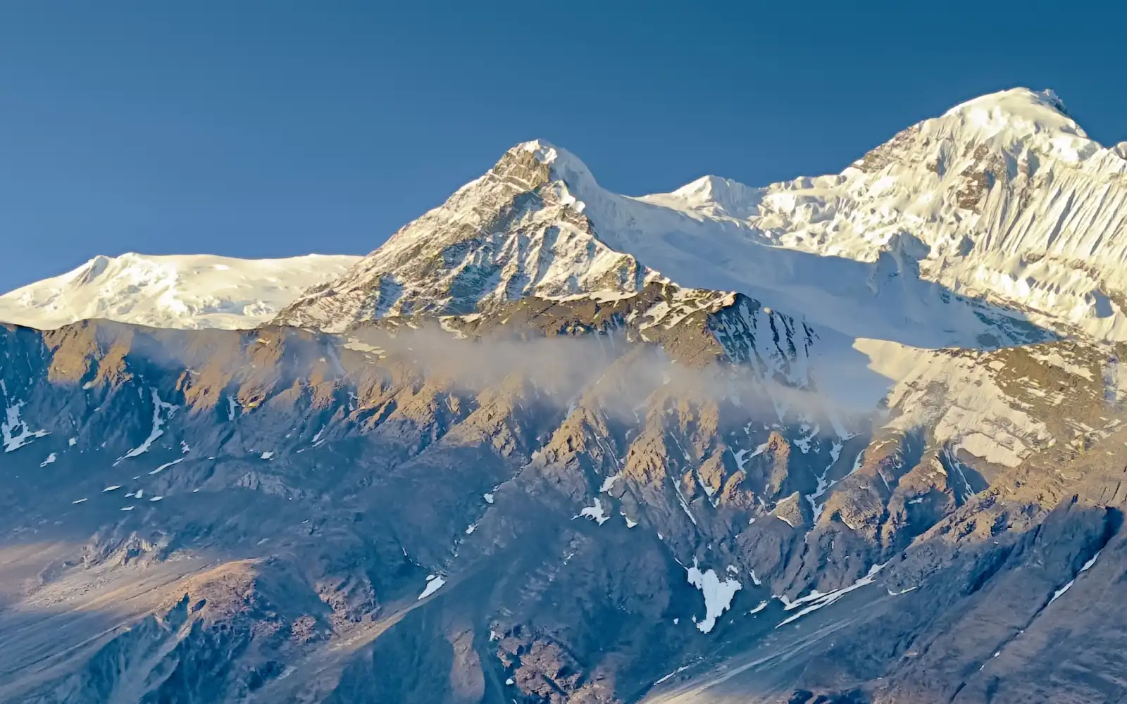
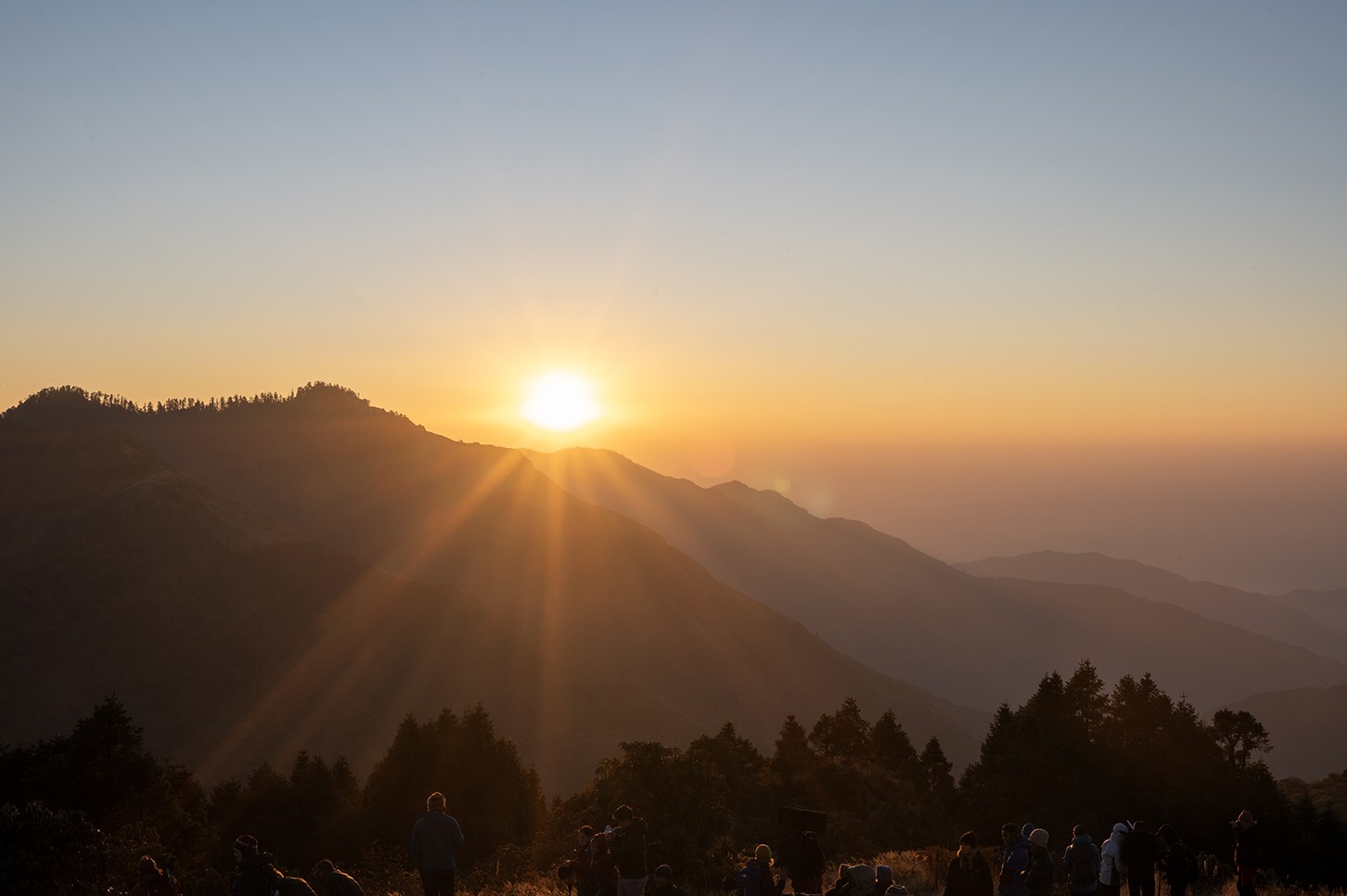
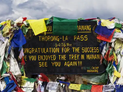
In fact, the highest point of this trek is the 5,416m (17,769ft) Thorong Pass, so you'll be going quite high!
Here, most people walk for 5 to 8 hours a day, and it's a good physical challenge for anyone who is reasonably fit. Whether you want a shorter drive-assisted trek or a full wilderness loop, the Annapurna Circuit will blow you away with everything it has to offer, from lush sub-tropical jungles to the stark, dry terrain of the high alpine desert.
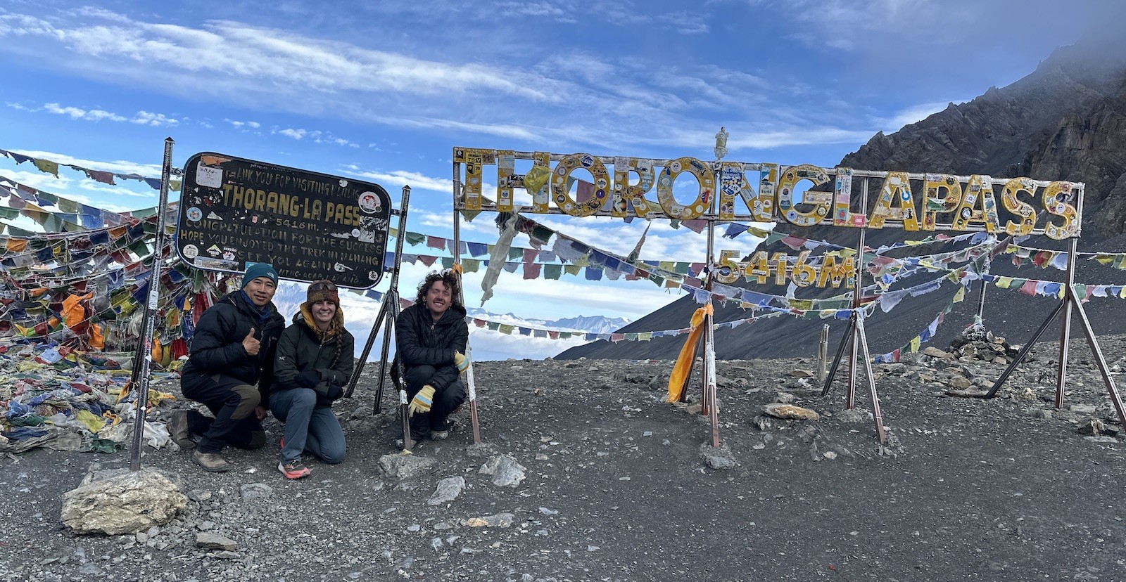
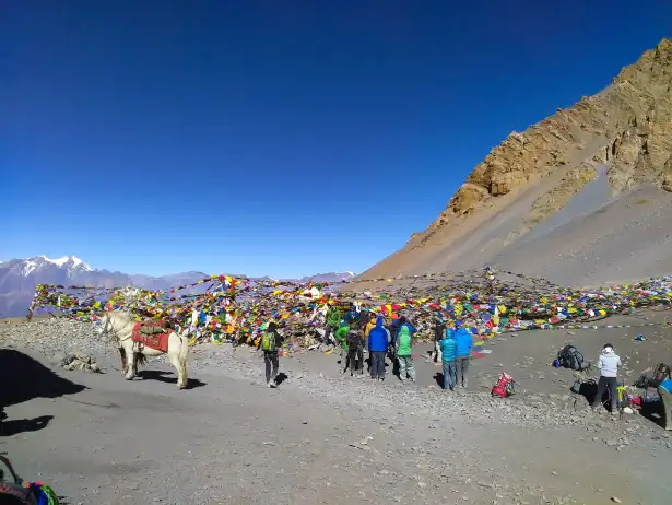
Summit of Thorong La Pass at 5,416 meters, one of the most rewarding moments on the Annapurna Circuit Trek.
Trail Setup
How far you'll walk
How long it'll take | Who's this for?
Short Circuit with Roads
100-120 km (62-75 miles)
10-12 days | People with limited time
Standard Full Trek
160-180 km (100-112 miles)
14-16 days | First-timers
Full Trek + Extra Adventures
200-230 km (125-143 miles)
18-22 days | Those wanting a full cultural experience
Annapurna Circuit Route Options :
Now, you can clearly see how making different decisions changes how far and for how long you'll be on the trail. At Haven Holidays, we tailor every single trip to your fitness, the amount of time you have available, and whether you want a full walking experience or a blend of hiking and driving.
So, when you ask about the distance of the Annapurna Circuit Trek, it's important to know there are a few ways to measure it. No matter if you choose the shorter 100 km or the epic 230 km journey around the Annapurna massif, it's a trip you'll remember forever. Let Haven Holidays help you plan your perfect Annapurna trek.
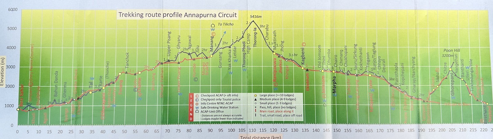
Annapurna Circuit elevation chart – a spectacular journey from subtropical valleys to the 5,416 m Thorong La Pass and down into the Kali Gandaki Valley
Road Building: The Real Reason Annapurna Mileage is So Confusing
Actually, it can be really confusing to figure out the total mileage for the Annapurna Circuit Trek because the landscape has changed so much in recent years with the construction of dirt roads (often called jeep tracks). Many sections of the old, traditional trekking trails have now been replaced by these roads, especially in the lower parts of the trek. This means you'll find vastly different figures on different websites – some focus purely on the days spent walking, while others base their calculations on the full, traditional route.
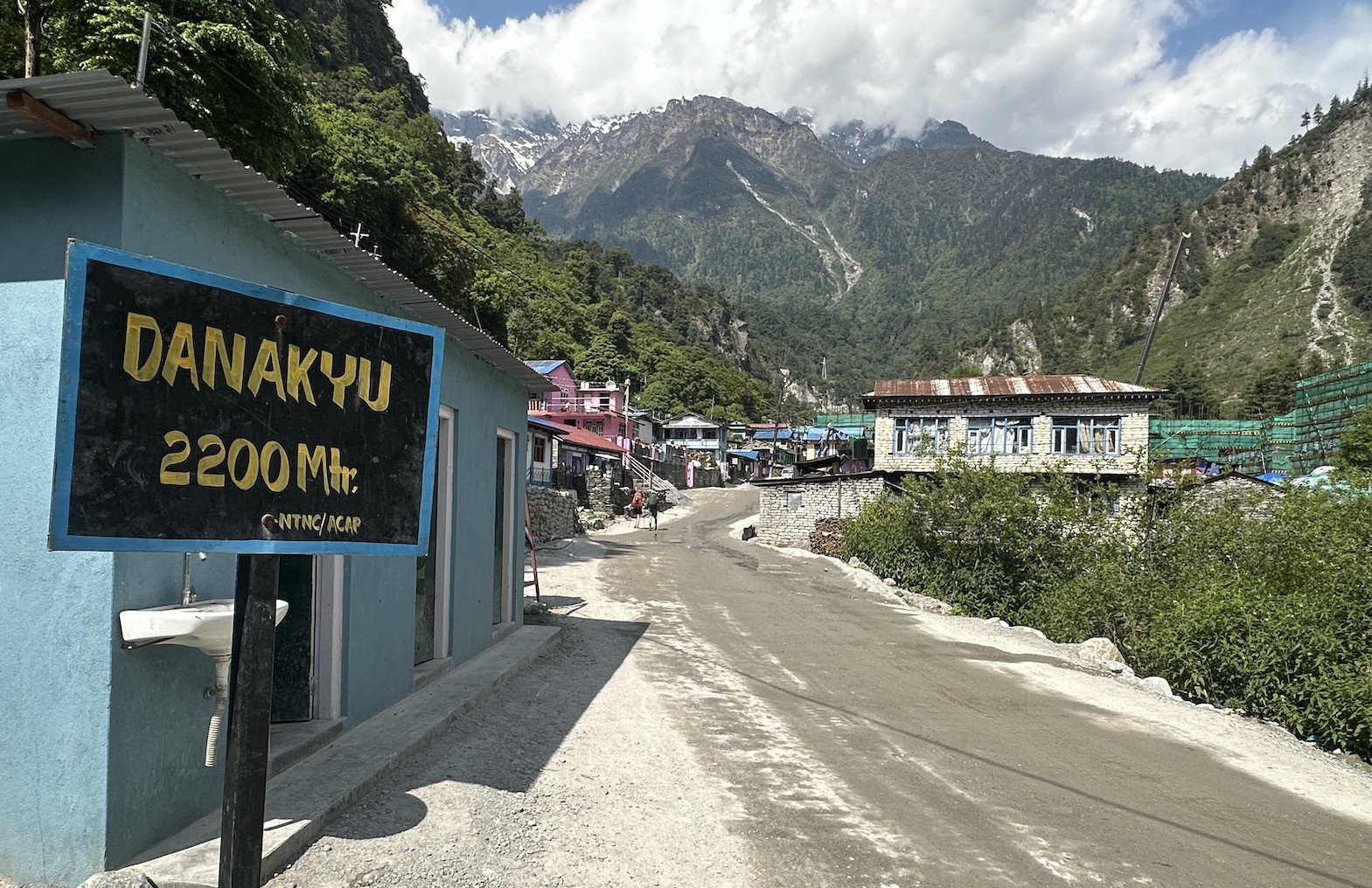
Danakyu Village – a peaceful Himalayan settlement with ancient culture and stunning Annapurna Circuit scenery.
Fortunately, many trekkers now choose to use the Natural Annapurna Trekking Trails (NATT). These alternative pathways allow you to skip the dusty roads and stick to traditional footpaths, which adds a lot of actual trail kilometers back into your trip. By taking the NATT routes, you can significantly increase the amount you're actually hiking and avoid the noise and dust of vehicle traffic.
Factors Influencing Total Trekking Distance Today :
The inclusion of driving sections in the route dramatically reduces walking mileage.
Taking NATT trails adds more pure walking days to the itinerary.
Adding side trips, like to Tilicho Lake or Poon Hill, significantly increases the overall distance.
The specific start and end points you choose (e.g., Besisahar versus Jagat, Muktinath versus Jomsom) also alter the total mileage.
Element
Impact on Total Distance
What we suggest
Jeep Tracks (lower valleys)
Shortens trekking by 30-50 km
Okay for a more comfortable trip
NATT Alternative Trails
Adds 20-40 km of walking
Best if you want an authentic trekking experience
Full Classic Circuit
160-180 km walking
The best of both worlds for most people
The Effect of Roads on Trek Distance :
Ultimately, the distance you actually hike is determined by how much of the trek you choose to do by road and how much on foot. Serious trekkers who are looking for a fully immersive experience often use NATT trails along with some popular side excursions to hit the higher end of the mileage range.
In conclusion, understanding how road building has changed the trek helps explain why there are so many conflicting Annapurna mileage numbers out there. By selecting the right balance of roads and trails, you can ensure you have the exact experience you're hoping for. Get in touch with Haven Holidays today to plan a Annapurna Circuit Trek that perfectly suits your desired distance and trekking style.
Establishing the Foundation: The Drive from Kathmandu to Dharapani Trailhead
Begin your Annapurna Circuit journey on solid logistical ground by completing the adventurous drive from Kathmandu to the trailhead at Dharapani. This vehicular leg of your trip covers a distance of 228 km (141.6 miles) along the picturesque Besisahar highway and will take approximately 8-9 hours by private jeep or public bus. You'll travel through breathtaking river valleys, terraced farmlands, and vibrant Nepalese towns on your way to the official point where your trekking days truly begin.
Located at around 1,860 meters (6,102 feet), Dharapani serves as the modern trailhead for most of today's Annapurna Circuit trekking routes. The time spent on this drive allows you a chance to rest, get acquainted with your guide, complete any necessary permit checks, and mentally prepare yourself for the trail ahead. Additionally, you'll get to witness glimpses of the incredible landscapes you'll be hiking through over the coming days.
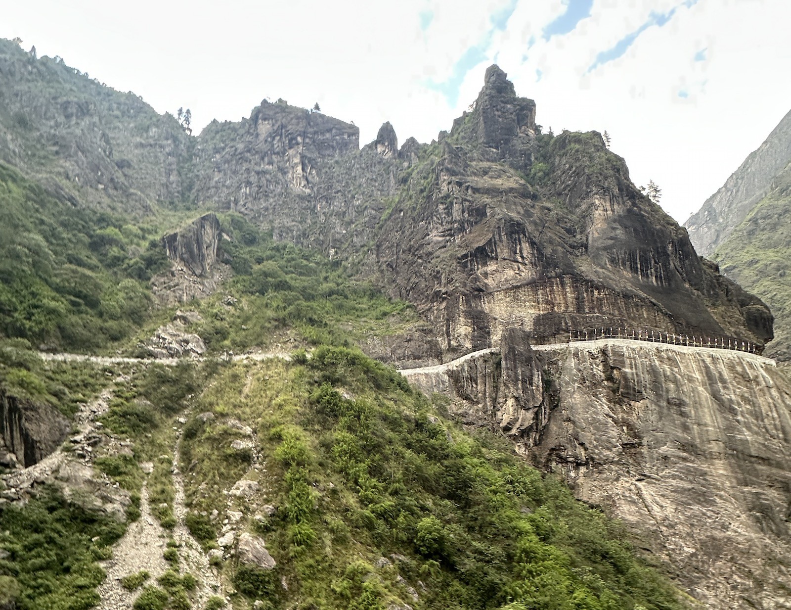
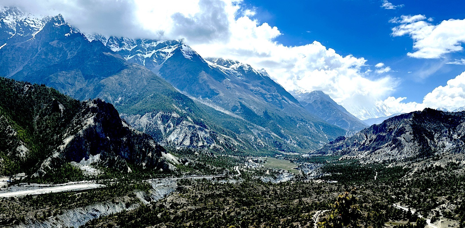
Road to Manang – a dramatic Himalayan route carved through cliffs, rivers, and high mountain landscapes
Here, Haven Holidays can arrange for a comfortable private transfer with experienced drivers to make this extended drive as smooth and safe as possible.
Key Highlights of the Kathmandu to Dharapani Drive :
Total Distance: 228 km (141.6 miles)
Travel Time: 8-9 hours (by jeep)
Scenic route along Besisahar highway
Convenient access to the trekking trailhead at Dharapani
Opportunity for acclimatization and briefing with your team
Stage
Distance | Duration
Notable Scenery/Experience
Kathmandu to Besisahar
170 km | 5-6 hours
Highway route with riverine vistas
Besisahar to Dharapani
58 km | 3 hours
More rugged mountain road
Overall Transfer
228 km (141.6 miles) | 8-9 hours
Gateway to the Annapurna Circuit
Transport Baseline Overview :
In summary, the Kathmandu to Dharapani via Besisahar drive is an essential step in establishing a well-organized and comfortable start to your Annapurna Circuit trek, ensuring you arrive at the trailhead feeling refreshed and ready to embark on your adventure. Get in touch with Haven Holidays today to organize your seamless transfer and fully supported Annapurna Circuit trek.
Phase 1 – Entry into the Marshyangdi Gorge: Dharapani to Chame and Upper Pisang
Actually, the trekking adventure truly begins as you step onto the trail from Dharapani and head into the dramatic Marshyangdi Gorge. This initial segment will introduce you to the steady rhythm of Annapurna Circuit trekking, with consistent uphill progress and spectacular river views.
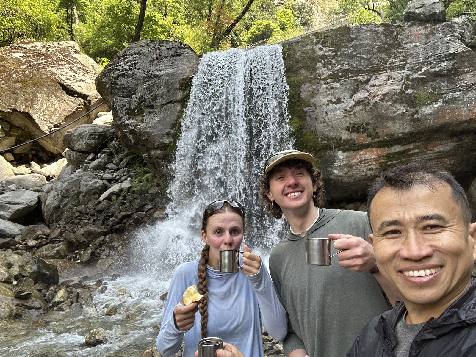
Coffee by the waterfall – a perfect Himalayan moment on the way to the Annapurna Circuit.
On Day 1, you will trek from Dharapani to Chame, a distance of 15.5 km (9.5 miles) that will take roughly 5 to 6 hours. The trail will meander alongside the powerful Marshyangdi River, passing through forests and traditional villages. The following day, you'll continue the uphill journey to Upper Pisang, covering 17 km (10.5 miles) in approximately 6 to 7 hours. These first couple of days will offer beautiful pine forests, iconic suspension bridges, and your first clear views of the majestic Annapurna range.
Dharapani to Upper Pisang Highlights :
Dharapani to Chame: 15.5 km (9.5 miles) - 5-6 hours trekking time
Chame to Upper Pisang: 17 km (10.5 miles) - 6-7 hours trekking time
Journey into the deep Marshyangdi Gorge
Gradual altitude gain with enriching scenery
First glimpses of towering Annapurna peaks
Segment
Distance | Miles
Walking Hours | Elevation Range
Dharapani to Chame
15.5 km | 9.5 | 5-6 hrs
1,860 m to 2,670 m
Chame to Upper Pisang
17 km | 10.5 | 6-7 hrs
Up to 3,310 m (10,860 ft)
Total for Phase 1
32.5 km | 20 miles
11-13 hrs | Significant early altitude gain
Phase 1 Distance Profile :
Here, these initial trekking days will help you build your trekking stamina while immersing you in the stunning natural beauty of the gorge. Haven Holidays ensures this phase is well-paced to provide you with a comfortable acclimatization process right from the start.
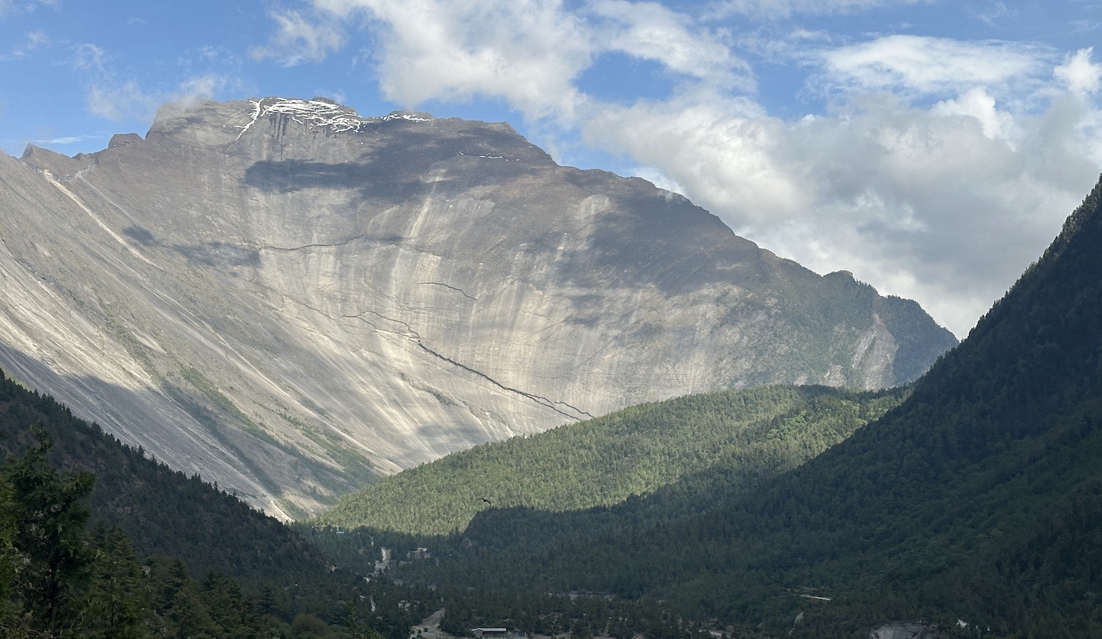
A natural gateway carved by time – towering rock cliffs and a breathtaking Himalayan valley view on the Annapurna Circuit Trek.
In conclusion, Phase 1, from Dharapani to Chame and Upper Pisang, sets a powerful and visually captivating tone for your entire Annapurna Circuit trek. These foundational trekking days combine moderate distances with breathtaking gorge scenery. Contact Haven Holidays today for a perfectly planned Annapurna Circuit with expert guidance from your very first step.
High vs. Low-Route Matrix: Trekking Upper Valley to Manang
When trekking from Upper Pisang to Manang, you have the crucial choice between the high-route and the low-route, and it will make a considerable difference in distance and scenery. The high-route through Ghyaru and Ngawal is home to arguably the best views of the Annapurna Massif, but at the cost of a day that covers a steep 18-19 km (11-12 miles) over 7 to 8 hours of difficult, alpine-style walking.
Here, this spectacular high path climbs steeply through stone villages and along ridges, revealing panoramic vistas of Annapurna II, III, IV and Gangapurna. It goes through typical stone villages and open ridges. Conversely, the low-route which follows the main valley road covers around 12-14 km but on dusty jeep tracks, with few viewpoints. For this reason, the high-route, despite its effort, is preferred by the majority of trekkers.
Manang Valley – a stunning alpine world where desert hills meet towering Himalayan peak
Route Option
Distance | Walking Hours
Elevation Gain | Scenery & Advantage
High Route (Ghyaru-Ngawal)
18-19 km (11-12 miles) | 7-8 hrs
Significant | Spectacular Annapurna Massif views
Low Route (Main Valley)
12-14 km | 5-6 hrs
Moderate | Faster but less scenic
Upper Pisang to Manang Route Comparison :
In fact, the Upper Pisang to Ngawal high route provides a hiker with some of the best photographic opportunities in all of the Annapurna Circuit. It traverses ancient monasteries and provides 360 degree mountain views that make the additional kilometers seem well worth the added effort.
Most importantly, Haven Holidays recommends the high-route to all trekkers that we take on this adventure as the acclimatization is better, and it does not put trekkers onto the more often used, lower road with vehicle traffic.
In summary, taking the high-route from Upper Pisang to Ngawal will turn an ordinary day into an outstanding alpine journey and ultimately is the decision that sets your Annapurna Circuit Trek apart. Contact Haven Holidays today for expert advice and a safe, well-paced trip according to your preferred route.
The Altitude Buffer Zone: Acclimatization Distance and Side Hikes in Manang
Here, you must give your body the best opportunity to adjust, which makes Manang a crucial altitude buffer zone. At 3,540 meters (11,614 feet), Manang is ideally positioned as the location for a mandatory 1-2 day rest period, and the days here are spent recovering with light activity rather than being completely inert.
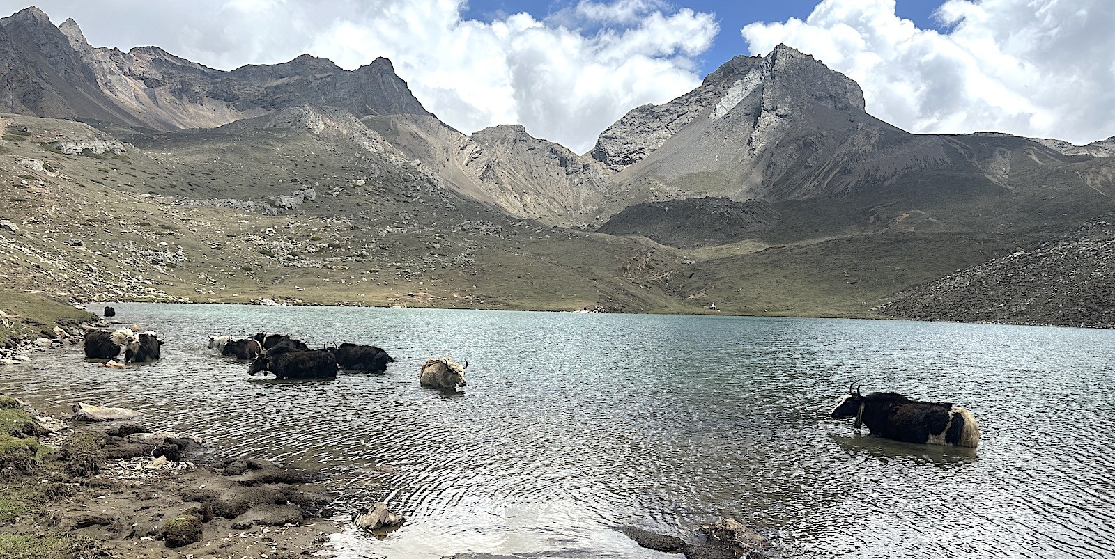
Ice lake near Manang – where yaks cool down under the bright Himalayan sun on the Annapurna Circuit.
Likewise, one ideal option would be a hike up to Ice Lake at 4,600 meters (15,092 feet), which is about a 10km (6.2 miles) round trip with steep but spectacular views. The hike up will present you with beautiful, turquoise-colored waters and mountainous views at the lake and this is a prime example of giving your body time to adapt prior to trekking over the high Thorong La Pass. Gangapurna Glacier lies above the village and is a nice shorter, more passive, hike.
Nar Phu Valley Trek with Annapurna Circuit | 16 days days
Mandatory 1-2 day acclimatization window at 3,540m (11,614 ft).
Side hike up to Ice Lake distance is 10 km (6.2 miles) round trip.
Gangapurna Glacier viewpoint is 2-4 km away.
Offers good bakeries and teahouses to recover.
Also offers a chance to explore the cultural Manang villages.
Side Trip
Distance
Elevation | Duration | Benefit
Ice Lake
10 km (6.2 miles)
4,600 m (15,092 ft) | 5-7 hours | Superior high-altitude training.
Gangapurna Glacier Viewpoint
2-4 km
3,700 m | 2-3 hours | Short and refreshing hike
Village Exploration
3-5 km
Around Manang | Variable | Cultural discovery
Acclimatization Side Hikes in Manang :
Importantly, Haven Holidays highly advises that each trekker allocate at least one full rest day to active recovery in Manang, particularly when completing an Annapurna Circuit Trek so that you may safely traverse Thorong La Pass.
In conclusion, giving yourself enough distance to acquire an altitude buffer zone in Manang through wisely chosen side hikes is crucial in your Annapurna Circuit Trek journey to help facilitate a safe trek over Thorong La Pass. Contact Haven Holidays to arrange the ideal schedule for your acclimatization.
To the Launchpad: The Thorong Phedi distance from Manang
Here, you leave the broad valley of Manang, turning sharply north and climbing out of the Marsyangdi River gorge towards the distant high pass. This stretch of the trail takes you out of the trees and into the harsh, rocky world of rock and ice, with every upward step becoming more and more strenuous, in a series of shorter, steeper climbs that build your acclimatisation.
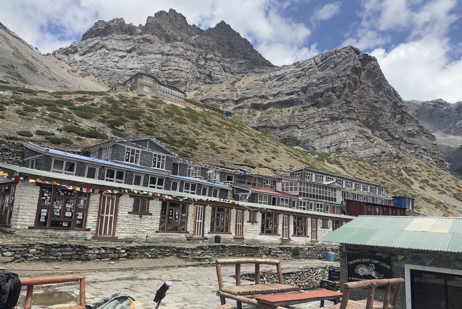
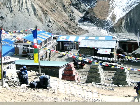
Thorong Phedi – the resting point before the challenging ascent to Thorong La Pass.
[Thorong Phedi Base Camp: 4,450 m] Launchpad to the Heavens- (+400m Incline | 6-9km)
In fact, this ascent is broken into manageable stages to aid acclimatisation. The Manang to Yak Kharka distance involves 10.5-12km of sustained climbing along the Jarsang Khola, and the 6-9km Thorong Phedi trail mileage to the foot of the pass next day brings you to the cusp of the summit ridge.
Entering the High Alpine: Getting to the launchpad ;
The Alpine transition: Here, you leave the low shrubs and junipers behind and enter a world of stark grey slate,scree slopes,and frozen streams.
The gradual incline: Although the distance covered may appear relatively short, the altitude gain requires a slow and steady rhythm to conserve breath in the rarefied air.
Scree danger zone: The path toward Thorong Phedi traverses a steep and exposed scree slope and a high risk of stone fall; be quick but careful!
Higher camp alternative: Strong hikers may prefer to trek beyond the Thorong Phedi huts (4,450m) up a further steep 450m to Thorong High camp (4,900m) thus shortening the following day’s distance.
Day Section Milestone
Destination Altitude | Trek Distance
Avg Walking Time | Trekking Surface and Footing
Manang Village Hub
3,540 m / 11,614 ft | 0.0 km / 0.0 mi
Departure | Well-trodden, hard-packed dirt tracks and narrow village alleys.
Yak Kharka Pastures
4,050 m / 13,287 ft | 11.2 km / 7.0 mi
4-5 hrs | narrow, winding high alpine tracks and a steep gravel slopes.
Thorong Phedi Base
4,450 m / 14,599 ft | 7.5 km / 4.7 mi
3-4 hrs | Steep, rocky, open slate-rock and scree trails, exposed to the wind.
Day-by-day trail from Manang hub:
Summit Day realities: Muktinath holy shrine over Thorong La pass
Meanwhile, this is the ultimate test, where your physical endurance and mental resolve are stretched to the limit. In the cold and dark of the early morning, you leave the eastern valley shelters and traverse a stark, alpine world to conquer the ridge that links the mighty peaks of Khatung Kang and Yakawa Kang.
[Thorong La Pass Summit: 5,416 m](1,600m of relentless downhill, testing your knees to their limit) (Pre-dawn effort climb)
In fact, this is the single most arduous section on the entire circuit. Covering a total distance of between 15 and 18km from Thorong Phedi to Muktinath requires and impressive 8-10 hours of walking in order to succeed at the Thorong La pass maximum altitude 5416m / 17,769 feet.
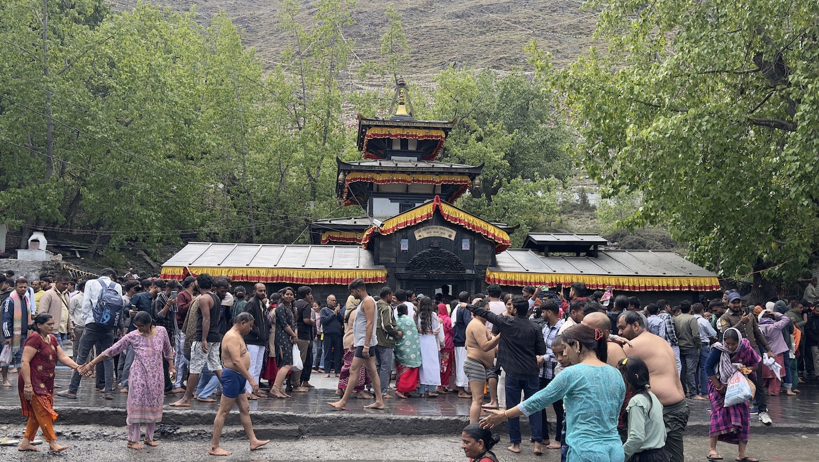
Muktinath Temple – where pilgrims cleanse themselves in sacred waters and seek spiritual renewal in the Himalayas.
Essential details about the Thorong La Pass Crossing :
Launch at midnight: The earliest teams depart the huts between 3 and 4am to ensure that they clear the exposed pass before the afternoon winds make the route dangerous.
Pulmonary strain: At the peak, there is less than half the oxygen available to you compared with sea level and your pace will slow as a result.
Frozen ascent: the steep, ice-packed trail climbs toward false summits over a terrain of hard ice; make sure your equipment, particularly microspikes, is in order
Desert descent: After the prayer flags at the summit ridge, the trail begins to drop 1,650 meters down a rocky, knee-jarring track until you enter the Mustang region, a stark desert landscape.
Pass crossing stage node
Elevation metric | Oxygen availability
Trek distance | Dominant physical demand
Thorong Phedi start
4,450m / 14,599 ft | 58% of sea level
0.0 km / 0.0 mi | Warm-up for pre-dawn muscles in the cold.
Thorong High camp
4,900m / 16,076 ft | 55% of sea level
1.5 km / 0.9 mi | Intense cardiac effort climbing up steep switchbacks.
Thorong La pass summit
5,416m / 17,769 ft | 51% of sea level
5.0 km / 3.1 mi | Test of the extremes of your endurance while traversing open snowy terrain.
Muktinath shrine basin
3,760m / 12,335 ft | 64% of sea level
16.5 km / 10.2 mi | Hard physical shock to your knees.
Altitude profile Thorong La Pass summit and descent:
Dropping into the Rain Shadow: The Long Descent from Jomsom to Tatopani Hot Springs
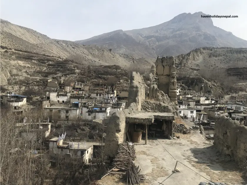
Witness an astonishing climatic change on any Himalayan trek, when you leave Muktinath to drop into the rain shadow via Jomsom to Tatopani hot springs. After crossing Thorung La, you will suddenly descend into the 1,600m deep arid Kali Gandaki gorge (the deepest gorge in the world). Within a few hours the terrain is desert like. There will be high winds and dusty tracks to deal with, but there are also many apple orchards scattered around.
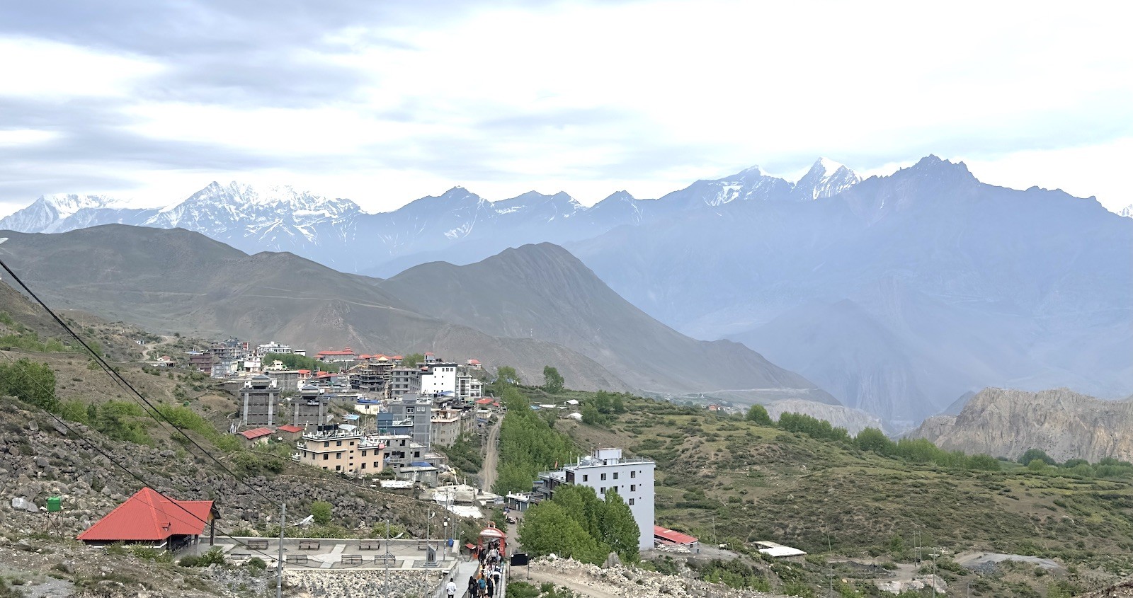
Muktinath /Mustang Valley – a sacred Himalayan landscape where culture, spirituality, and mountains meet
As many trekkers find the windswept and dusty roads tedious, and have fatigue after Thorung La crossing; they opt for a local jeep transit between Muktinath to Jomsom. Walkers will walk to the pretty village of Marpha and further, known for apple brandy and architecture.
Muktinath to Jomsom Walking Distance Highlights :
Entering the rain shadow zone
Strong Kali Gandaki winds and dry scenery
Apple orchards of Marpha village
Jeep option is convenient for roads
Segment
Distance
Walking Time | Key Features
Muktinath to Jomsom
15-18 km
5-6 hours | Windy gorge & temple area.
Jomsom to Marpha
8-10 km
3-4 hours | Apple orchards & homes.
After Marpha
--
-- | jeeping possible to Tatopani.
Descent Profile :
Here, walking for too long combined with the high winds from Muktinath to Jomsom is tiring, but the changing landscape to the arid valley coupled with the natural hot springs at Tatopani makes this part of the journey worth the effort. Haven Holidays provides optional itinerary with strategic jeep transfer, so you can maintain your energy levels.
In conclusion, entering the rain shadow via Jomsom to Tatopani marks a turning point on the Annapurna Circuit trek. This long descent has challenges and contrasts. Contact Haven Holidays today to plan your customized Annapurna Circuit Trek.
The Legendary Foothills Extension: The Ascent from Tatopani to Ghorepani
Actually, this part of the trek is known as the legendary foothills extension, and involves the steady and sometimes steep climb from Tatopani back to Ghorepani. For those who wish to walk all the way, this 15 to 17 kilometer (9 to 10.6 miles) uphill is a lung bursting effort up a lush sub-tropical woodland which later enters thick rhododendron forests.
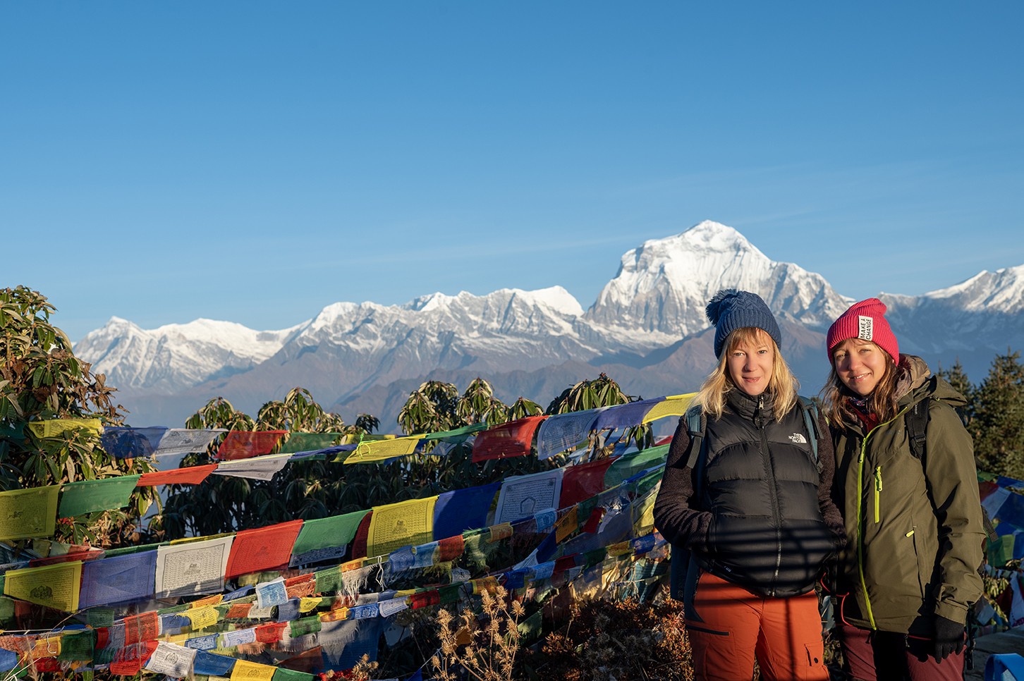
Poon Hill – trekkers rewarded with Himalayan views of Annapurna and Dhaulagiri.
After the tiring descent it really tests your legs again, but what a reward in scenery, which you will encounter on the whole circuit. The trail ascends through terraced fields, tiny villages and forests, an astonishing contrast to the arid gorge you just left. You will gain tremendous amount of altitude, climbing up to the colorful hub of Ghorepani at 2,874 meters (9,429 feet). Rhododendron season provides a very colorful experience for the trekker.
Tatopani to Ghorepani Distance Highlights :
Tiring but scenic 15-17 km (9-10.6 miles) uphill walk
Beautiful rhododendron forests
Contrast to the dry arid gorge
Plenty of teahouses for rest
Good acclimatization before further descent
Segment
Distance
Elevation Gain | Walking Time
Tatopani to Ghorepani
15-17 km (9-10.6 mi)
1,190 m to 2,874 m (3,900-9,429 ft) | 7-9 hours
Foothills Extension Profile :
Here, this legendary part of the trek is highly recommended by Haven Holidays for those trekking the Annapurna Circuit, as it also acts as a final warm up before any subsequent down climb from the region.
In conclusion, the famous foothills extension from Tatopani to Ghorepani involves a demanding but incredibly beautiful climb on the Annapurna Circuit trek. The reward of the rhododendron forests makes the struggle for the ascent worthwhile. Contact Haven Holidays to include this leg in your Annapurna Circuit trekking itinerary.
A Grand Finale: Poon Hill Sunrise and the Descent to Nayapul
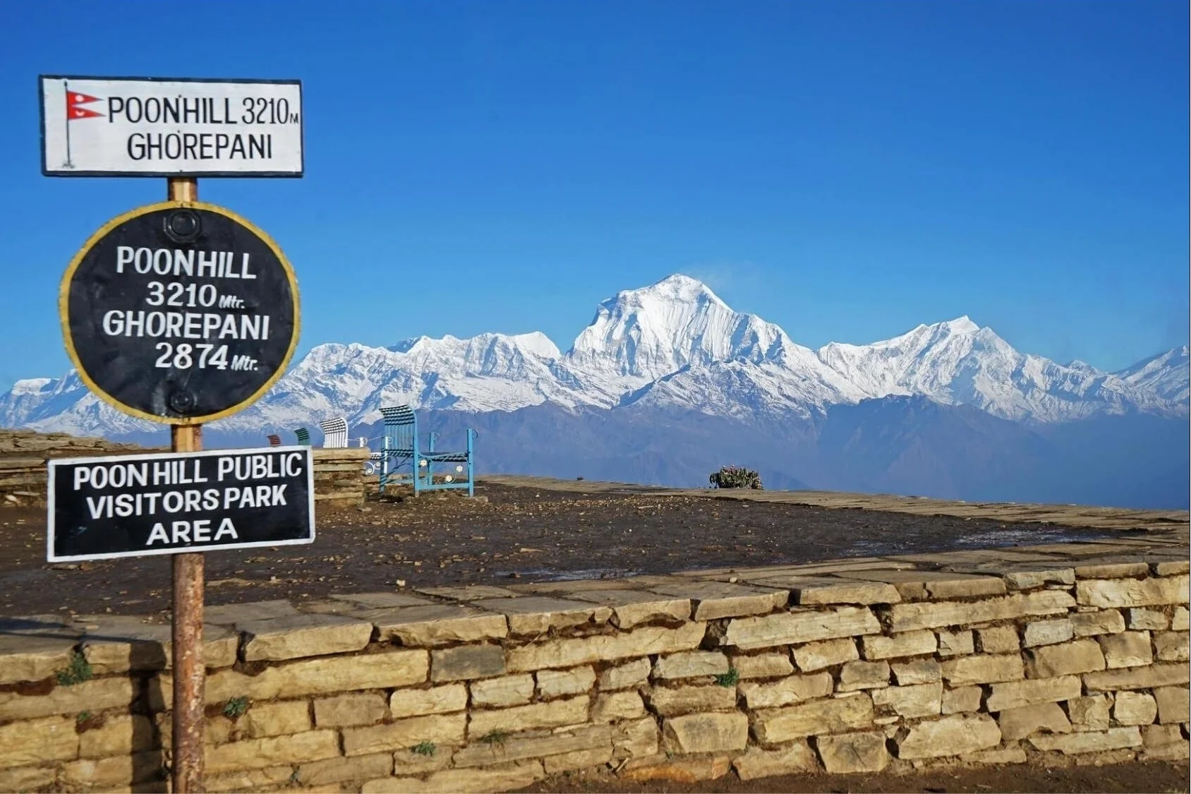
Conclude your Annapurna Circuit trek with a truly unforgettable panorama from Ghorepani. After your uphill journey from Tatopani, you can opt for a short pre-dawn 3km hike to the world-renowned Poon Hill viewpoint at 3,210 meters (10,531 feet). In the darkness, this short ascent will take you to what many consider one of the most spectacular sunrises in the Himalayas, offering unobstructed 360-degree views of the Annapurna and Dhaulagiri ranges.
Poon Hill sunrise – a magical Himalayan moment
Likewise, following the breathtaking sunrise, it is time for the lengthy and often steep descent of 16 to 20 km (10 to 12.4 miles) through rhododendron forests and stone staircases to reach the roadhead at Nayapul, which is the final stop of the Ghorepani to Nayapul loop. This final segment of your trek will see you rapidly lose altitude through lush vegetation, providing a strong sense of accomplishment and the feeling of having successfully returned to the lower, more verdant hills.
Highlights of the Poon Hill Sunrise Viewpoint Walk:
A short but memorable pre-dawn 3km climb from Ghorepani
An iconic 360 sunrise vista at an elevation of 3,210 m (10,531 ft)
Considered by many to be the most photographed location on the entire circuit
Leads directly into the long descent to Nayapul
Trek Segment
Distance
Walking Time | Highlights of the Walk
Ghorepani to Poon Hill (Round trip)
3 km
1 - 1.5 hours | An epic sunrise viewpoint.
Ghorepani to Nayapul
16-20 km (10-12.4 miles)
6-8 hours | A steep descent through rhododendron forests.
Total Distance on the Final Day
19-23 km
7-9 hours | A triumphant and satisfying conclusion to your circuit.
Profile of the Final Descent to Nayapul:
Here, the final stretch rewards you for the entirety of your long trek with both natural beauty and an immense feeling of accomplishment. The sunrise viewed from Poon Hill is widely regarded as a perfect culmination of the Annapurna Circuit.
In summary, your final panoramic vista from Poon Hill and subsequent trek to Nayapul create a highly memorable and satisfying conclusion to your journey. Reach out to Haven Holidays today to arrange for this classic sunrise experience to be included in your personalized Annapurna Circuit trek package.
Conclusion: A Master Comparison of Distances, Altitudes, and Durations
Make your Annapurna Circuit trek choice with complete confidence thanks to this ultimate comparison table of distances, altitudes, and trekking durations. This excellent pacing guide and final trek itinerary checklist will make planning easy and transparent.
Circuit Configuration
Total Walking Distance | Trekking Duration
Maximum Altitude | Ideal For
Short Road-Assisted Circuit
100-120 km (62-75 miles) | 10-12 Days
5,416 m (17,769 ft) | Those with limited time.
Standard Footpath Circuit
160-180 km (100-112 miles) | 14-16 Days
5,416 m (17,769 ft) | First-time Annapurna trekkers.
Full Classic with Side Excursions
200-230 km (125-143 miles) | 18-22 Days
5,416 m (17,769 ft) | Those seeking complete cultural immersion.
Annapurna Circuit Daily Distance Chart and Route Comparisons:
Snapshot of the Average Daily Distance (based on a 14-16 day itinerary):
Days 1-3 (Dharapani to Manang): 45-50 km
Days 4-5 (Manang acclimatization): 10-15 km (includes side treks)
Days 6-7 (Manang to Muktinath via Thorong La pass): 35-40 km
Days 8-10 (Muktinath to Tatopani): 50-60 km (jeep available for segments if needed)
Days 11-14 (Tatopani to Ghorepani and then to Nayapul): 50-60 km
Here, this chart serves as a useful at-a-glance itinerary overview. The Annapurna Circuit in its current form is extremely versatile, ranging from shorter road-assisted routes to the full, immersive classic which can be expanded to include side trips to places like Tilicho Lake and Poon Hill.
In conclusion, regardless of the itinerary you choose, the Annapurna Circuit trek promises an exceptionally diverse and rewarding Himalayan experience, leaving you with lasting memories thanks to its unique landscapes. Contact Haven Holidays today to book your custom Annapurna Circuit trek, complete with expert guides, comfortable teahouse accommodations, and perfectly arranged logistics to match your individual fitness and schedule.
FAQs- Annapurna Circuit Trek total distance
1. What is the total walking distance for the classic Annapurna Circuit Trek? The traditional, entire, classic Annapurna Circuit Trek total distance covers approximately 230 kilometers (143 miles). The celebrated circuit begins in the steamy lowlands of Besisahar, then loops entirely around the colossal Annapurna range, ending in the lakeside town of Pokhara.
2. What is the total walking distance for the modern Annapurna Circuit Trek? Because of new road construction in the region, the modern, mainstream, Annapurna Circuit Trek total distance can be shortened to roughly 160-180 kilometers (100-112 miles). Most trekkers now opt for the jeep transfer to get out of the dusty lower valley and use the beautiful, high-altitude trails.
3. What is the shortest possible walking distance of the circuit? With maximum use of vehicle or jeep assistance along the route, the shortest Annapurna Circuit Trek total distance decreases to about 100-120 kilometers (62-75 miles). These roads are used to bypass the majority of the route, but trekkers start walking directly from Dharapani or Chame and finish after the pass and descend to Jomsom on foot.
4. How much distance is added when you detour to Tilicho Lake? To add Tilicho Lake, the world's highest altitude lake (at 4,919m), you must add 25-30 kilometers (15-18 miles). This gorgeous Alpine addition stretches your total circuit length by another two to three walking days.
5. How much distance do you walk on an average day on the Annapurna Circuit? On average, trekkers cover between 10 to 15 kilometers (6 to 9 miles) on a given walking day. Keep in mind that daily distances vary wildly; distances will be longer in lower elevations, but you'll cover shorter mileage at high elevations to avoid altitude sickness.
6. Where does the modern Annapurna Circuit walking route officially start? The standard, modern Annapurna Circuit walking route starts at Dharapani (1860m). By taking an 8-10 hour scenic drive directly from Kathmandu to Dharapani via Besisahar, you skip the lower mountain motorable tracks.
7. How many kilometers is the walking distance from Dharapani to Chame? The walking distance from Dharapani to Chame on day one is 15.5 kilometers (9.6 miles). This trek can take you about 5-6 hours to walk and starts your trek gently on an uphill trail through pine forests.
8. What is the distance of the trail between Chame and Upper Pisang? The walk between Chame and Upper Pisang is 13.5-15 kilometers (8-9.3 miles) long and takes approximately 5-6 hours to complete as you follow the rocky trails and look at dramatic rock formations such as Paungda Danda.
9. How many kilometers is the trail between Pisang and Manang? The walking distance of the Pisang to Manang trail is 17 kilometers (10.5 miles) via the lower route, or approximately 19 kilometers if you choose the upper route (which is more scenic and takes more time).
10. How many kilometers do you walk on your rest day in Manang? The day dedicated to rest in Manang (Day 6, 3540m) usually includes a short, preparatory walk of 4-6 kilometers (2.5-3.7 miles) for acclimatization purposes such as the Gangapurna glacier walk or Ice Lake trek.
11. Why are daily walking distances reduced between Manang and Thorong Phedi? Daily walking distances are reduced to 7-11 kilometers to avoid the risk of altitude sickness as you travel between Manang, Yak Kharka and Thorong Phedi. When trekking at such high altitudes, it's best to stick to your guide's recommendations, ensuring you do not gain more than 300-500 meters of sleeping altitude a day.
12. What is the exact distance between Manang and Yak Kharka? The mountain trail from Manang to Yak Kharka is 10.5 kilometers (6.5 miles) long. The trek usually takes 4-5 hours.
13. What is the length of the high-altitude walking trail between Yak Kharka and Thorong Phedi? The walking distance between Yak Kharka and Thorong Phedi is a relatively short 7-8 kilometers (4.3-5 miles), which takes around 3.5 to 4 hours.
14. How many kilometers do you walk from Thorong Phedi over Thorong La pass to Muktinath? The longest and hardest day of the circuit is the crossing of the Thorong La pass (5,416m) to Muktinath, which is a trek of 16-20 kilometers (10-12.4 miles). This day of trekking takes about 8-10 hours.
15. How many kilometers is the walking distance between Muktinath and Jomsom? The trek down to Jomsom from Muktinath takes approximately 16-18 kilometers (10-11.1 miles) and passes through the arid landscape of the Kali Gandaki river valley. The walk to Jomsom usually takes about 6 hours.
16. How many kilometers do you walk when you add on the Poon Hill extension? When you extend the Annapurna Circuit Trek by visiting Poon Hill, you will add an additional 15-20 kilometers to your walking itinerary. The trek leads through charming villages and lush, rhododendron-filled forests.
17. How does elevation impact the perceived distance when trekking the Annapurna Circuit? It’s impossible to convey the difficulty of trekking in Nepal using only mileage. Covering 16 kilometers in the mountains-especially at elevations above 5,000m where the oxygen content of the air is reduced by almost half compared to sea level-requires three times the effort compared to covering the same distance at home.
18. Are the historical walking routes still open parallel to the new roads? Yes, over 160 kilometers of untouched trails still exist across the region, all clearly marked, thanks to the efforts of Natural Annapurna Trekking Trails (NATT) to preserve the original footpath as much as possible.
19. How many days do I need to complete the Annapurna Circuit, given the modern trekking distances? Given the more road-inclusive trekking distances on the modern circuit, you will need a minimum of 12 to 15 days to complete it. These lengths account for acclimatization, rest days and potential weather delays.
20. How should I prepare physically for the Annapurna Circuit trekking mileage? To successfully complete the entire walking distance of the Annapurna Circuit, you'll need endurance and stamina. Cardiovascular training such as cycling, swimming or long runs along with day-hiking excursions of up to 15 kilometers over the prior three months are essential. Carry a 5-7kg backpack on all training hikes to simulate walking with gear.